Category Archives: Wheelerville

Finding Ghosts

Since this is the “Spooky Season”, I thought I would share an interesting way of using technology to find ghosts in in the woods. Specifically, the ghosts of railroads past…

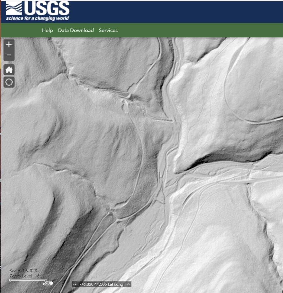
This technology is called “LIDAR”, for “Laser Imaging Detection and Ranging”, and has been in use in various forms since the invention of lasers in the early 1960’s. It is commonly used to make 3-D terrain maps for various purposes. The increasing resolution of LIDAR systems (down to elevation differences of mere inches), and the ability to subtract light reflections from vegetation, has made LIDAR an invaluable tool for archaeologic research. This also applies to industrial archaeology, I.E., abandoned railroads.

Mapping LIDAR data removes existing structures as well as vegetation, but foundations of no-longer-extant structures can often be seen. The data is also most useful in more remote areas, where later alterations of the ground are less likely to have occurred over time.

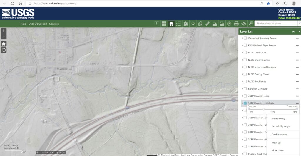
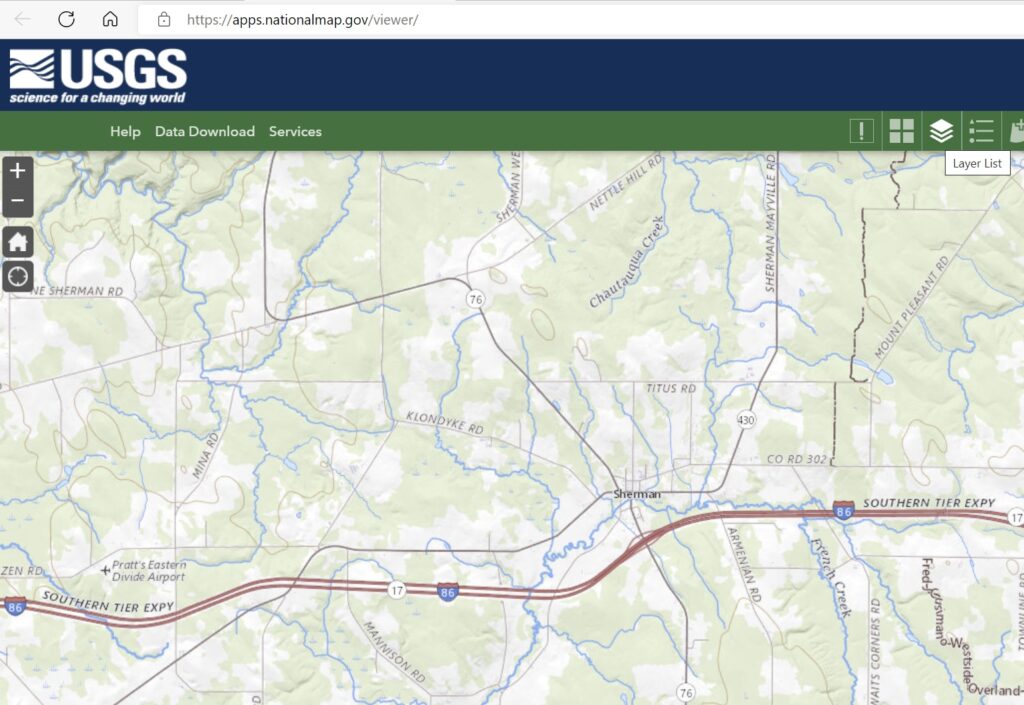
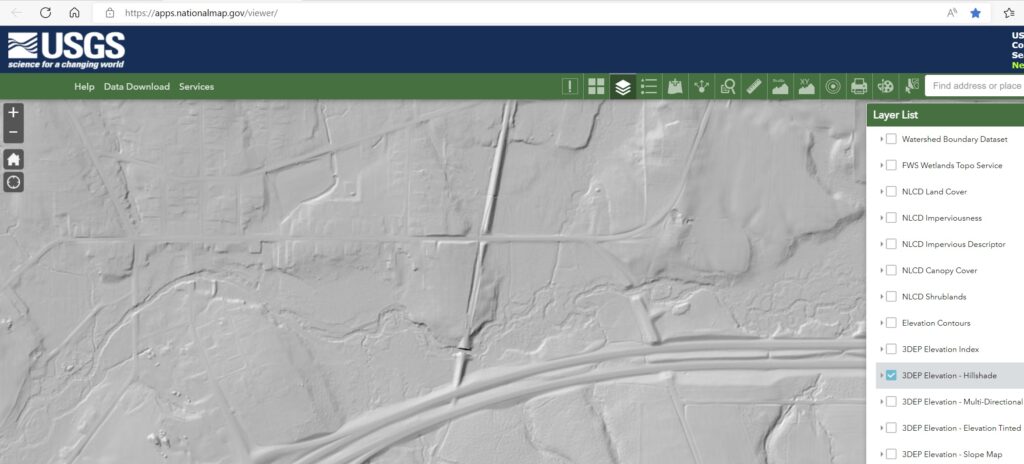
This mapping technology is available on the internet from the United States Geologic Survey (USGS) at: The National Map – Advanced Viewer. To use the online browser, navigate to the site, use the map to navigate to the area of interest, open the “Layer List” tool on the toolbar, check the box next to 3DEP Elevation – Hillshade, and zoom in a bit to your area of interest. It will take a few seconds or a bit longer to load the data into the browser, so if you have a slow internet connection, be patient. You should be rewarded with a shaded grey-scale image of the ground. Clicking the three black dots opens another set of tools, one of which allows you to adjust the transparency of the shaded layer so the associated map layer can be seen.


USGS website and navigation map


3DEP Elevation – Hillshade


Topo map overlaid

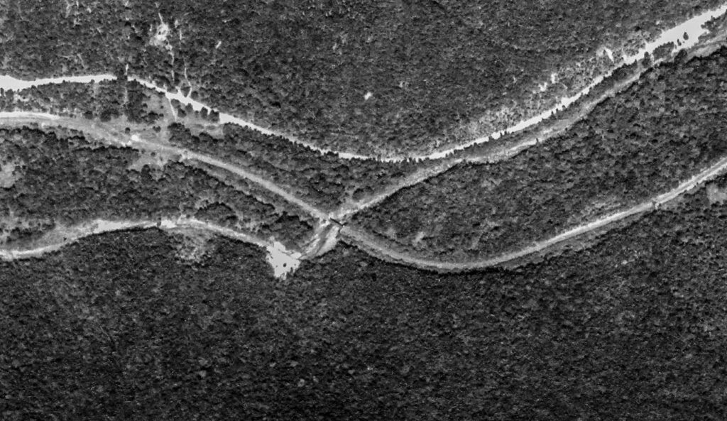
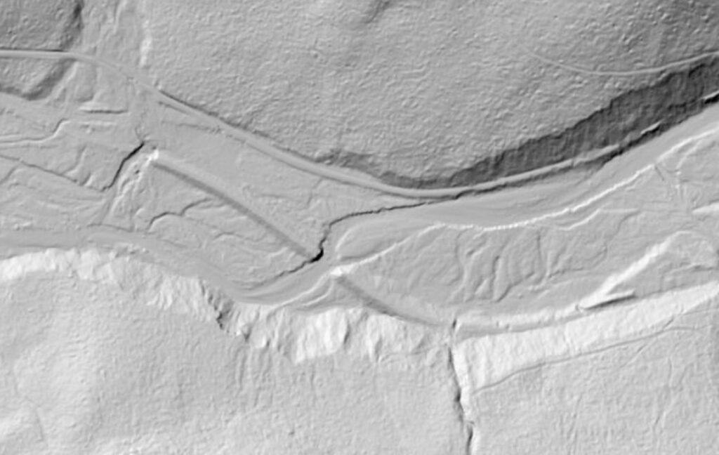
The above examples show the course of the long-abandoned PRR Chautauqua Branch roadbed and the still-extant bridge over French Creek near Sherman, NY. This bridge can still be seen in the winter months from westbound Interstate 86.

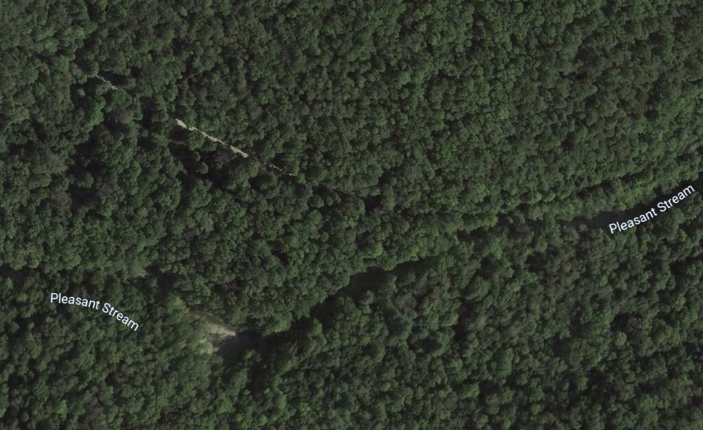
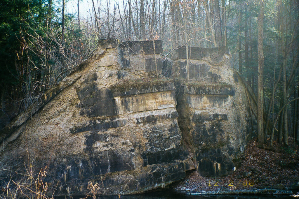
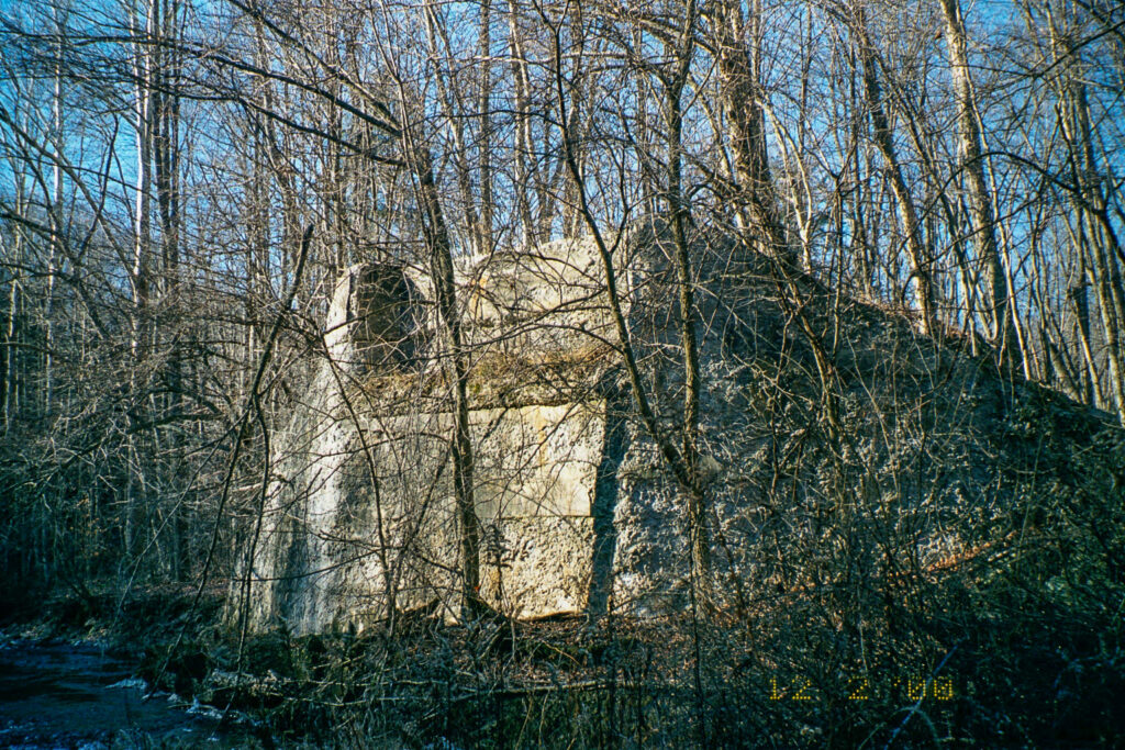
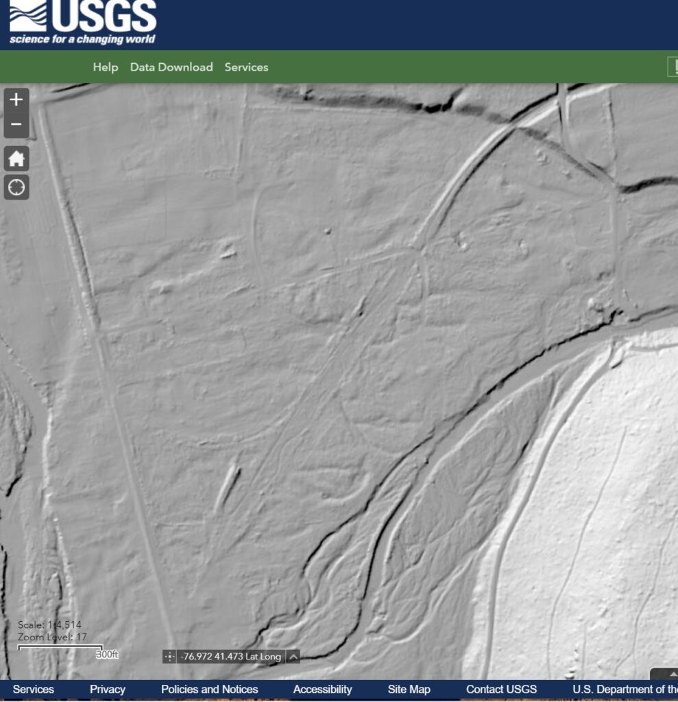
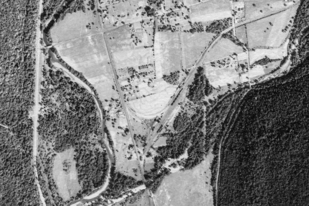
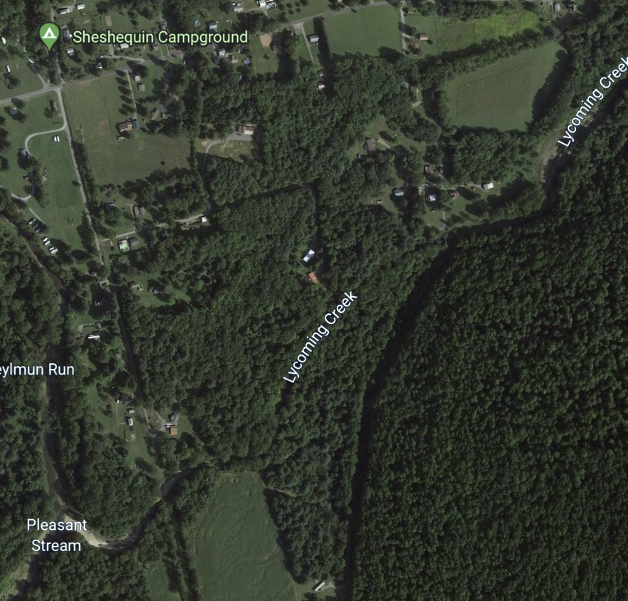
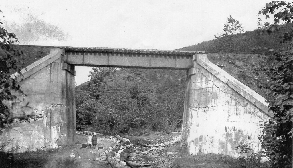
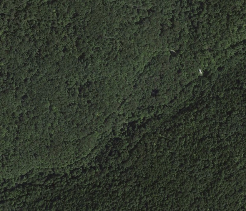
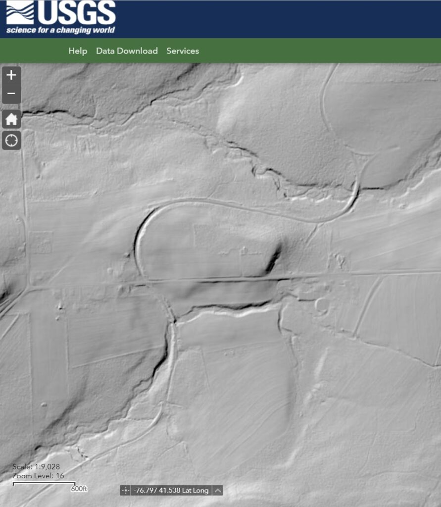
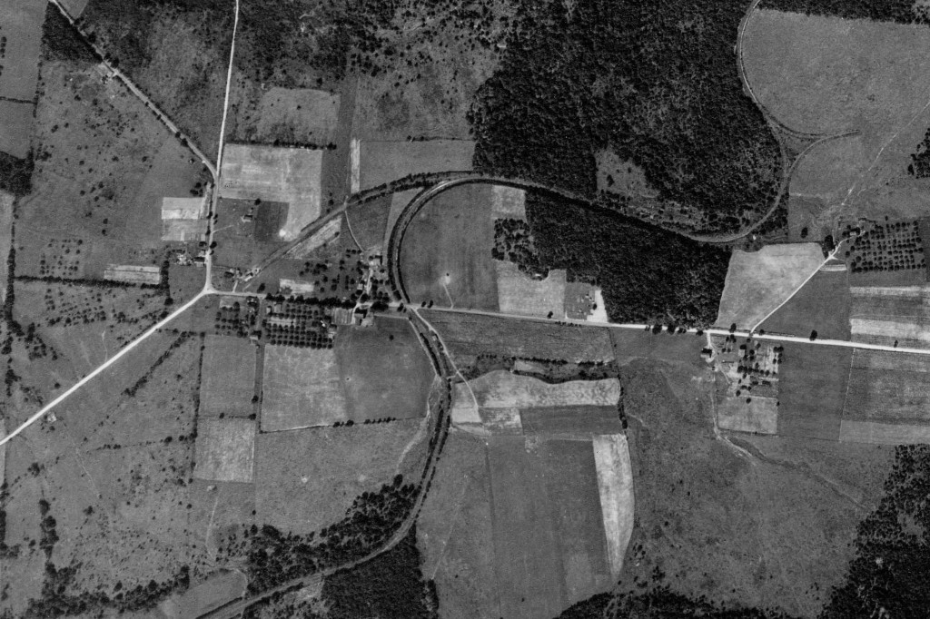
We can combine the USGS LIDAR information with data from other online resources such as Google Earth as well. In this instance, the Susquehanna & New York Railroad roadbed and bridge site over Pleasant Stream dating to circa 1917-1920 can still be seen, despite several severe floods in the early to mid-2000’s which significantly altered the streambed. Images from Google Earth are not useful due to tree canopy cover, but the bridge can be seen in aerial photographs from the late 1930’s available online at: Penn Pilot (arcgis.com). The photos show the bridge abutments as they looked in 2000.

Penn Pilot


USGS LIDAR


Google Earth

Photo by Author


Photo by Author

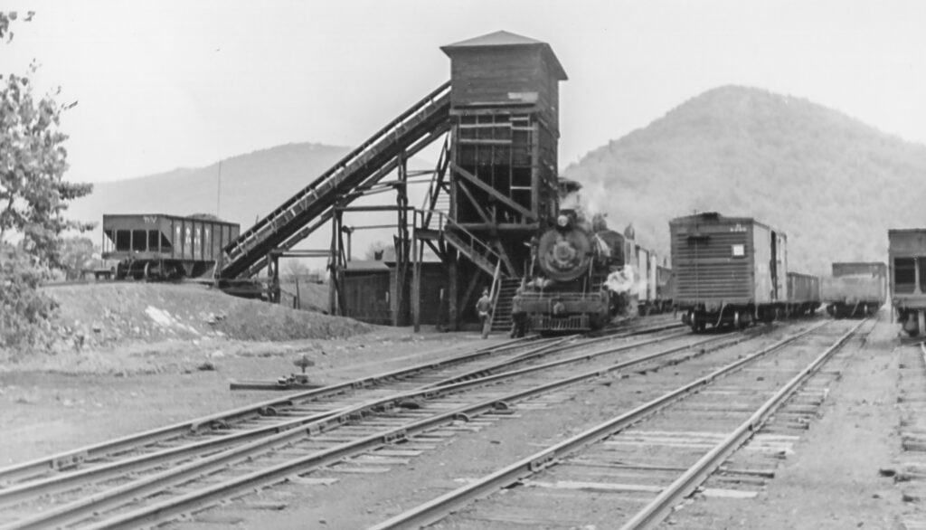
Another interesting example is at Marsh Hill, PA. Here, the standout feature is the elevated ramp serving the coal dock along one leg of the wye track, still visible due to laser light and the power of applied mathematics 80 years after the S&NY was abandoned. The faint traces of the S&NY yard, the rest of the wye, and the roadbed heading east along Pleasant Stream can also be seen. These traces correlate with the Penn Pilot photographs but are nearly completely obscured by trees and modern structures on the Google Earth view.

USGS LIDAR


Penn Pilot


Bill Caloroso- Author’s Collection


Google Earth

One can spend hours following old roadbeds and hunting traces of “what once was” for fun, but the usefulness of this technology for model railroaders researching a particular prototype railroad cannot be understated.

Let’s do a couple more:

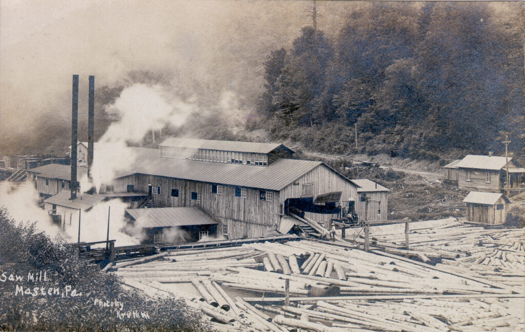
Here is a LIDAR view of the Masten area. In addition to the modern roads, both the “old” S&NY right-of-way and the “new” ROW leading to and from the Masten Loop (out of view to the right) can be seen. In addition, the remains of the log pond dam are revealed in the center of the image.

USGS LIDAR

Author’s Collection

Google Earth

Again, the ground surface details are completely obscured by forest canopy on the Google Earth view.

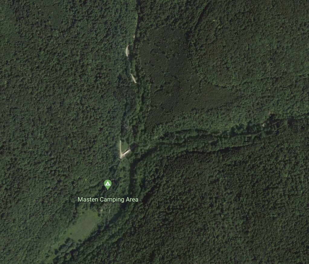
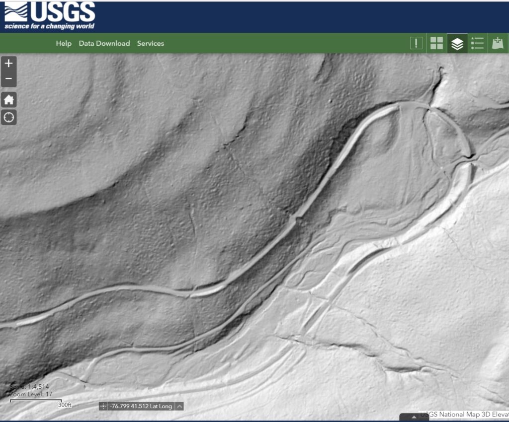
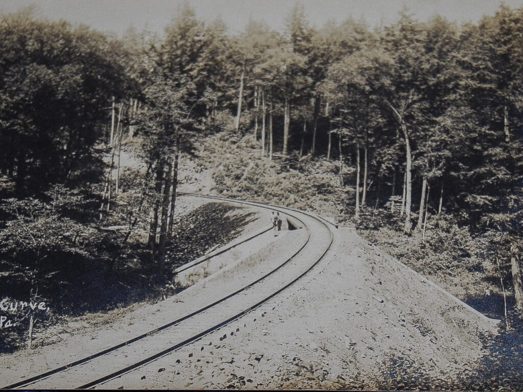
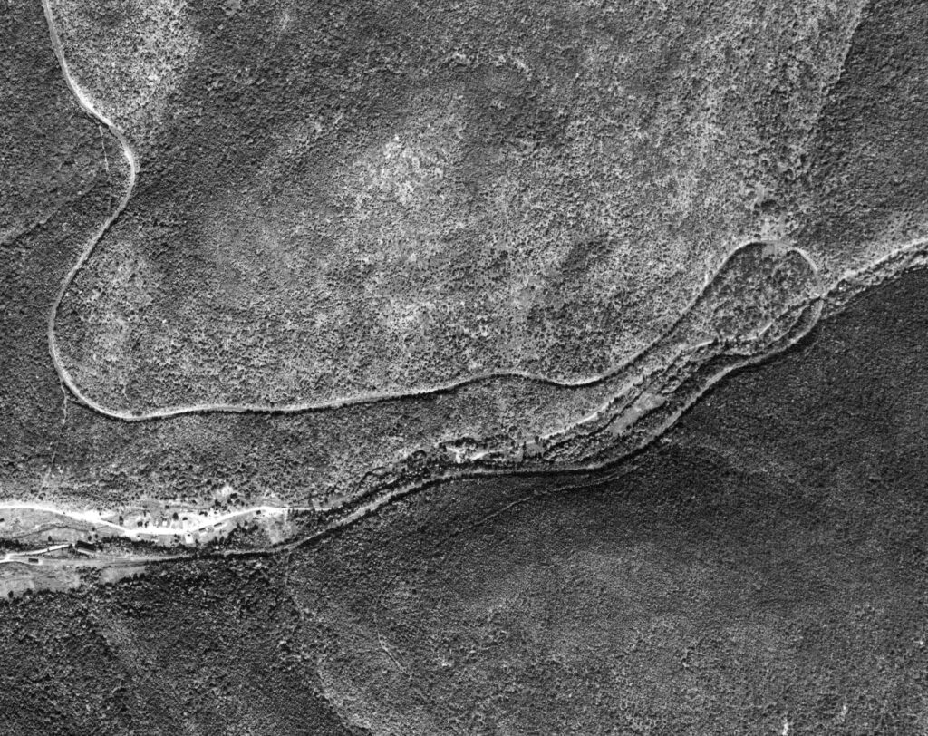
Let’s move to the Masten Loop area. The USGS LIDAR data gives us this view of the roadbed, associated cuts and fills, and the bridge site over Pleasant Stream:

USGS LIDAR

An old postcard view:

Author’s Collection

The view from the air circa 1938:

Penn Pilot

Ground view, date unknown, possibly mid-1930’s:

Walter Parmeter Collection via John Eastlake

And finally, the modern view via satellite:

Google Earth

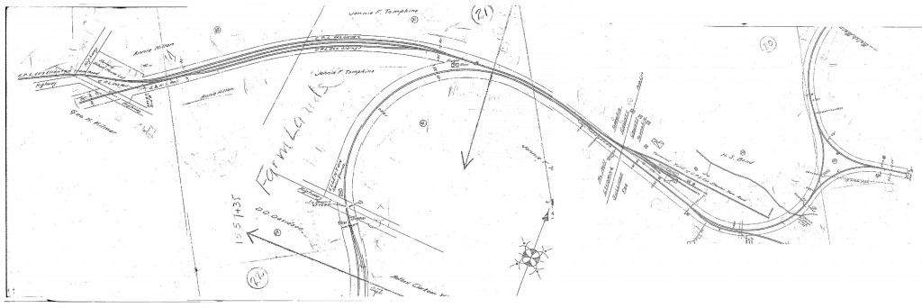
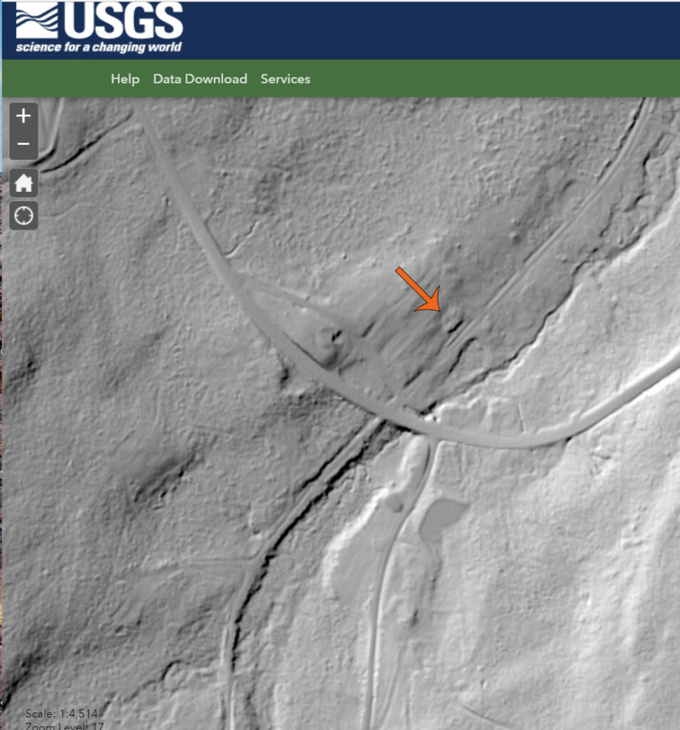
Moving upgrade and northeastward, the outlines of the wye track at Ellenton can still be made out:

USGS LIDAR

1930’s aerial view:

Penn Pilot

Valuation map of the area:

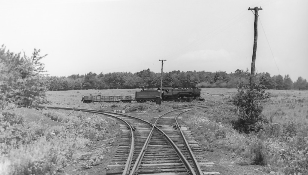
Ground level view, likely during abandonment in 1942:

Bill Caloroso – Cal’s Classics

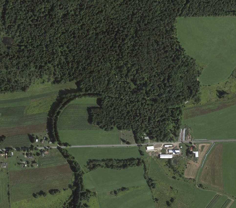
Current Google Earth view:

Google Earth

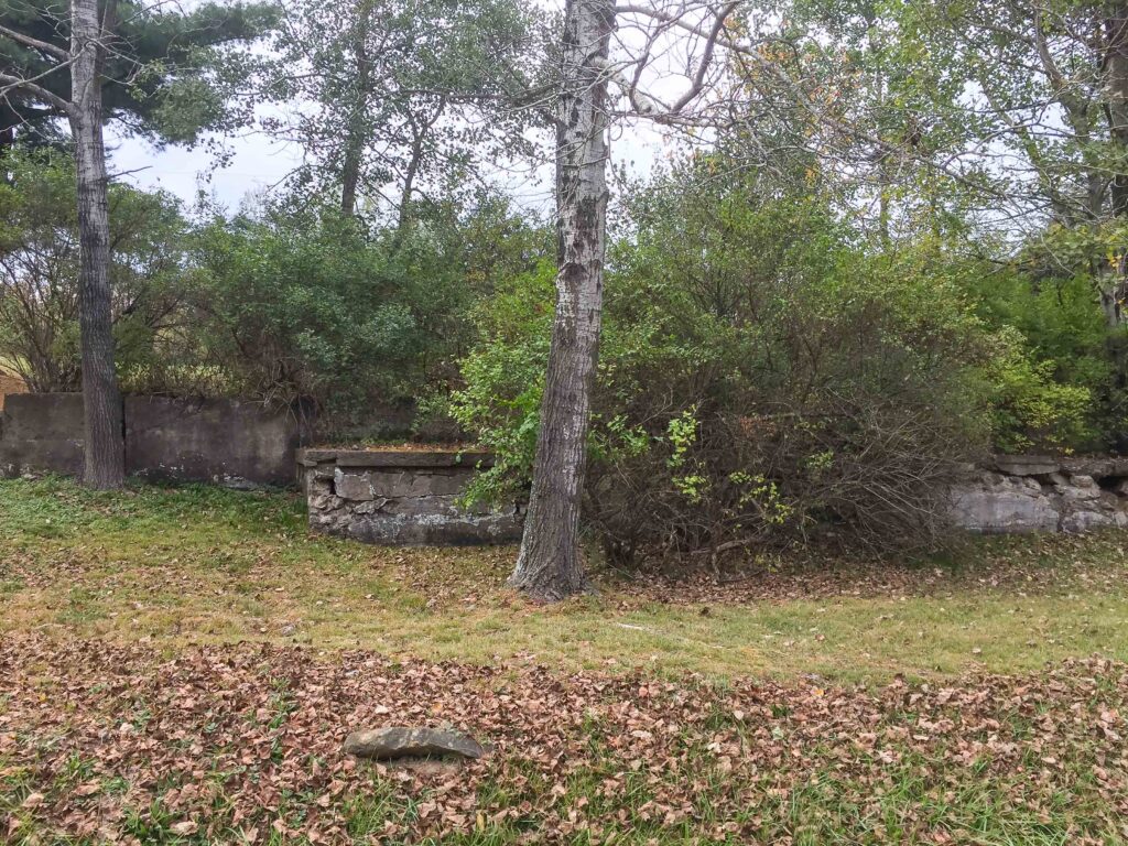
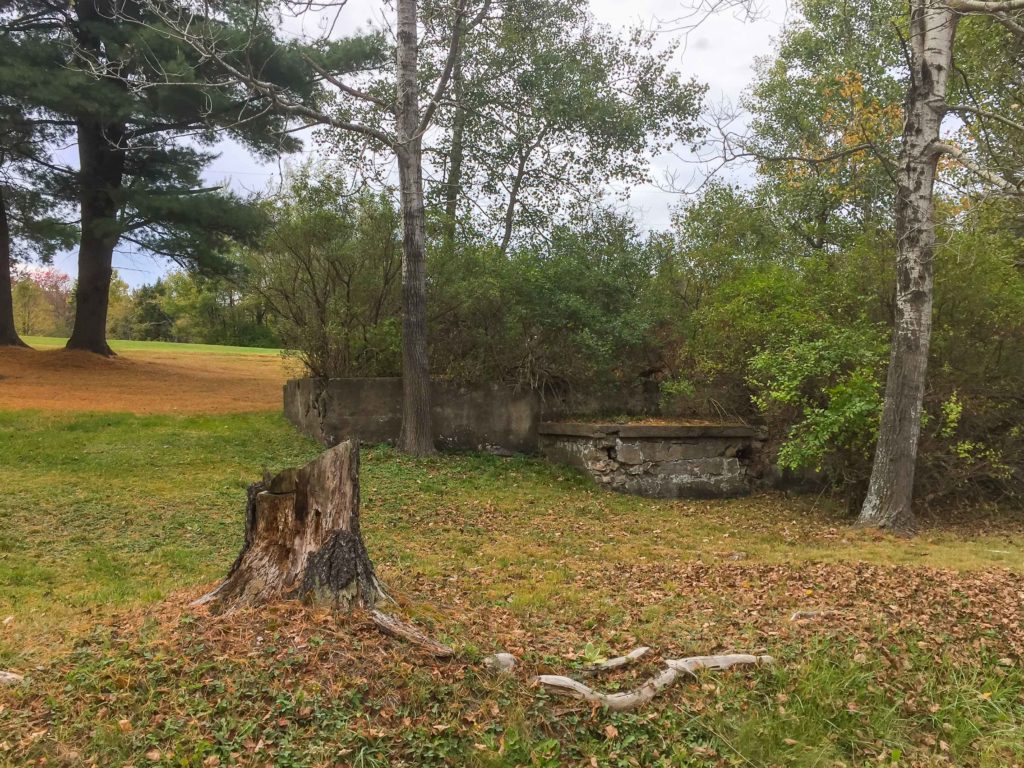
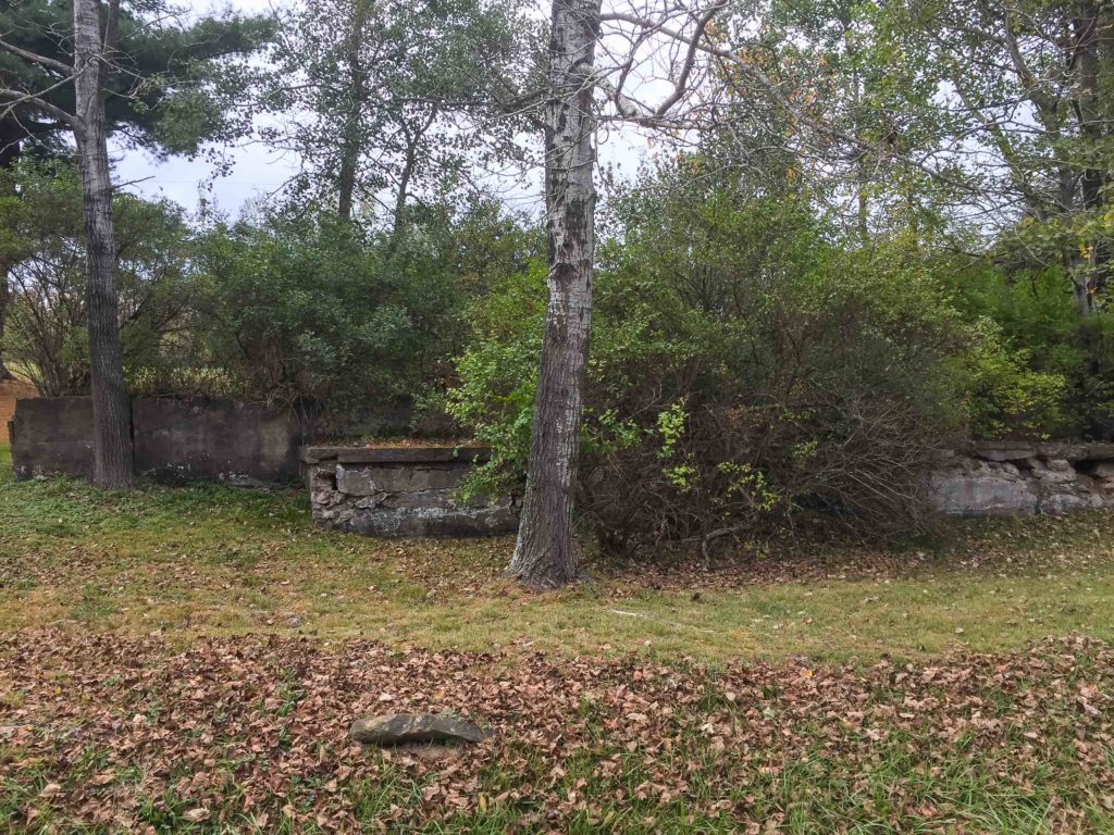
Foundations of long-gone structures can also be seen using this tool. In this view of Wheelerville, the foundation of the old creamery is visible adjacent to the S&NY roadbed, now called Schrader Creek Road:

USGS LIDAR

View of the creamery foundations in 2017:

Photo by Author

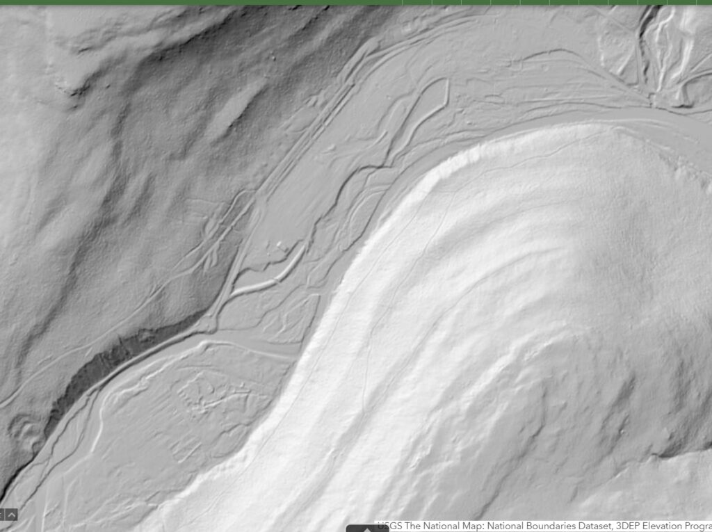
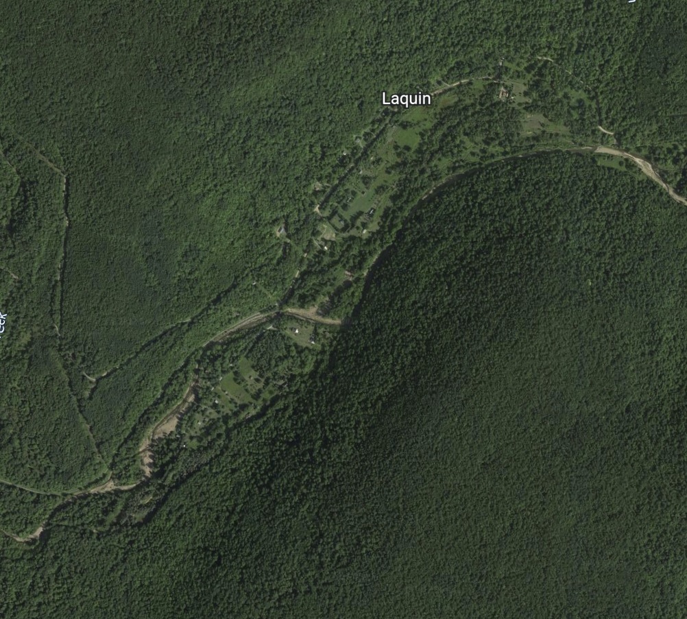
Lastly, let’s have a look at the Laquin area. Hard to make out much detail due to later flooding and the construction of a CCC camp. This is where other resources can come in handy:

USGS LIDAR

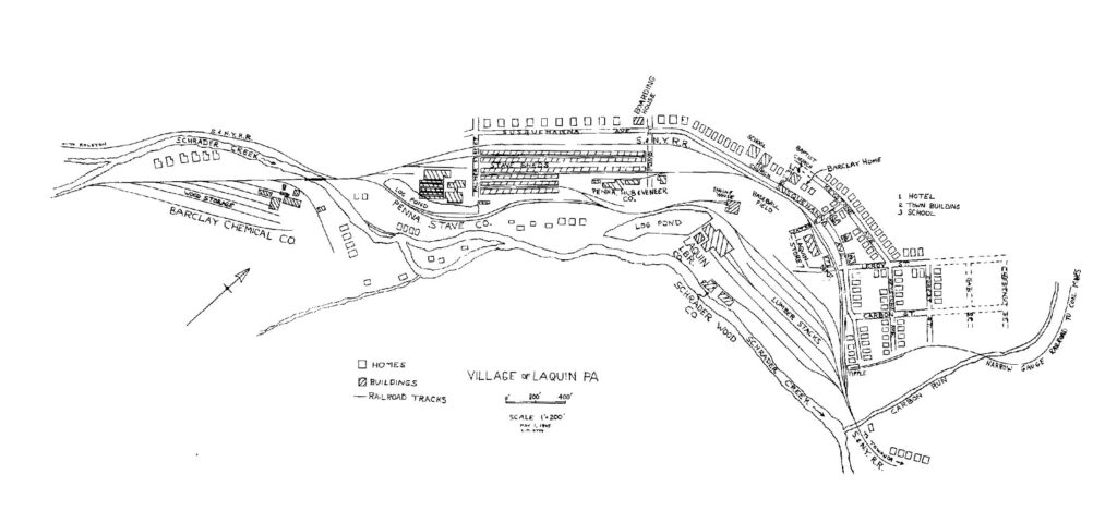
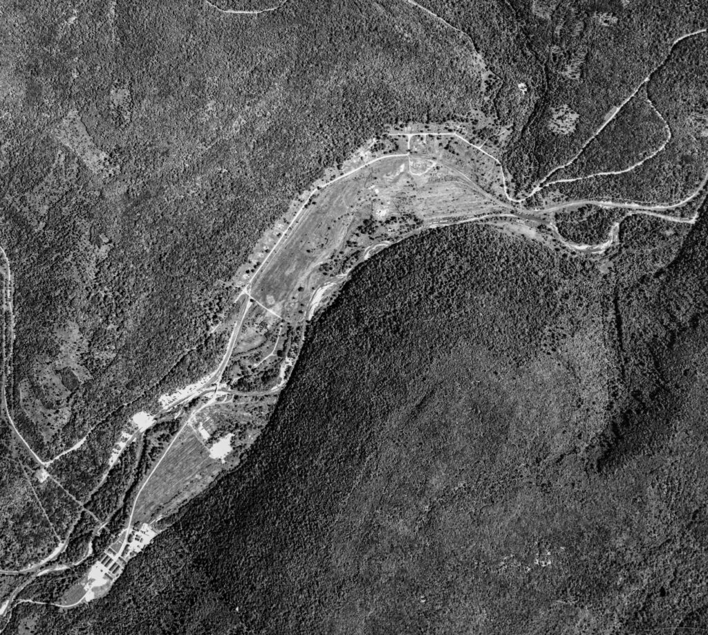
We can get an idea of what to look for, based on a map from Tom Taber’s book “Ghost Lumber Towns of Central Pennsylvania” and the Penn Pilot aerials:

Excerpted from “Ghost Lumber Towns of Central Pennsylvania”


Penn Pilot

On the LIDAR image, we can still see faint traces of the lumber stack area at the lumber mill, the stave mill area, and the chemical plant and associated trackage.

Google Earth

The modern Google Earth view is much less useful, again due to the tree canopy.

Hard to believe we have this technology to research the past right at our fingertips. Truely, we live in an age of miracles. Give these tools a try, and maybe you’ll find your own “ghosts”!
Bradford County Safari and LSOPS 9 (Part 1)

A few weeks ago, I traveled to the eastern part of the state for the 9th Lehigh/Susquehanna Ops Weekend, sponsored by the Susquehanna Division (Division 11) of the NMRA Mid Eastern Region and the NMRA Operations Special Interest Group (OpSIG).

Having an extra day off that week, I decided to leave a day early, and spend part of the day inspecting our hunting camp north of Williamsport, PA, and the rest of the day exploring around S&NY territory west of Towanda. I hoped to get some nice fall leaf photos along the way, but the leaves were not yet at peak due to the recent warm weather.

As it turned out, I ended up spending far too much time hiking and shooting photos at the camp, but was able to get one decent shot (out of many marginal ones) of the creek and a few early autumn leaves:

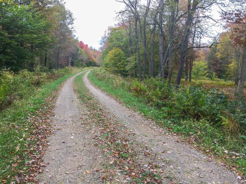
Next I headed up over the mountains to Wheelerville, where I hoped to pick up township road 395/396, and take that down into the Laquin area. Unfortunately, that gravel road, while easily driveable in a pick-up, runs through the 24,000 acre State Game Lands 12, and is prohibited to motorized vehicles between September and January unless one possesses a valid disabled hunter permit. Too bad, as much of this access road is in the old S&NY roadbed.

At the gate:

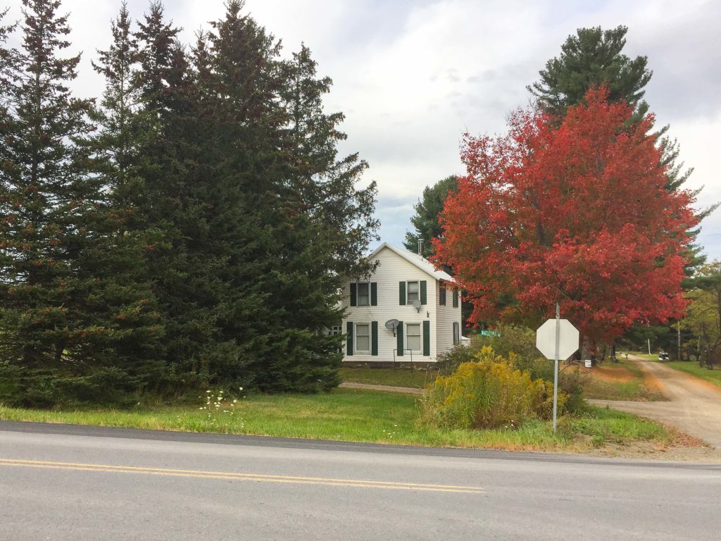
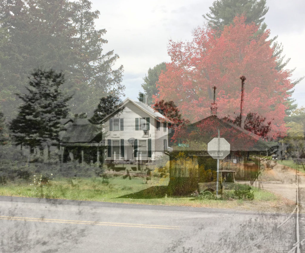
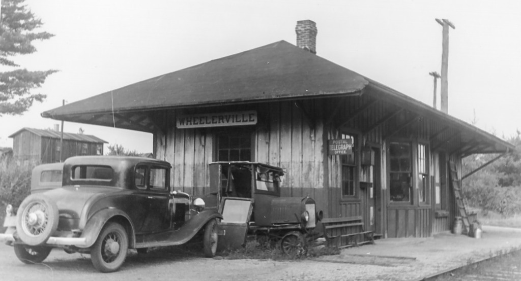
Still, I was able to get photos of the location of the Wheelerville station in person:

Nearly the same view, only 70 or so years earlier:

And now, with a little Photoshop magic, we can see the Wheelerville station as a “ghost”:


I was also able to grab a couple of shots of the foundations of the Wheelerville creamery:

So, I then back-tracked over the mountains and headed east on Southside Road, paralleling Rt. 414, hoping to find a good road back over to the Laquin area, but my nav system was less than helpful and I was not successful. (Helpful hint: Don’t follow roads with colorful names like “Pine Swamp Road” when trying to find a shortcut…)

By the time I came out near Towanda I was too tired to back-track through Powell and Monroeton. Will have to save that for another day.

After a night in the palatial Comfort Inn at Towanda, I was off bright and early for Allentown and LSOPS 9.

More on that in Part 2…

Wheelerville Store

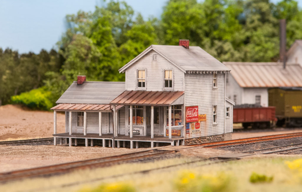
Slow progress continues on recreating this scene in HO on the model S&NY:

Finally finished weathering the house/store in the background in the above photo:

The structure was kitbashed, starting with a City Classics Company House. A Tichy storefront was cut down and replaced the lower front side of the company house. The addition is scratchbuilt, along with the porches and roofs. Chooch flexible stone material was a close match for the kit foundation, and that was used under the addition. Signs are a mix of homemade and commercial offerings, and the “interior” made up of flats created from downloaded images. Window treatments are manila envelope material and homemade from internet images. Weathering is layers of oil-turpenoid washes, powders, and Pan Pastels.

I left off the porch stairs for now until the model is permanently affixed to the layout. I was afraid I’d break them off during handling otherwise. Also still needs a few details, like a gravity-fed gas pump and perhaps a red Coke cooler on the porch. Oh, and a dog. Gotta have a dog lounging on the porch for passersby to pet…

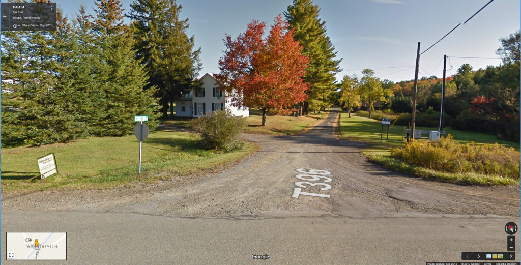
3/26/17 ETA: Google Maps screenshot of the same area today. County road has been re-aligned; the original road is still in front of the house. The SNY station would have been right about where the bush is at the corner of the two gravel roads on the modern view.

Building Wheelerville Depot

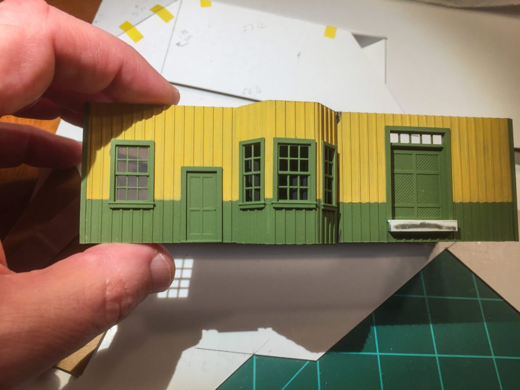
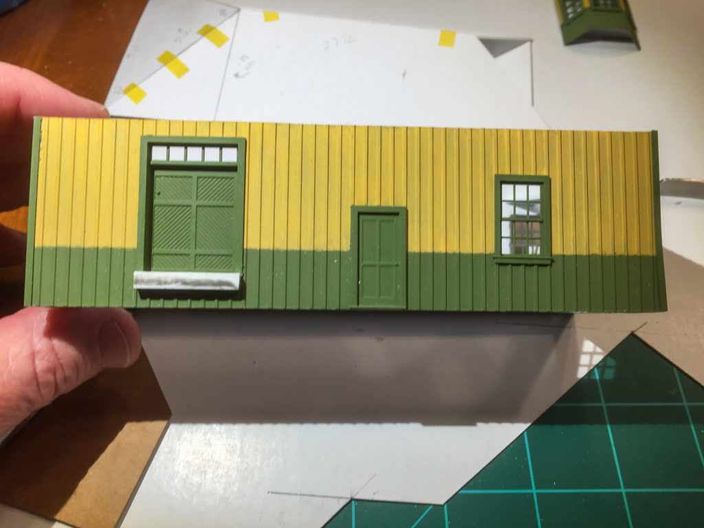
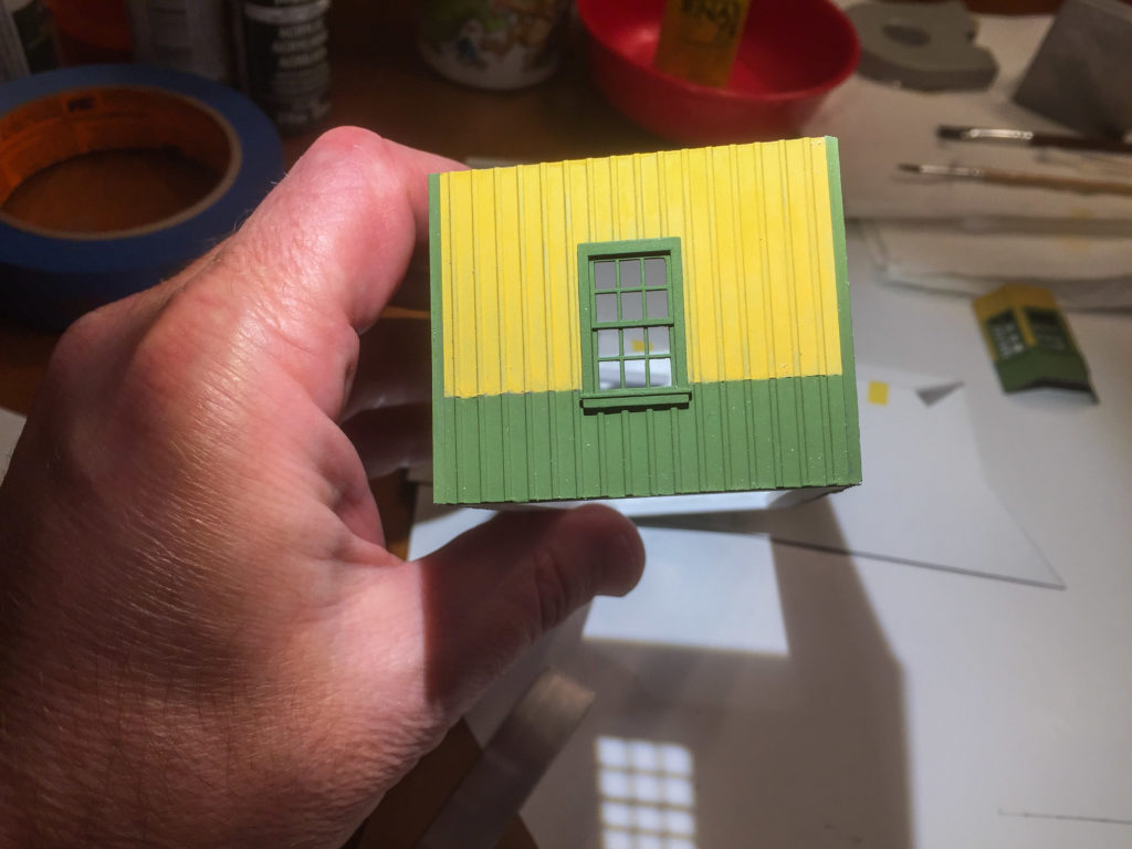
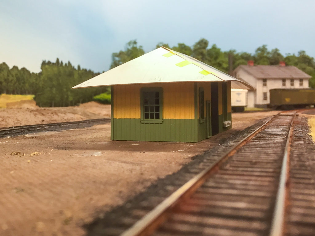
Spent the last week or so attempting to scratchbuild the Wheelerville station. I do have a couple of views that show the south and east walls, but the configuration of the other sides of the building are a complete mystery, and are educated guesses on the model.

I made the assumption that one batten and one board on the real station probably measure close to one foot. I used that guestimate to count boards and battens to arrive at a rough approximation of the overall dimensions, which worked out to 43′ x  16′. I used a wall height of 13′, arrived at by comparing plans of similar stations in the Model Railroader digital archive. I did fudge the long dimension  a foot or two so that the operator’s bay would fit between the battens evenly, and to accommodate the dimensions of the Tichy windows I planned to use. The bay dimensions and the angles of the bay walls were also guestimated by what looked right, the Tichy window dimensions, and measurements of similar depots in the MR archive.

Front view:

wheelerville-model-1

Rear view:

wheelerville-model-2

Side view:

wheelerville-model-3

The hip roof is the trickiest part. I referred to a John Nerich article on building hip roofs in the May 2014 RMC, and I also corresponded with John via Facebook on some of the nuances of construction, particularly regarding the appropriate amount of overhang, which could vary from about 5′ up to 7′ on some stations. The overhang I will end up with will be around 5-6′. The next tricky part will be trimming the bay walls to fit the slope of the overhanging roof. I had to brush up on my high school trigonometry to work out some of the dimensions, and in the end I did simply resort to a little trial-and-error cutting and fitting of the cardboard roof mock-up.

Here is the mocked-up roof compared with the real station:

wheelerville-cropped-1 wheelerville-roof-mock-up-1

Bill Caloroso - Cal's Classics

Bill Caloroso – Cal’s Classics

Author's Collection

Author’s Collection

At first I thought the real station had a more squat appearance than the model, but the more I look at it, I think it will be “close enough” once the roof supports, foundation, and a few other details are added.

To be continued…


Talky Tuesday #39

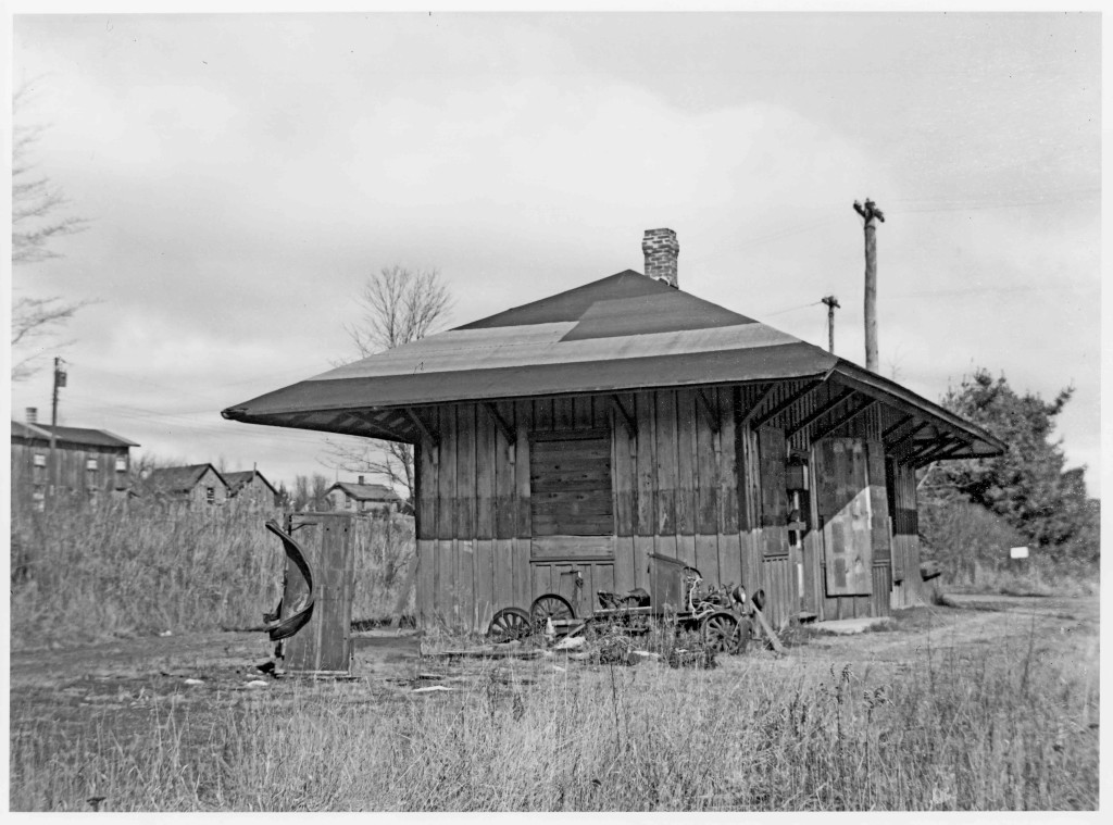
The depot at Wheelerville, PA sits forlorn and abandoned in last week’s “WW #67”. This is a closer shot than “WW #66”, and shows a few architectural details to better effect. The model-T inspection car looks to be vandalized, or partially stripped for scrap in this view as well.

I am uncertain of the date, though it is certainly post-1942 abandonment, and may even be post-war.

I wonder what became of the station sign??

Wordless Wednesday #67

Author's Collection

Author’s Collection

Talky Tuesday #38

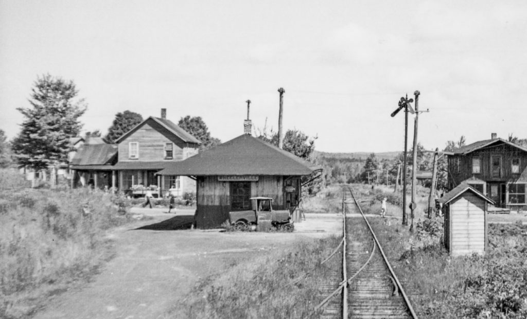
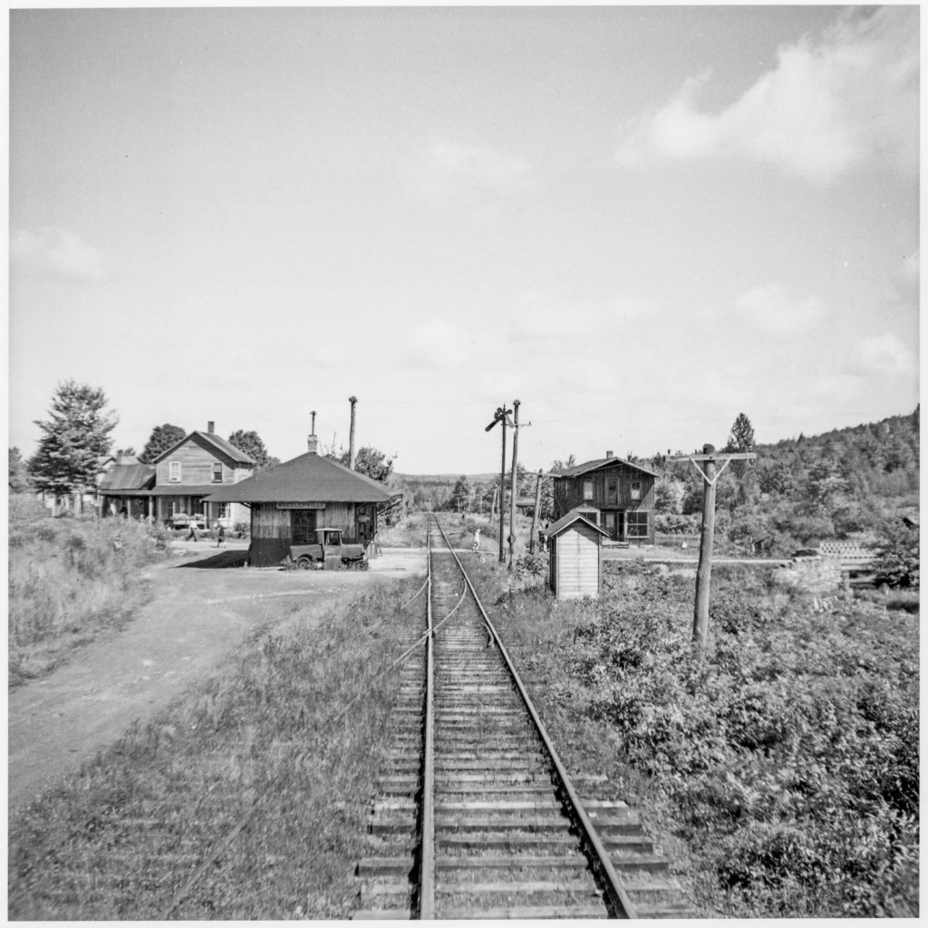
Last week’s “WW #66” gives us an excellent overview of Wheelerville, PA, probably taken from the rear platform of a caboose on an eastbound train.

There is a wealth of detail for the modeler in this photo, which makes it all the more valuable. To the left, we have an excellent look at the eastern or southern side of the Wheelerville station. Rusting away in the weeds next to the station is an inspection car, likely built from a Ford Model T. This should be an easy project using a Jordan kit and a bit of judicious rust weathering powders. Across the tracks, a phone box and train order signal keep vigil. The passing siding is nearly obscured by weeds in the (presumed) late summer view.

In the background, a large flowerbox decorates the front porch of a home, whose front has the appearance that it might have been a general store in the past. Despite the remote location and small size of the village,  there are at least three pedestrians going about their business on the county road.

All in all, a fascinating little vignette of the past…

Wordless Wednesday #66

Author's Collection

Author’s Collection