Bill Caloroso – Cal’s Classics
Bill Caloroso – Cal’s Classics
Bill Caloroso – Cal’s Classics
Bill Caloroso – Cal’s Classics
S. Van Gorder photo, Author’s Collection

Bill Caloroso – Cal’s Classics
Haven’t been able to add much to the site for the past couple of months due to other commitments, but I’ve been waiting for the weather to change to something more appropriate before I added these two photos. That time is upon us, so here they are:
Author’s Collection
The original photo is not the best quality, especially as regards to sharpness; but a little tweaking in Photoshop helps a little.
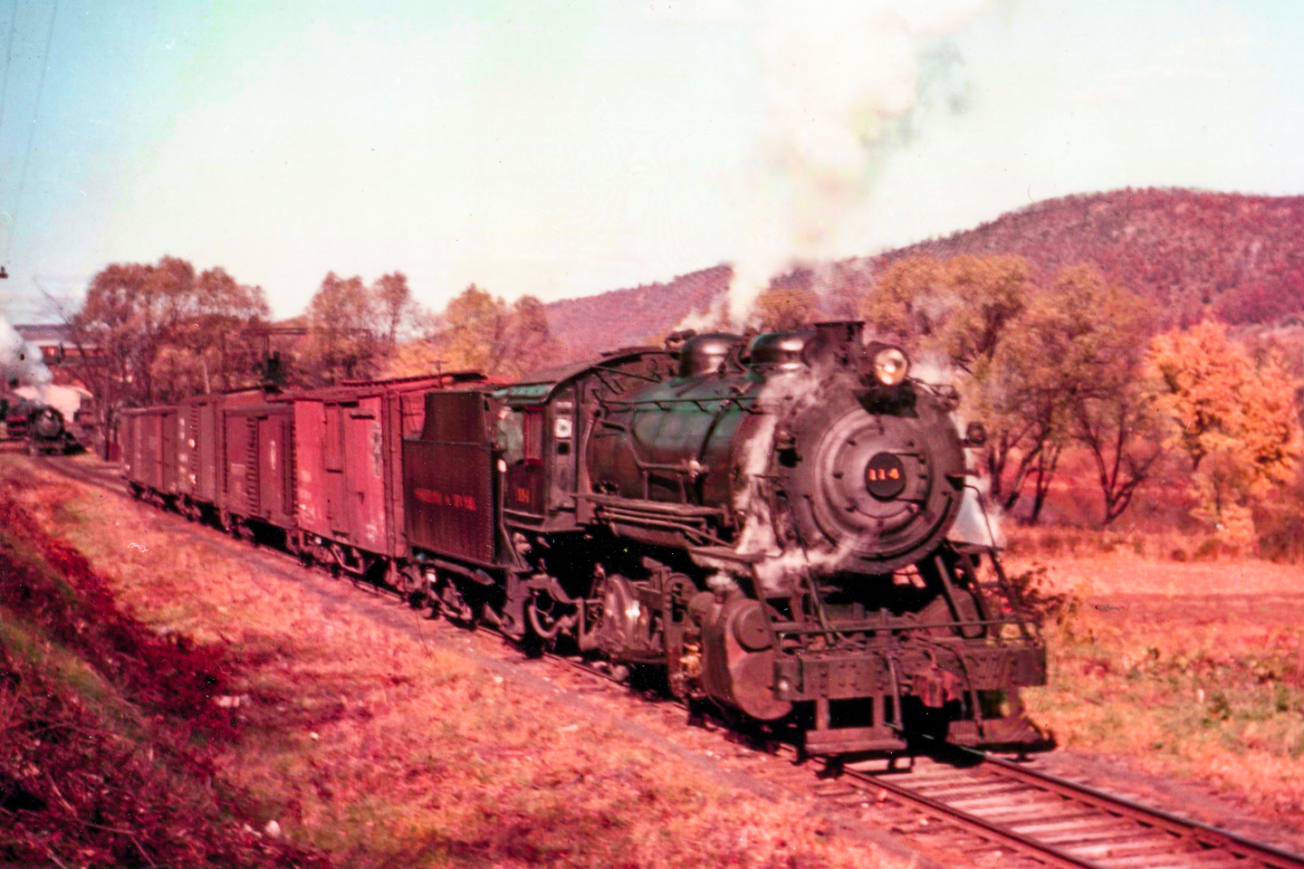
I believe rail historians tend to (unconsciously) think of the past as being in “black and white”, since nearly all of the images from the steam era especially, are in that format. For this reason, color images from that era are incredibly valuable, since they make the past seem more “real” and immediate somehow. Doubly so for an obscure railroad line like the SNY. Even though the image itself is technically limited, it is still quite evocative. We can imagine a crisp fall day, with the leaves near their peak, just enough of a dry chill in the atmosphere to allow the steam from the engines to condense around them to show how alive they are. The war in Europe still seems quite far away, and finishing up the fall harvest and hunting season are more immediate concerns in this rural corner of Pennsylvania. For now, we can sit in the warm sun and watch #114 work to put together a Newberry-bound freight. In a minute or so the engine and cars will back down on the helper engine and the rest of the train in the distance, lace up the air hoses, test the brakes, and storm past us downriver.
This photo is a goldmine for the modeler. First, we can see the variety of roof heights, weathering patterns, and overall coloration of the pre-war boxcars behind the engine. The first car is a truss-rod boxcar, perhaps Great Northern; the second is clearly a PRR X29. The others are too small in the image to identify. Second, we can note the coloration of the roadbed and ballast, and the surrounding vegetation. Last is the locomotive, where we can see in great detail the condition of the paint and the weathering patterns on the smoke box and pilot.
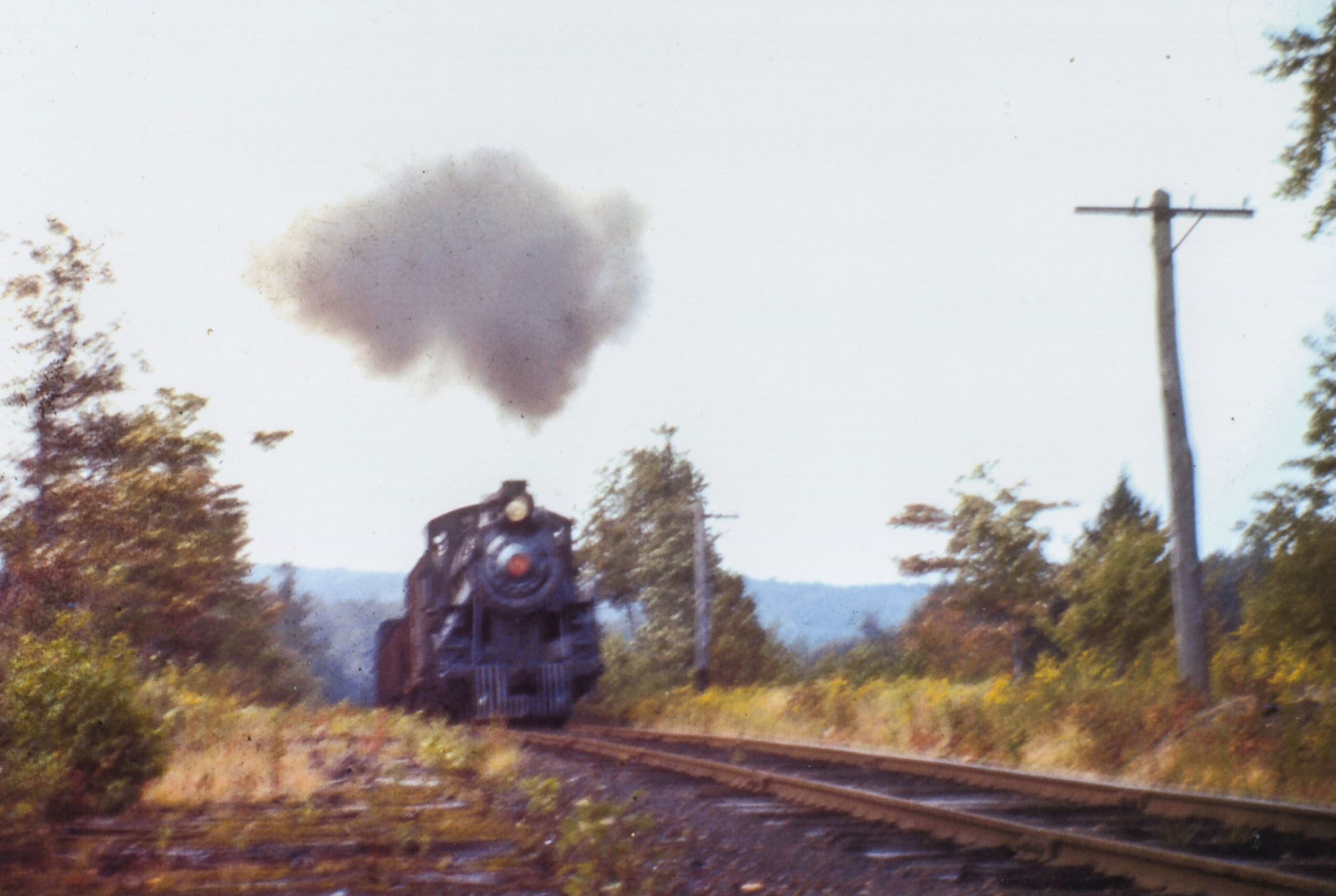
This photo is really unsharp, but still has a lot of atmosphere, and useful information for the modeler. The train seems to be literally hanging over the edge of the hill behind the engine, and we can get a hint of the grades the SNY had to contend with. We can see the condition of the SNY roadbed, and see the variety of colors of the weathered ties. The telegraph poles are only “sort-of” straight, and are weathered to an interesting grey color. Golden-rod is in flower, but is kept away from the roadbed along with the other weeds by the acidity of the ash and cinders, and probably spraying by herbicides that are banned today.
In either event, the engine must really be pounding away trying to get this tonnage over the hill, so let’s stand back a bit and watch him go by…
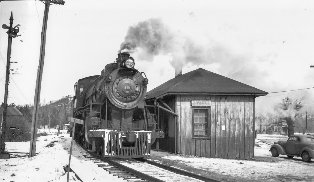
Ralston, PA is a small town nestled in the mountains along the Lycoming Creek, some 30 miles north of Williamsport. Ralston was an important crew-change point and helper station along the PRR’s Elmira Branch until the late 1920’s. The town’s importance to the PRR declined after this time, as larger, more powerful locomotives were developed that could make a through run from Tyrone or Altoona to Southport yard in Elmira, NY in a 16 hour crew day, obviating the need to exchange crews that were about to “outlaw” on hours-of-service for rested crews that had been stationed in Ralston. For a more detailed look at PRR activities in Ralston, see the excellent book “Set Up Running – The Life of a Pennsylvania Railroad Engineman” by John W. Orr. The book also includes a map of Ralston and the PRR facilities there.
Ralston was relatively less important to the SNY, but was served by a short branch from Marsh Hill yard. A large tannery, operated by the Elk Tanning Company, was located there. I have heard from other sources that there were several other smaller industries in Ralston in the early and mid-20th century, most notably a brick yard and a baseball bat factory, but I have no hard sources for that information.
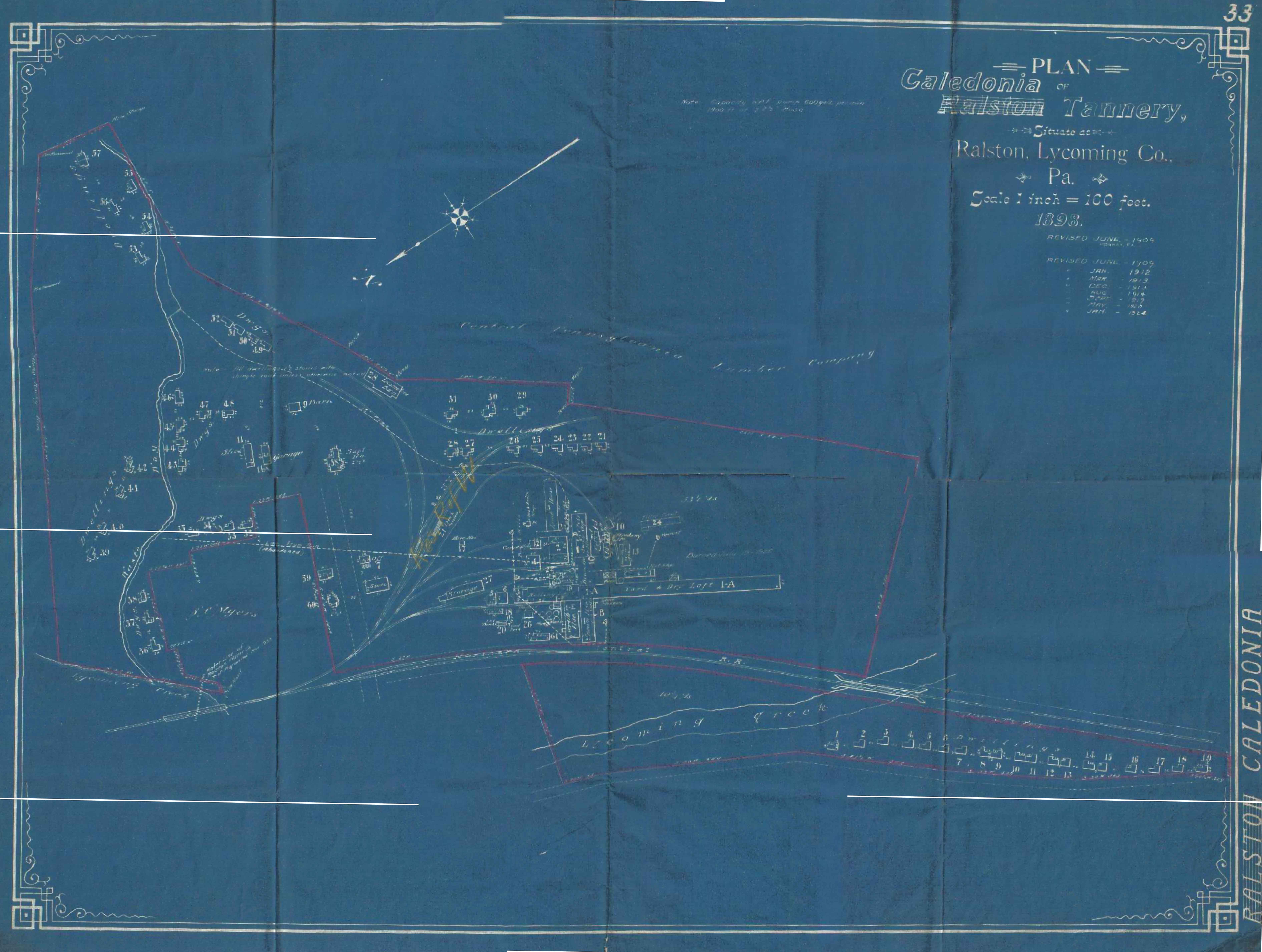
Map Courtesy Roy Breon via the “Elmira Branch” Yahoo Group
Above is a scan from a valuation map of Ralston posted to the “Elmira Branch” group on Yahoo. This map dates from 1898 (with periodic revisions noted, the last dated 1924), prior to the existence of the SNY. The SNY did not come into being until 1902, and did not reach its western terminus at Ralston until September 1903. It can be assumed that the tannery was probably served by the Northern Central Railroad (precursor to the PRR in this area) prior to the arrival of the SNY in 1903. Indeed, part of the impetus for completion of the SNY was to service tanneries owned via various corporate entities by the United States Leather Company. Most of the timberland along the SNY route was owned by the Keystone Lumber Co., another subsidiary corporation of US Leather; and the SNY railroad itself was owned ultimately by the US Leather Company as well. This large conglomerate most likely did not want freight revenue to “leave the family”, so to speak; so why not build its own railroad to capture the revenue instead of paying the Northern Central.
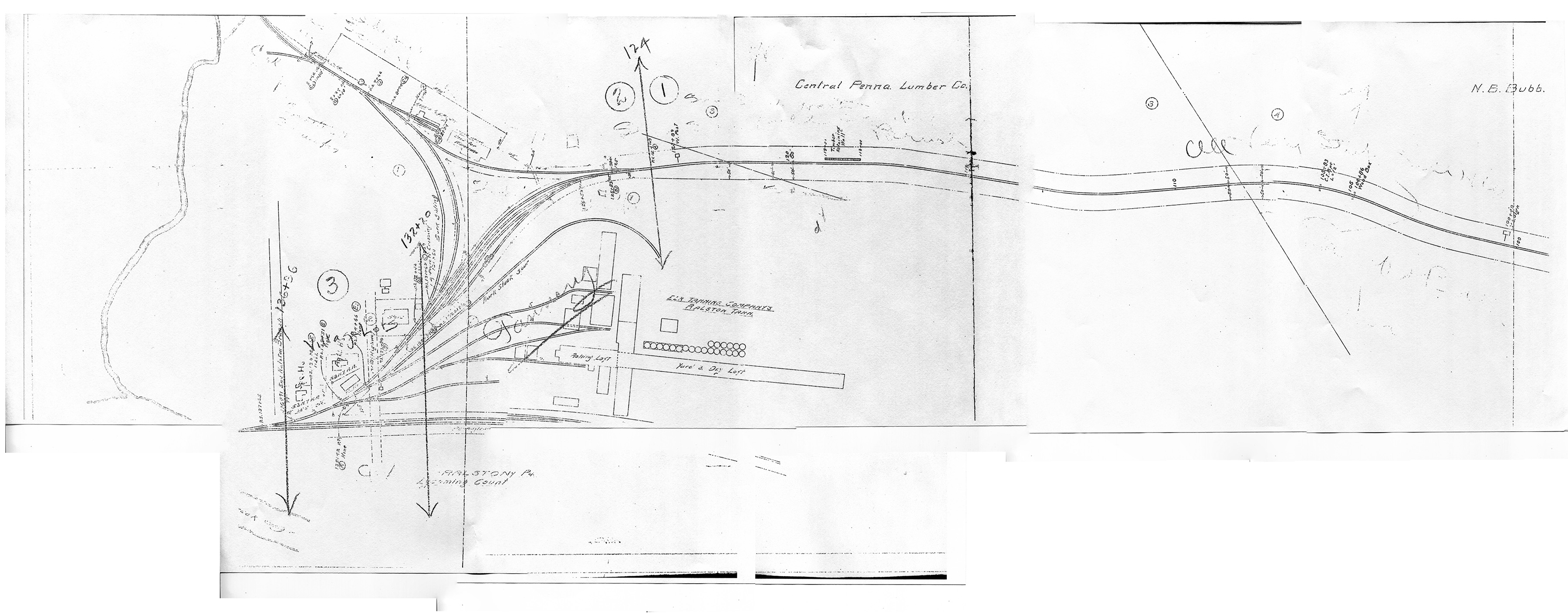
Map Courtesy of Charlie Marvin
Above is a valuation map, circa 1918, provided by Charlie Marvin. North is to the viewer’s left. We can now see by this time that the SNY enters the area from the south along Lycoming Creek. However, the western terminus of the SNY is no longer at Ralston, as the railroad decided to construct a new yard and engine service facilities further south at Marsh Hill as part of the railroad’s plans to expand south to connections at Newberry, PA. However, there were still a few customers to be served in Ralston, and the SNY ran local trains up the branch from Marsh Hill to service them. I believe I had read in one source that the tannery had burned down by the mid-1920’s and was not rebuilt, as the hemlock bark used in the process had been pretty much exhausted from the area forests, all the hemlock having been timbered. One of these industries was apparently a “wildcat” coal mine that produced a few cars a week. The struggle the SNY had to get cars upgrade to this mine is described vividly in “Set Up Running”. I believe most of this coal was probably used as locomotive fuel by the SNY itself, and not much was likely interchanged offline.
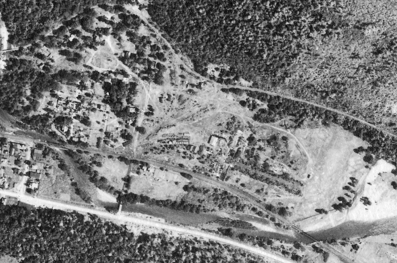
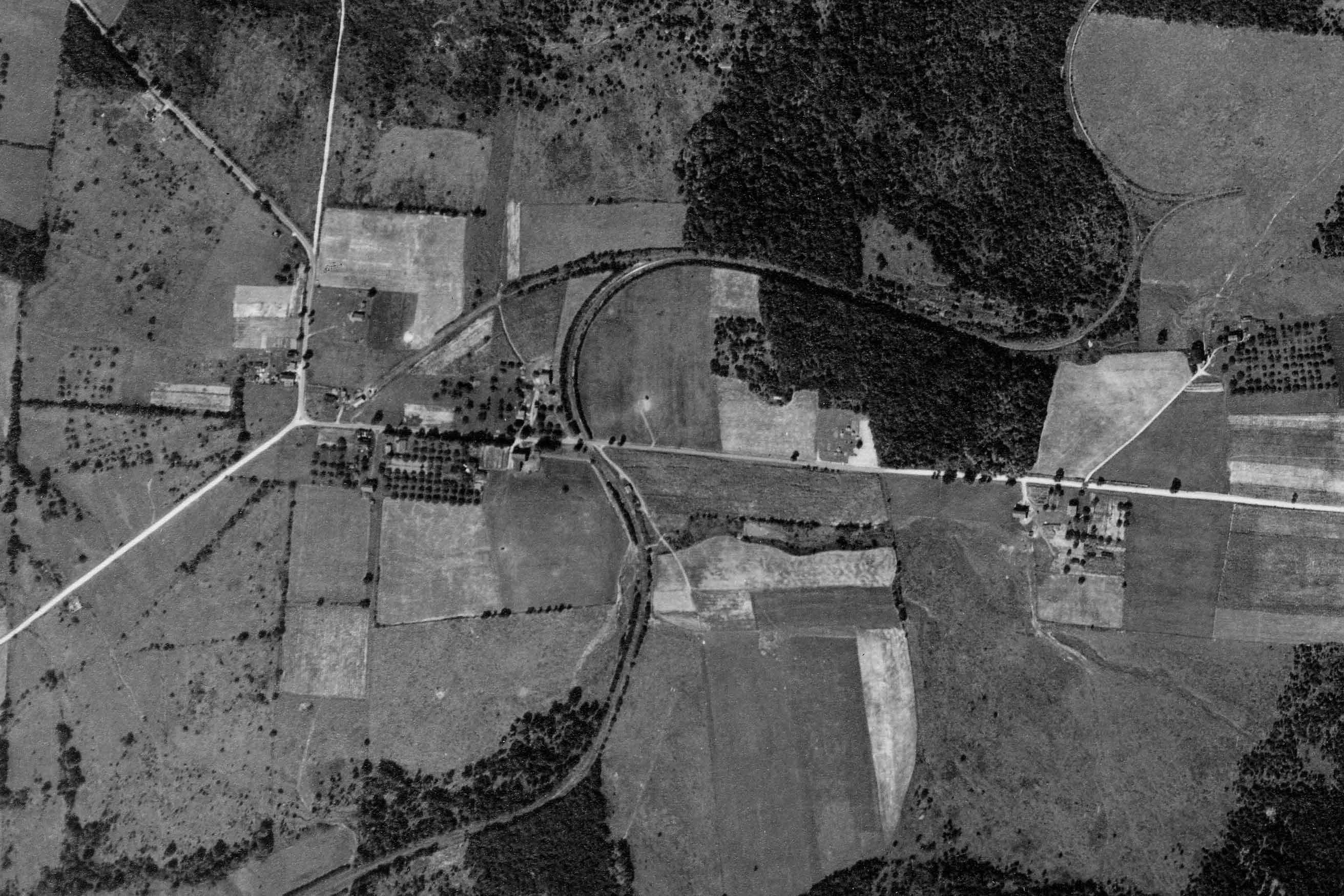
Penn Pilot – Penn State
Above is a 1938 aerial view from Penn State’s Penn Pilot site. I have cropped and rotated the original to match the valuation maps above. We can see the SNY branch to Marsh Hill heading off to the viewer’s right, and the SNY wye, and remains of the tannery buildings in the center. At the lower center is the PRR Elmira Branch running right to left, with two bridges crossing Lycoming Creek at the middle and south end of town.
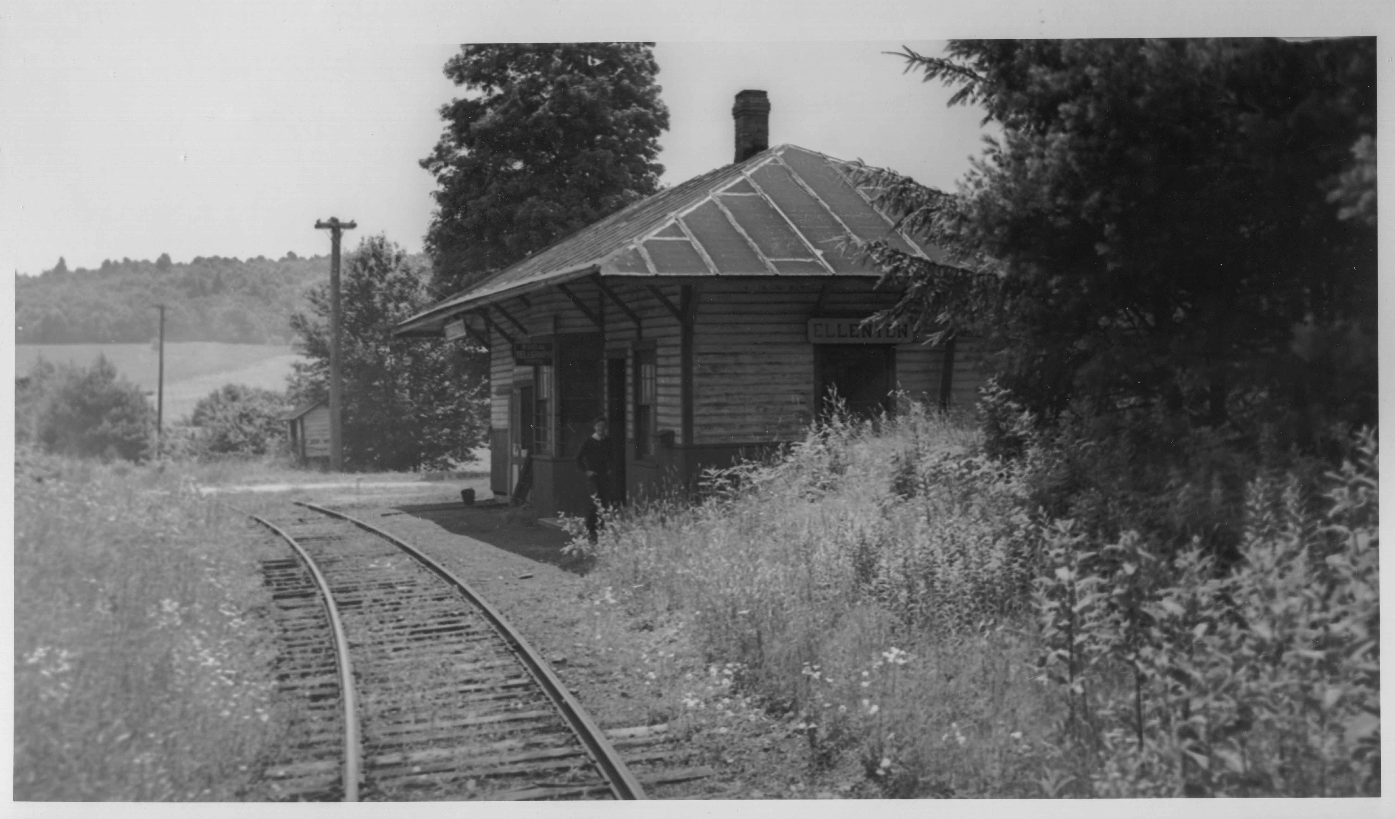
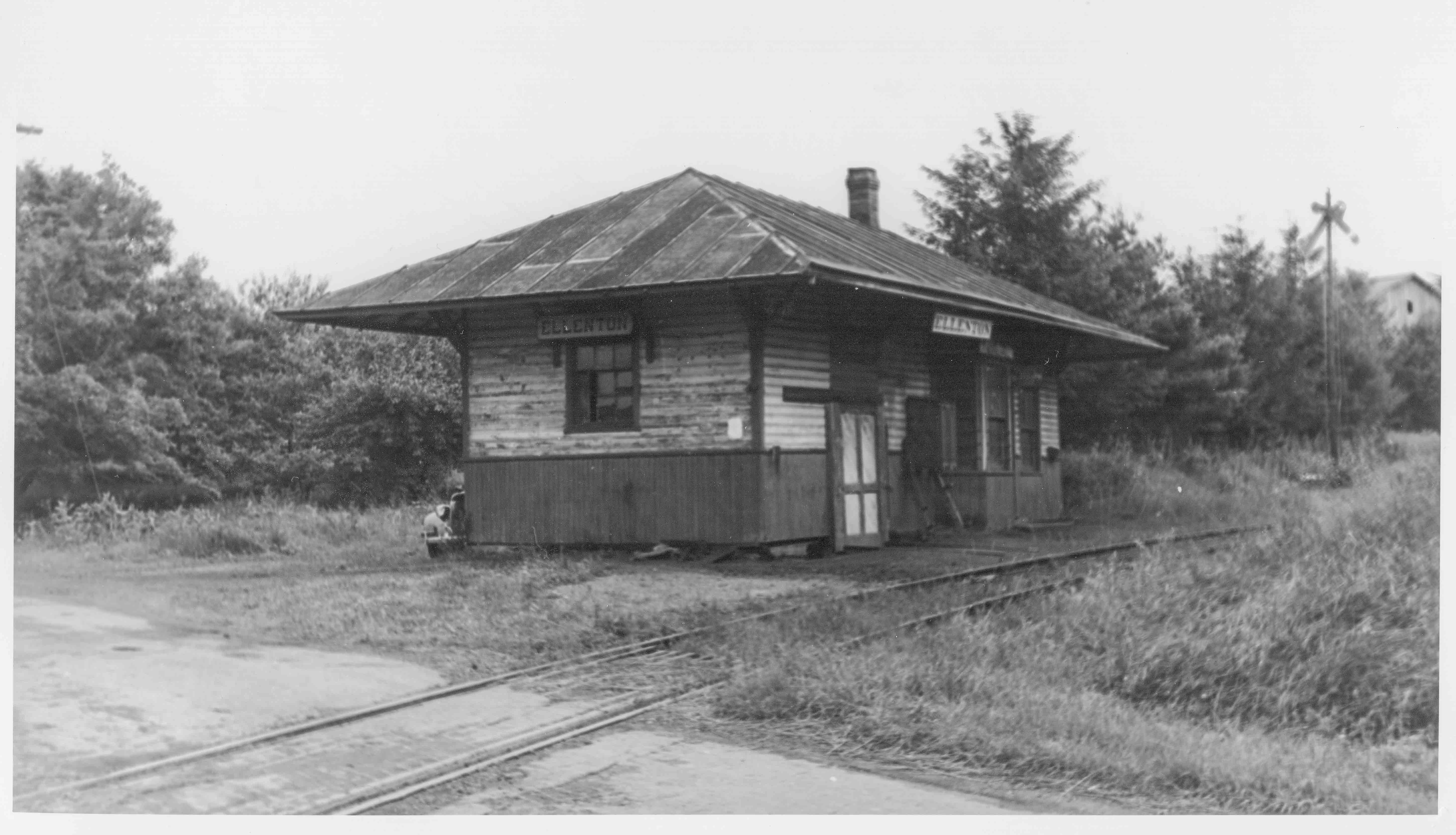
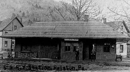 Above is a poor quality scan from the ‘net of the SNY station at Ralston. This is the only photo of SNY structures in Ralston I have come across. I believe it was probably located at the north end of the SNY wye trackage, near Lycoming Creek and the Northern Central (later PRR).
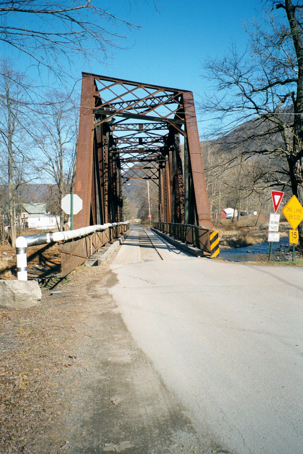
Photo by Author
Above is a view looking northward, of the second of three PRR bridges in Ralston (At the viewer’s left lower center in the 1938 aerial view above). This bridge survived the flooding during Hurricane Agnes in 1972, but was abandoned by Penn Central since the flooding wiped out many of the branch’s other Lycoming Creek bridges. Later taken over by the town of Ralston and used as a road bridge after more floods in 1996 destroyed the nearby road bridge, it was finally removed in 2002 after a modern concrete road bridge was built by the county immediately adjacent.
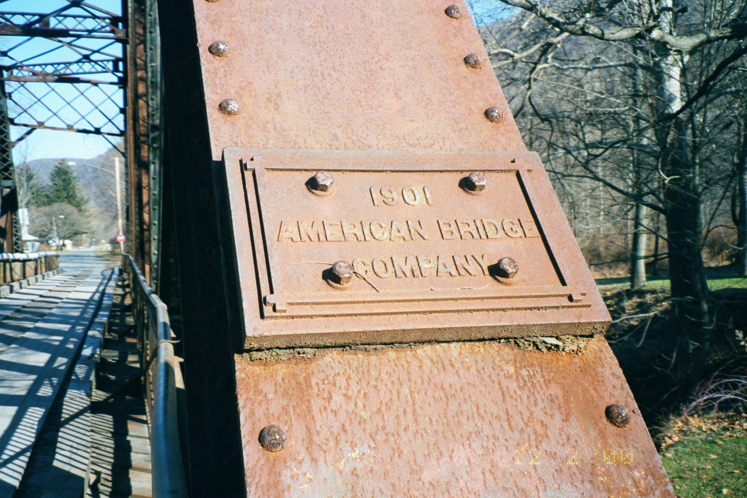
Photo by Author
Detail view of the bridge, built in 1901. Ironic to note that this bridge actually dated to the Northern Central Railroad era, and pre-dated the arrival in Ralston of both the PRR (the NC was not completely absorbed by the PRR until 1917), and the SNY (which did not arrive until 1903), yet outlived them both.
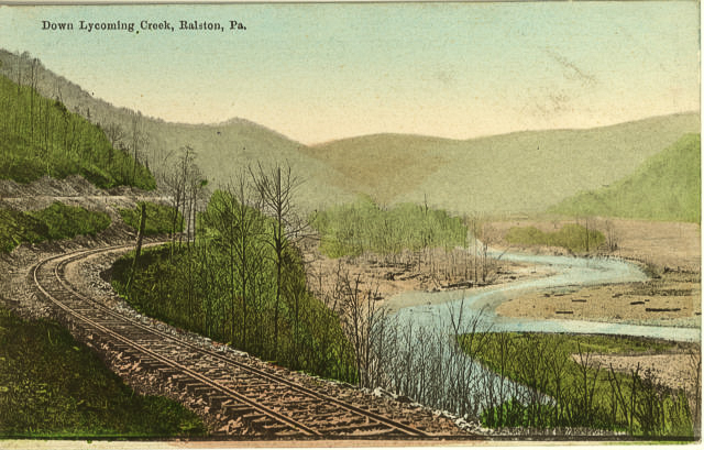 Above is a scan of a postcard view of the Lycoming Creek valley near Ralston from the early part of the 20th century. Aside from the size of the trees, Lycoming Creek in most spots does not look much different today.
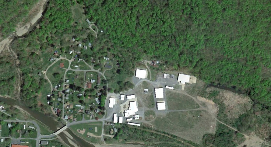
Google Earth
Lastly, above is a modern satellite view of Ralston from Google Earth, again oriented with north to the viewer’s left . The modern bridge which replaced the hundred year-old Northern Central bridge can be seen in the lower left corner, and is just downstream from the site of the old bridge. A modern wood-products plant is sited on the footprint of the old tannery. Time, floods, trees, and newer construction have pretty much obliterated any trace of the SNY, though the old Elmira Branch roadbed can still be faintly seen curving just west of the new factory.
Update 11/29/13:
Reader George Lane provided a link (http://www.loc.gov/pictures/item/2008677185/) to a stereoscopic view of the Northern Central station at Ralston ca. 1870 from the Library of Congress. I would guess the view is looking north with the northern-most of the three bridges over Lycoming Creek in the background. I am not sure of the identity or precise location of the colonnaded building in the background:
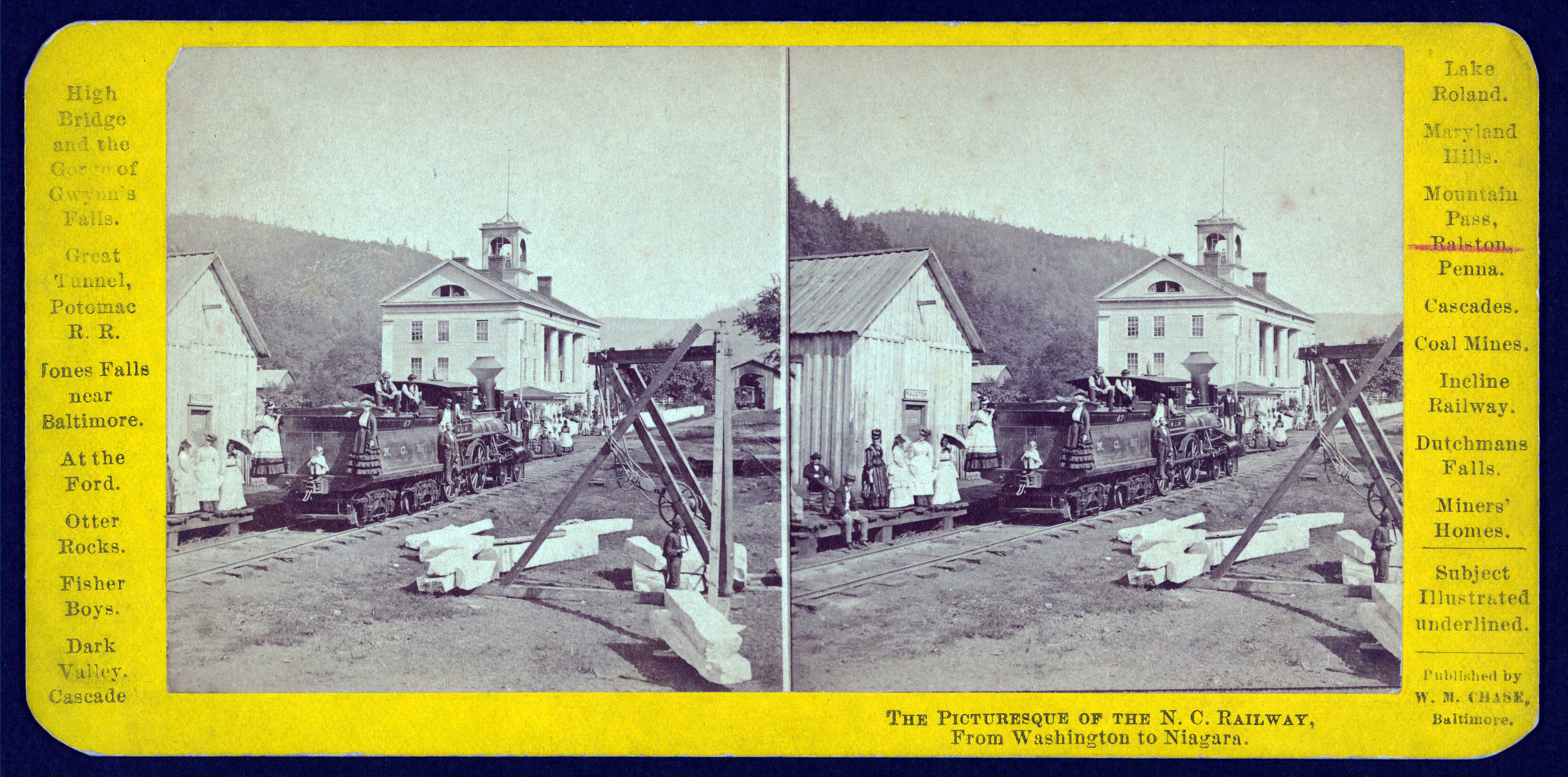
Library of Congress
Ellenton was a small crossroads near the summit of the railroad, between the Pleasant Stream and Schrader Creek valleys. The SNY was disadvantaged by having to climb steep grades both ways between Marsh Hill and Towanda, coming and going. On the aerial view from circa 1938, a wye track is visible north east of Ellenton, used to turn helper engines.
PSU – Penn Pilot
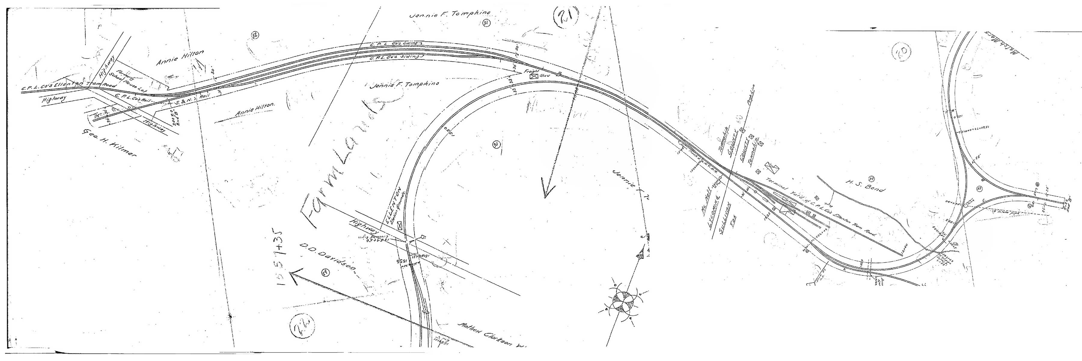 Above is a scan of SNY valuation maps, kindly provided by reader Charlie Marvin, and stitched together by the author in Photoshop. I had wondered what the long spur was north of Ellenton, but we can see from the map that is actually the remnants of the Central Pennsylvania Logging Co. logging railroad and the original S&NY alignment to Masten. (Updated 8/3/15)
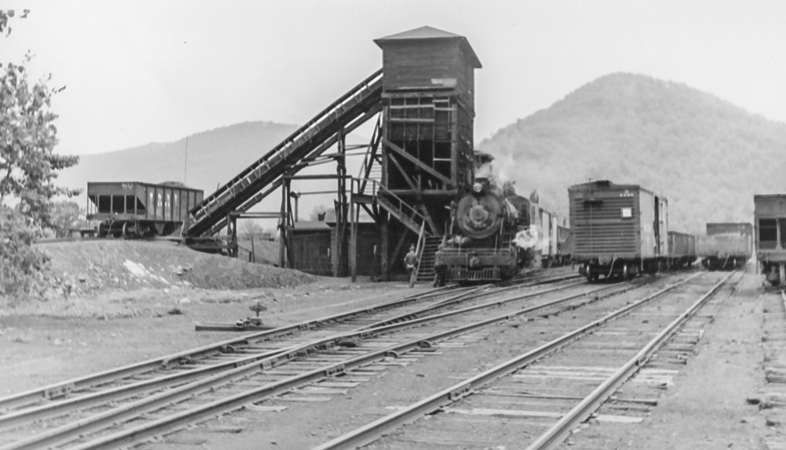
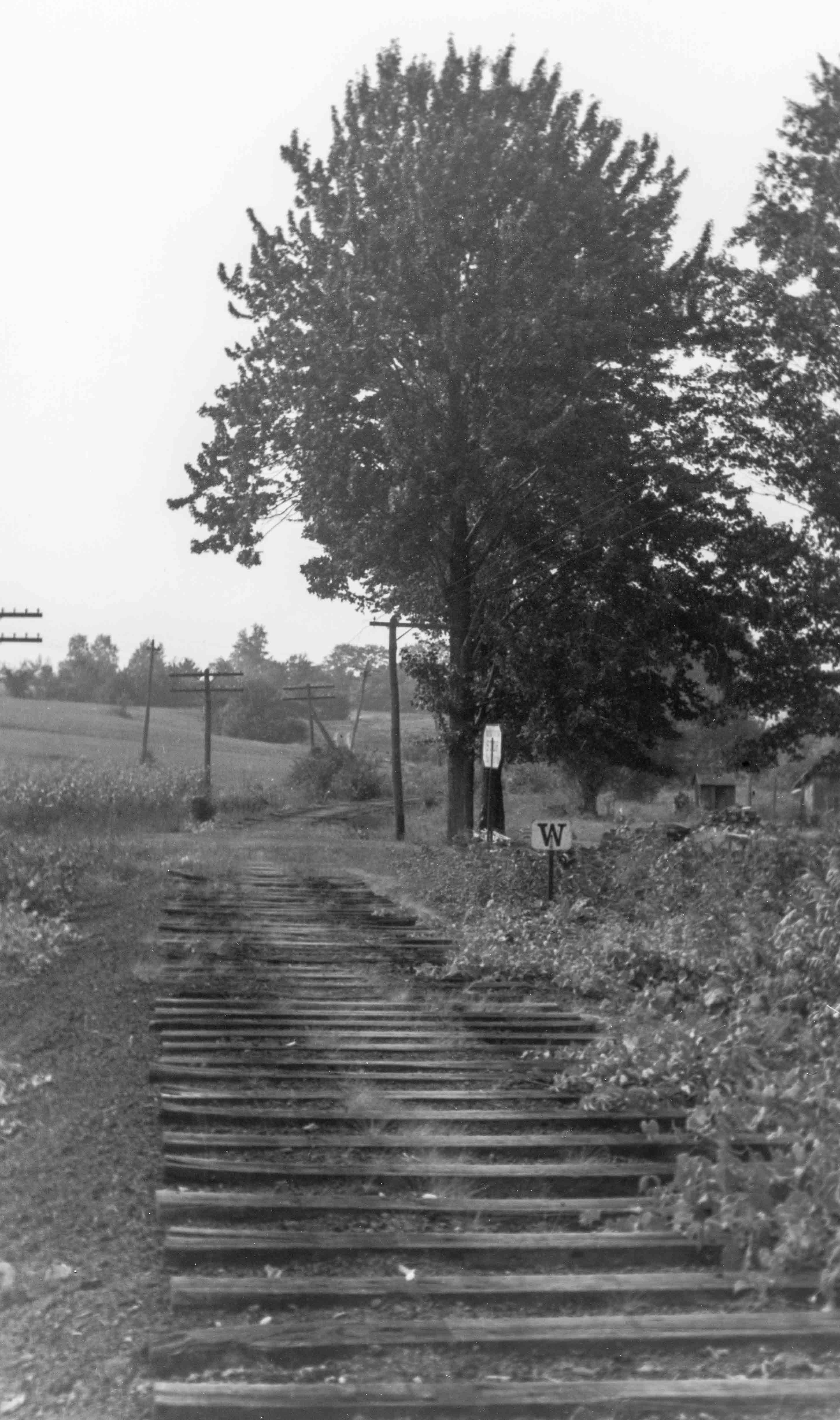
Here is a view of the SNY roadbed at Ellenton, PA, probably taken during abandonment operations in 1942. This view is looking downgrade and roughly southwest towards Masten.:
Bill Caloroso – Cal’s Classics
Bill Caloroso – Cal’s Classics
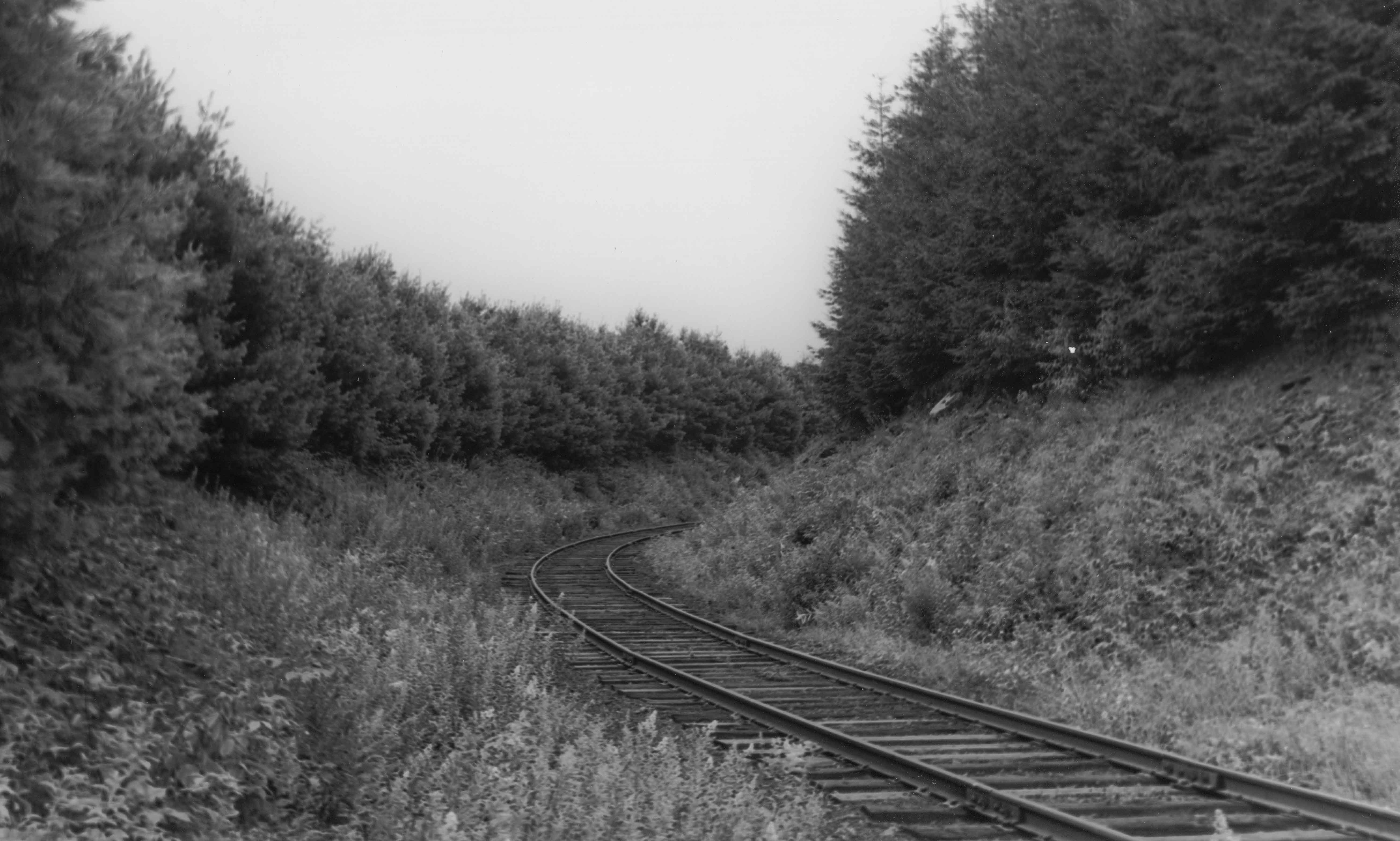
The above view is looking roughly northeast towards the true summit and wye track. The pine trees were reportedly planted to help diminish drifting and blowing snow from closing the cut.
Bill Caloroso – Cal’s Classics
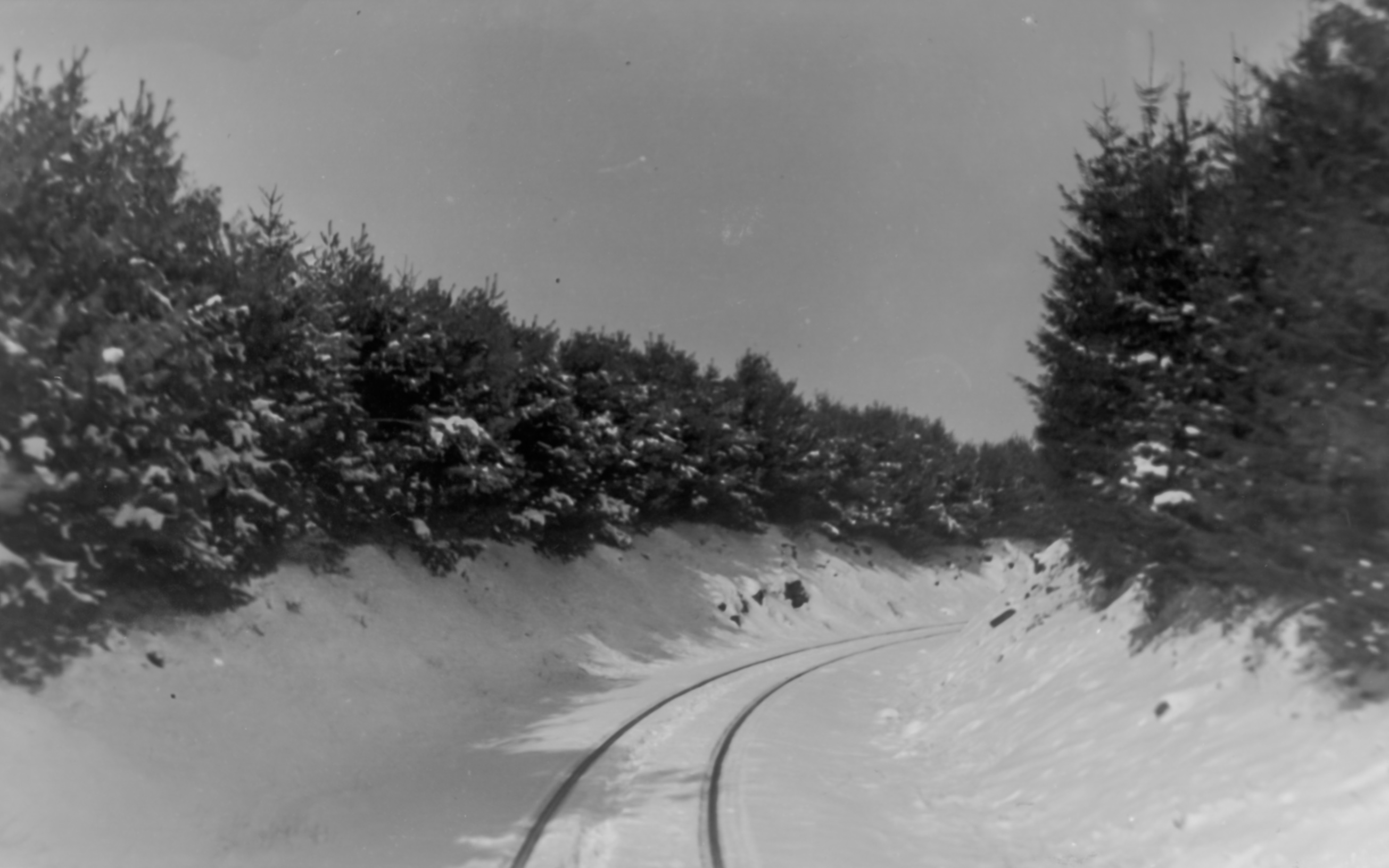
Here is a view of the same area, possibly during the winter of 1941-1942. The modern views below show the area in the early winter 2000. We can see how the trees have grown up over the intervening 58 years.The old roadbed crosses the road at the “dip” just beyond the largest trees along the right side of the road. The photographer in the second view above would have been standing in the roadbed off to the right, albeit some 58 years earlier in time. The road ( according to Bing maps McIlwain Rd.; PA Route 4002), paved in the 2000 photo, appears to be dirt or gravel in the 1942 view. Interestingly, the SNY roadbed is labeled “S&NY Road” on Bing maps.
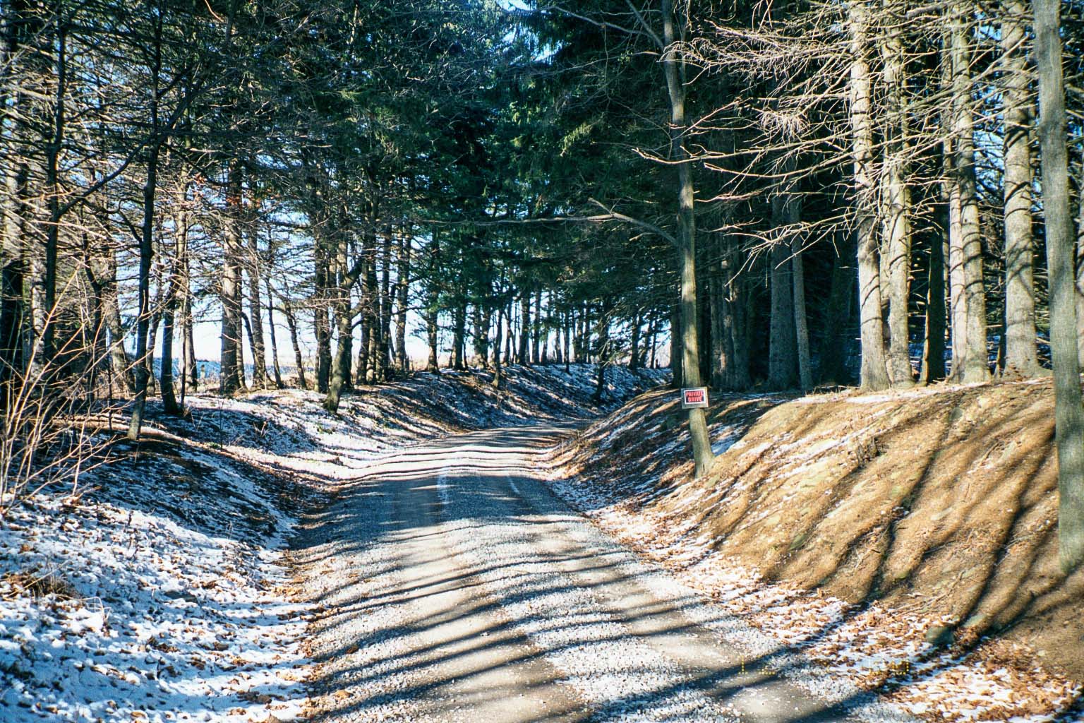
Photo by author
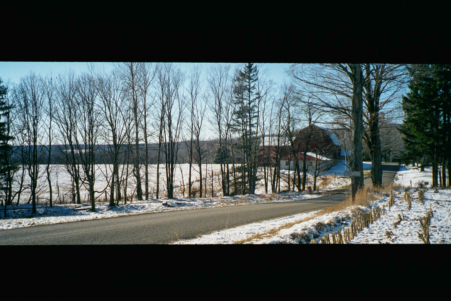
Photo by author
Below are three views of the station at Ellenton. The first is looking downgrade toward Masten, similar to the abandonment view above, albeit earlier in time, perhaps the mid-1930’s. The second and third look roughly northward in the opposite direction, probably near the end of the SNY in late 1941 or ’42. The station looks to be in pretty rough shape in the last two photos.
Bill Caloroso – Cal’s Classics
Bill Caloroso – Cal’s Classics
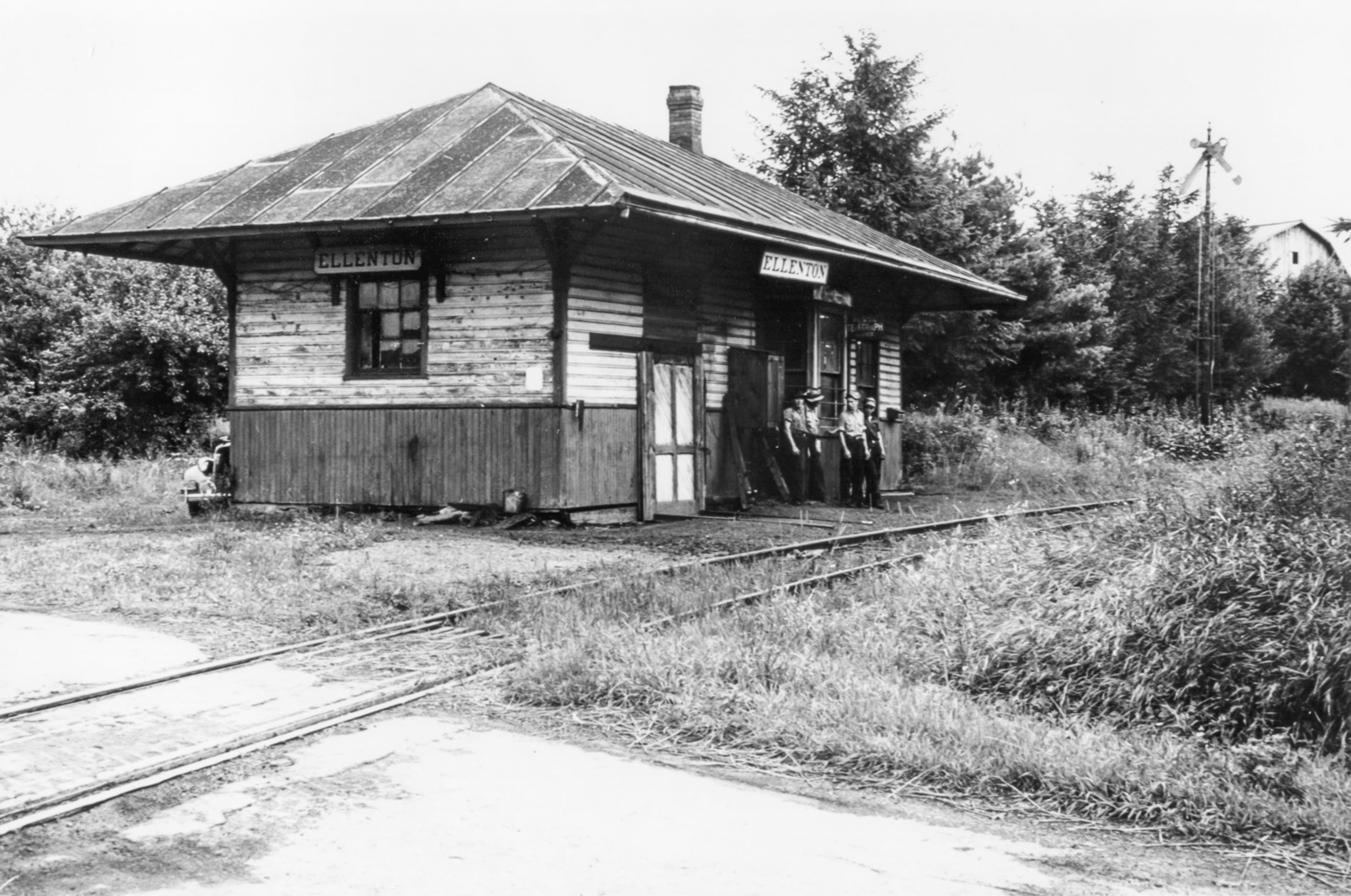
Bill Caloroso – Cal’s Classics
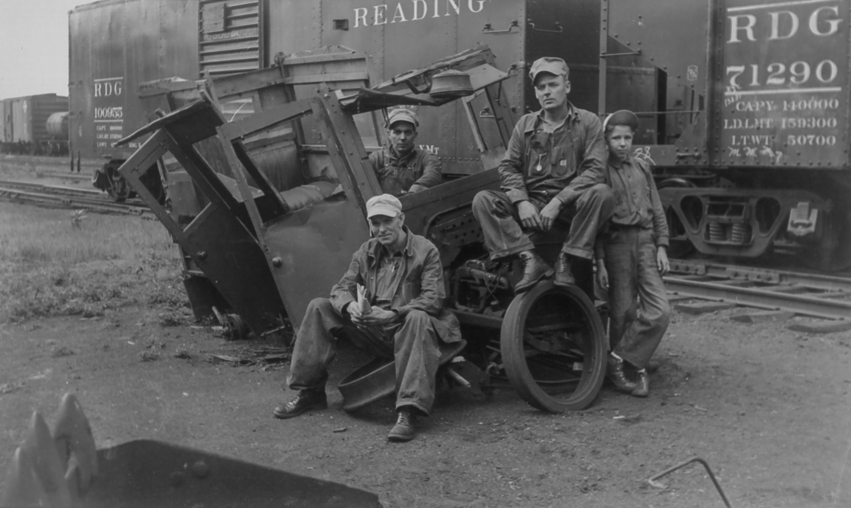
The station was also apparently used as a section house, and the section hands stored a speeder car in the station in the part behind the wooden door seen to the left in the above photos. In the photos below, the section crew is man-handling the speeder onto the rails. Anyone know the identity of the gentlemen in the photo?
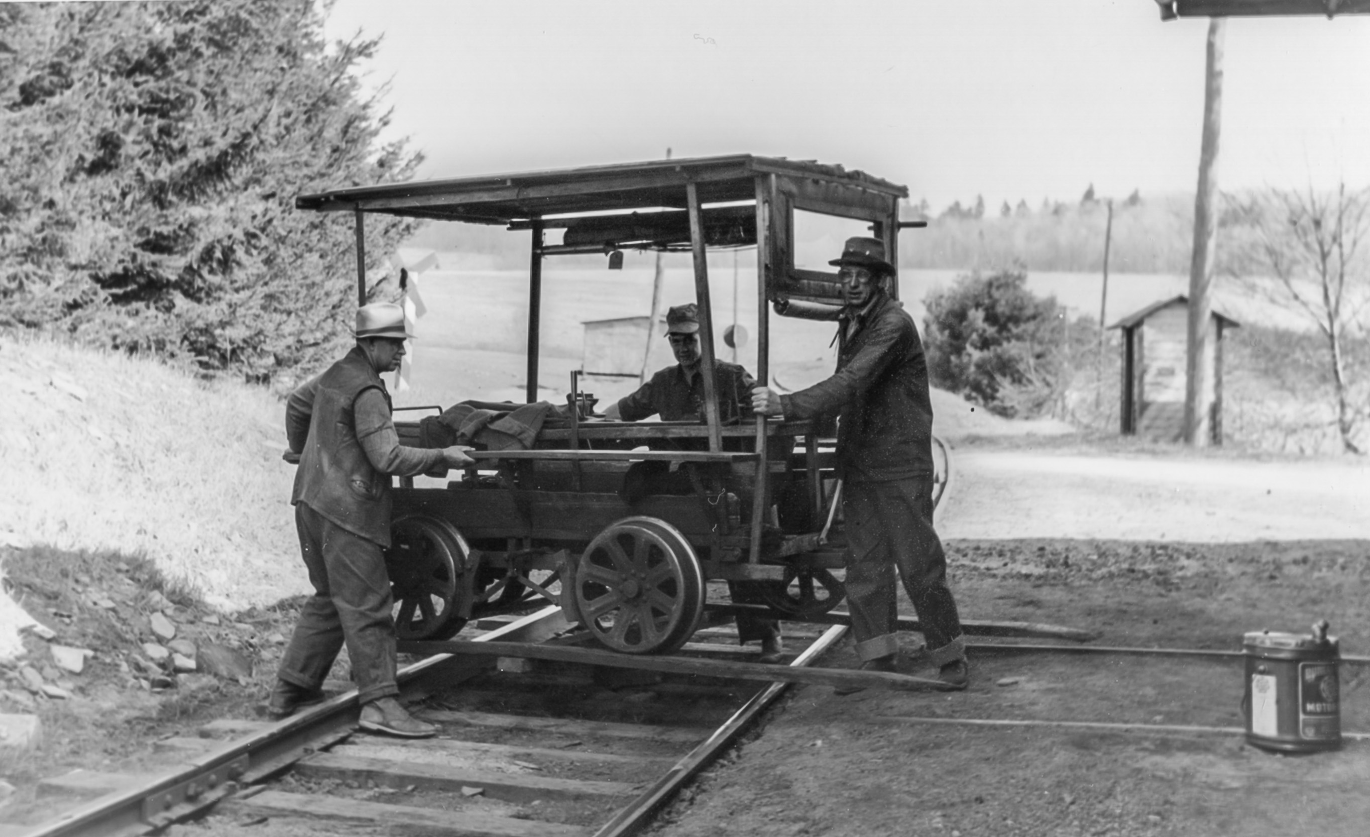
Bill Caloroso – Cal’s Classics

Bill Caloroso – Cal’s Classics
I do not know the function of the smaller building in the background, although it appears to be a similar paint scheme to the Ellenton station. Perhaps a phone box, or flag-stop passenger shelter? A passing siding coming upgrade from Masten can be seen ending at the switch in the background of the above two photos, and I think a phone box so crews in the siding can call the dispatcher is the more likely explanation. This structure is not evident on the valuation map from 1919, and must necessarily be newer than that date.
Update 8/7/2014: Scanned a view of the Ellenton Wye. Note the PRR GRA gondola. A lot of interesting detail in this view; including the call box in the center of the wye track, the weathered ties on the cinder right-of-way, and the weeds and wildflowers:
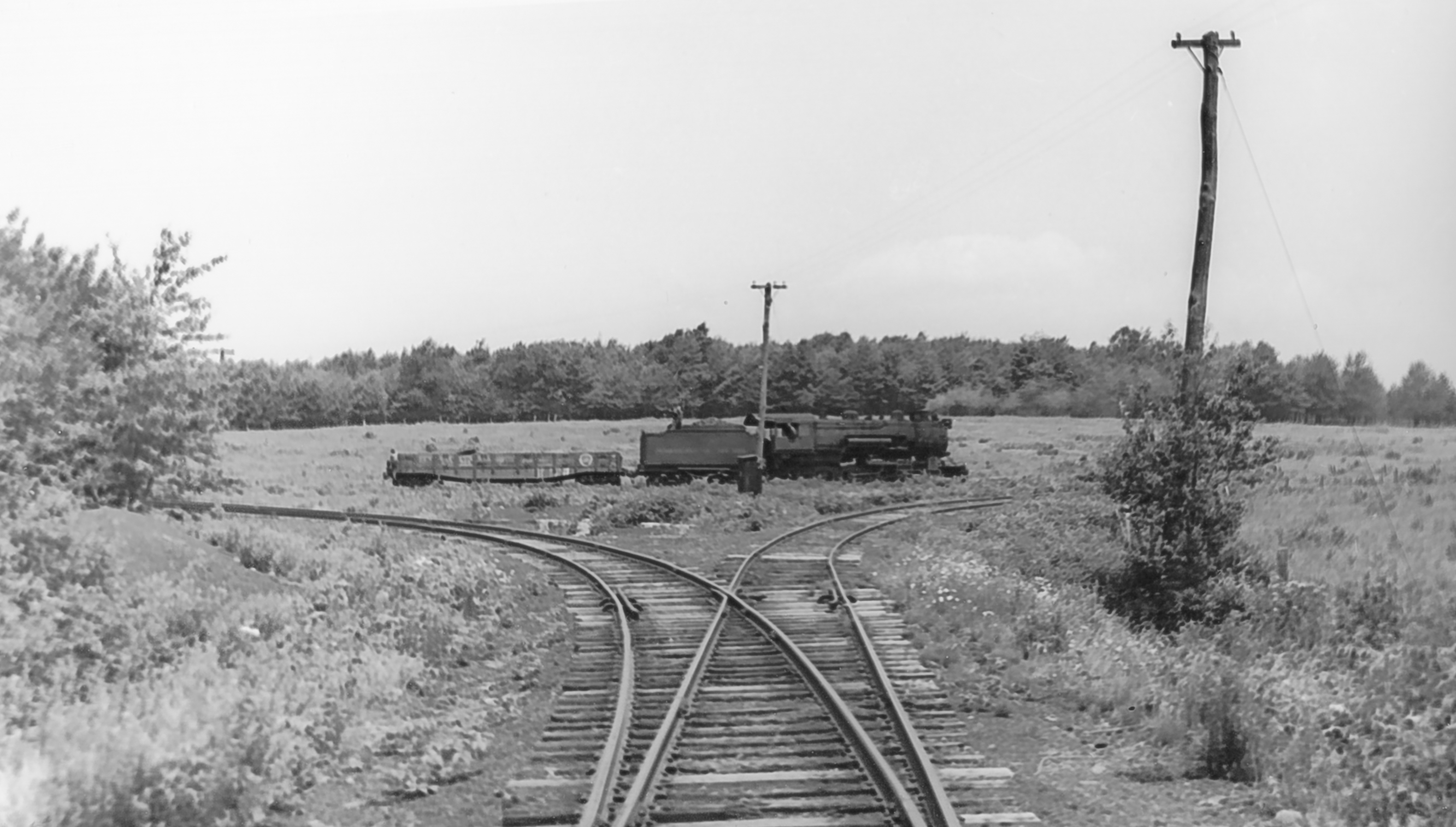
Bill Caloroso – Cal’s Classics
Update 2/24/2014: I have been in email correspondence with Ms. Ferne Gochnauer, who lived on the farm adjacent to the site of the Ellenton station from 1965 to 1989. She kindly provided a number of photos from her own research of the Ellenton area:
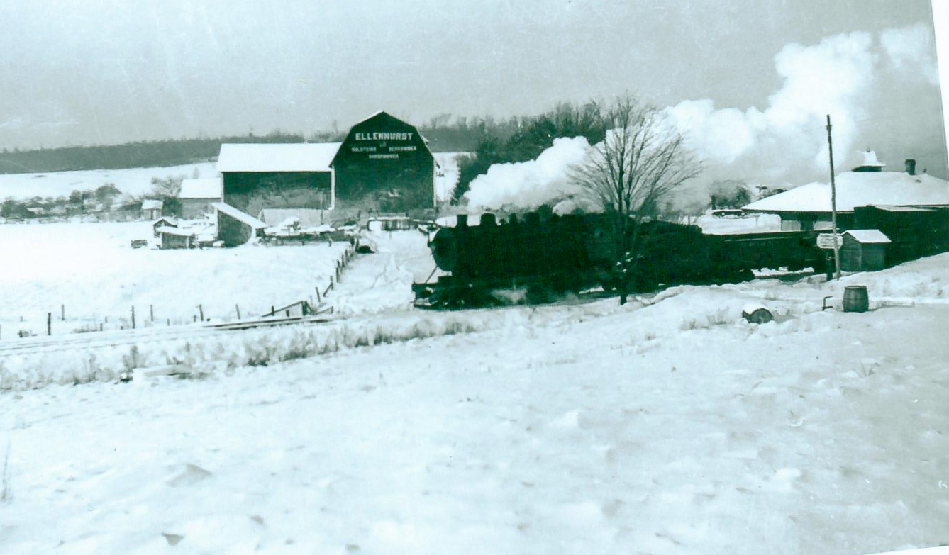
Photo courtesy Ferne Gochnauer
An SNY freight passes by the Ellenton station enroute to Masten, downgrade to the left in this view. Compare this photo with the view from 2000 above. This view may significantly pre-date some of the views taken closer to the 1942 abandonment, given the absence of trees behind the station. The small shed across from the station also does not appear in the other images above, but rather is located across the road on the same side of the tracks as the station in the Caloroso photos.
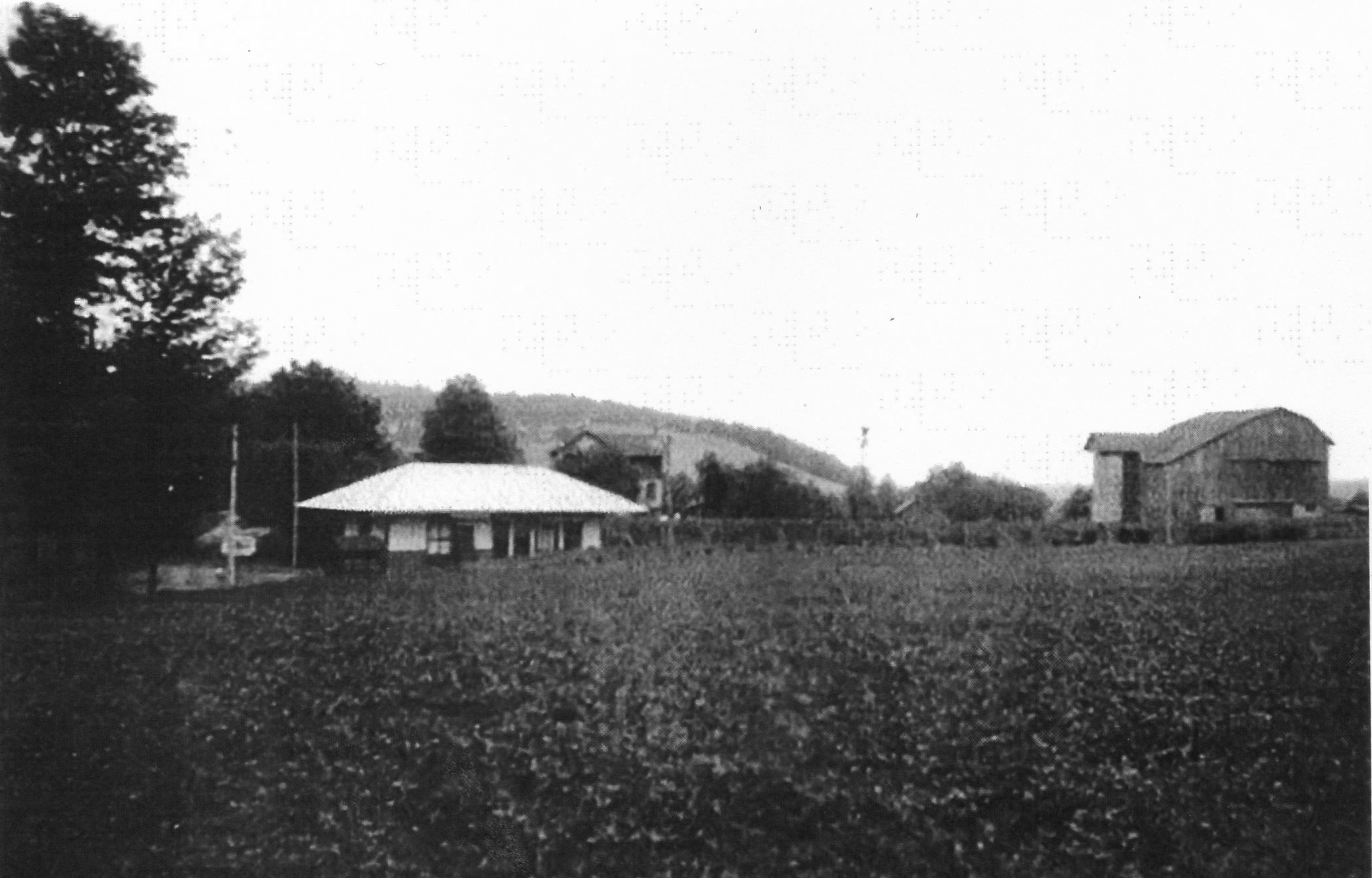
Photo courtesy Ferne Gochnauer
In this undated view, we can see the small barn whose roof is visible in the background of the Caloroso images above. Also note the trees planted along the edge of the shallow cut between the station and the barn. According to Kaseman, these were planted in the 1920’s to act as a snow fence, so the photo must date from that time. See the later photos above, when the trees were much larger.
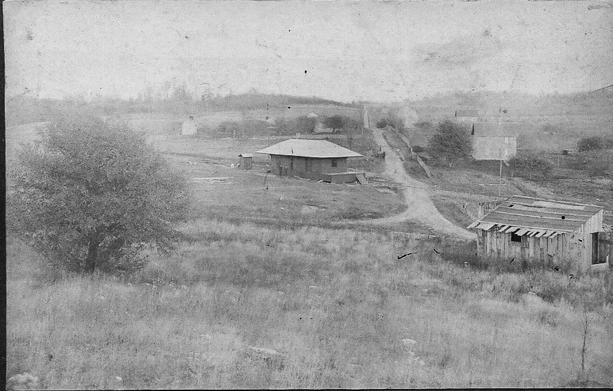
Photo courtesy Ferne Gochnauer
This photo dates prior to the 1918-1919 valuation map, likely shortly after the SNY was completed, probably ca. 1905. This eastward view shows the original alignment of the SNY mainline to Masten (to the right in this view) and the original location of the station near the road intersection and the CPL tramroad, seen further to the west on the valuation map and the Penn Pilot aerial view. We can see the opposite side of the large barn in the middle distance seen in the center of the 2000 view and the earlier view provided by Ms. Gochnauer.
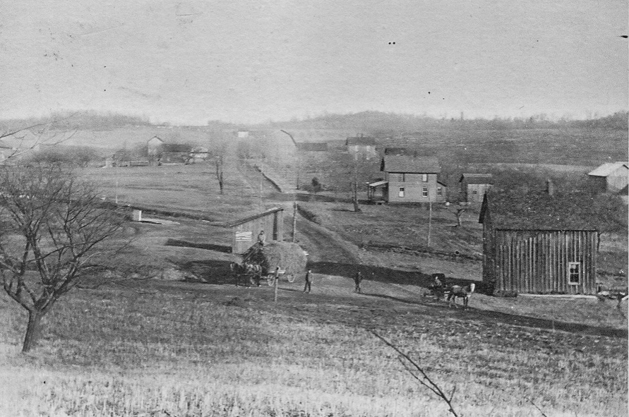
Photo courtesy Ferne Gochnauer
The Ellenton station has now been moved to its final location after the re-alignment of the SNY mainline, and can be partially seen as a low, light-colored structure in the left middle distance. The “old” SNY alignment can be seen crossing the road from left to right behind the nearest structures.
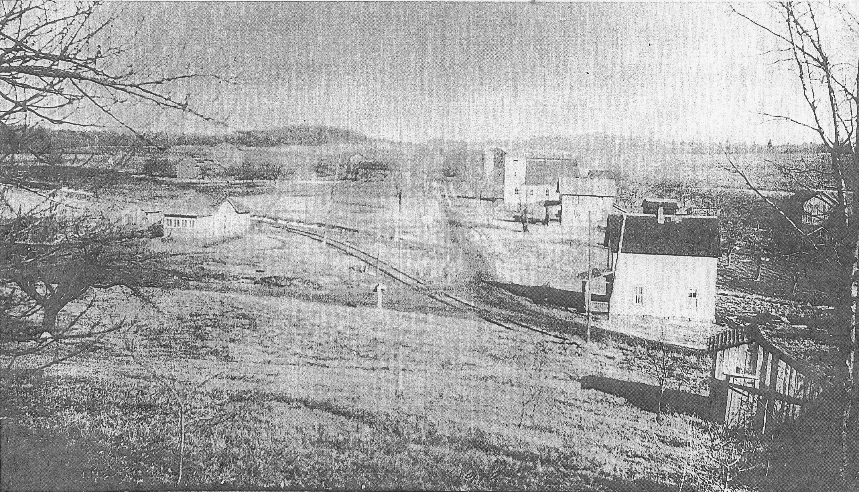
Photo courtesy Ferne Gochnauer
A house or other structure has now been built on the original site of the Ellenton station, and the Central Pennsylvania Lumber Co. tracks now join the old SNY mainline just in front of the new structure. These tracks are seen on the 1918 valuation map labeled “CPL tramroad”.
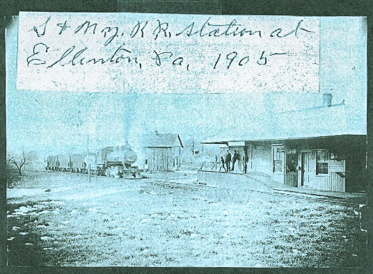
Photo courtesy Ferne Gochnauer
This is a southwestward view of the Ellenton station at the original location ca. 1905 . The small house next to the tracks on the last two views above can be seen behind the locomotive. The road junction can be partially made out behind the elevated station platform and the gentlemen standing upon it.
I had no idea that the Ellenton station had originally been at a different location, and subsequently moved, until Ms. Gochnauer provided that information.
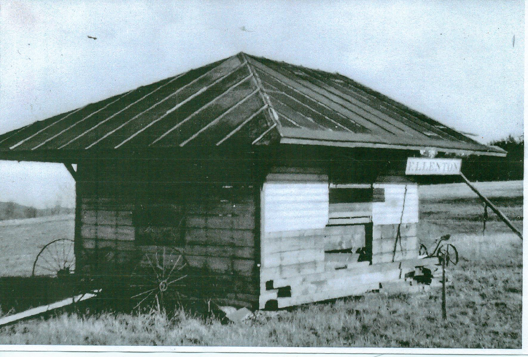
Photo courtesy Ferne Gochnauer
Lastly is a view of the remnants of the station after it was partially torn down and moved to a nearby field after the SNY abandonment. according to Ms. Gochnauer, one of the Ellenton station signs still exists and is in the possession of a local resident.
Pursuant to a recent discussion on the PRR Elmira Branch Yahoo group regarding Bergan tower, and the junction of the S&NY with the Elmira Branch, I offer these scans:
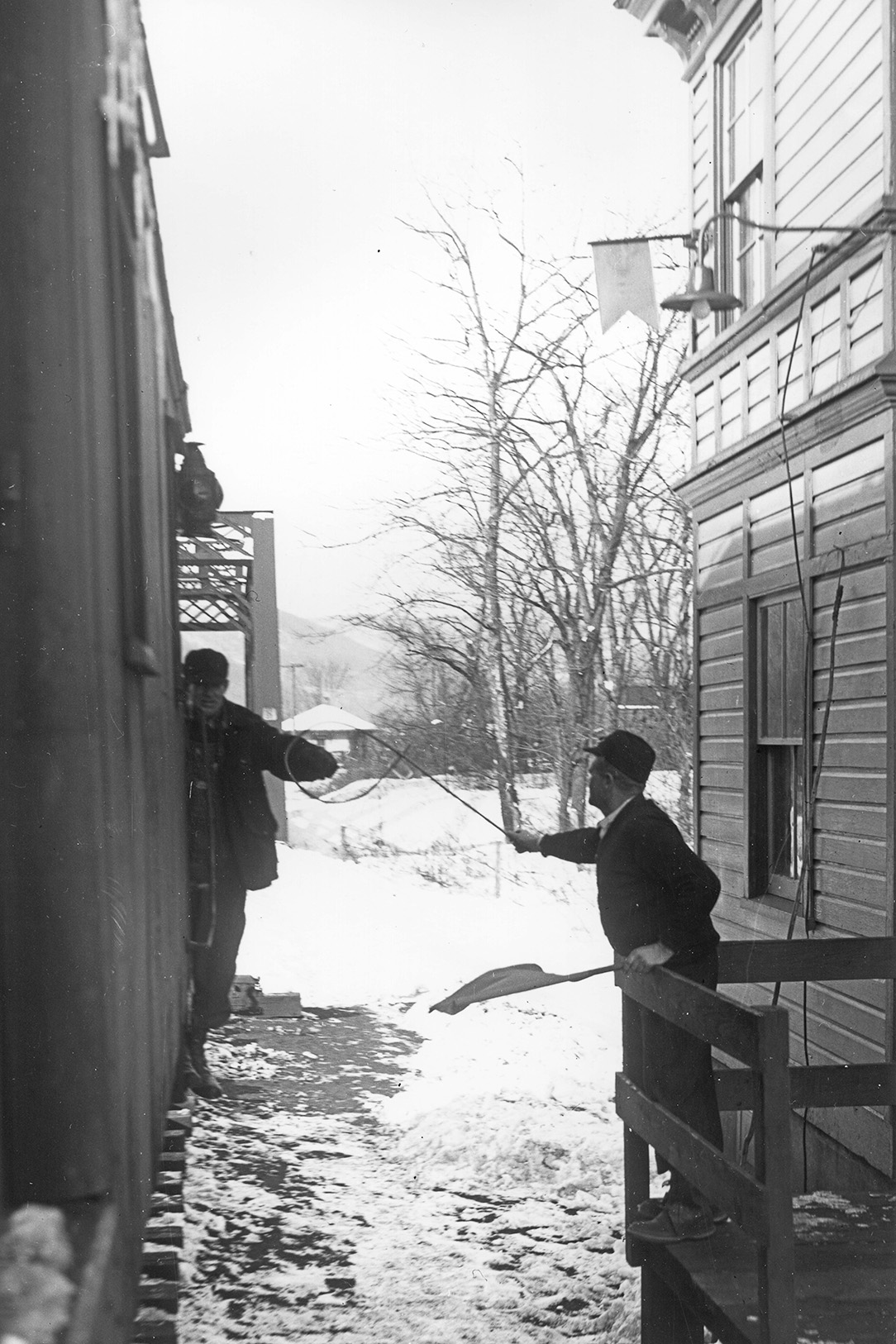
Bill Caloroso – Cal’s Classics
First is this northward winter view of the PRR operator at Bergan tower “hooping up” train orders to the rear brakeman or conductor of a southbound SNY freight. In the background we see the PRR bridge over Pleasant Stream, and the roof of the SNY depot at Marsh Hill junction. The SNY train would have come out from the SNY yard to the right, on “our” side of the depot, entering the Elmira Branch at the junction switch at the far end of the bridge.
Bill Caloroso – Cal’s Classics
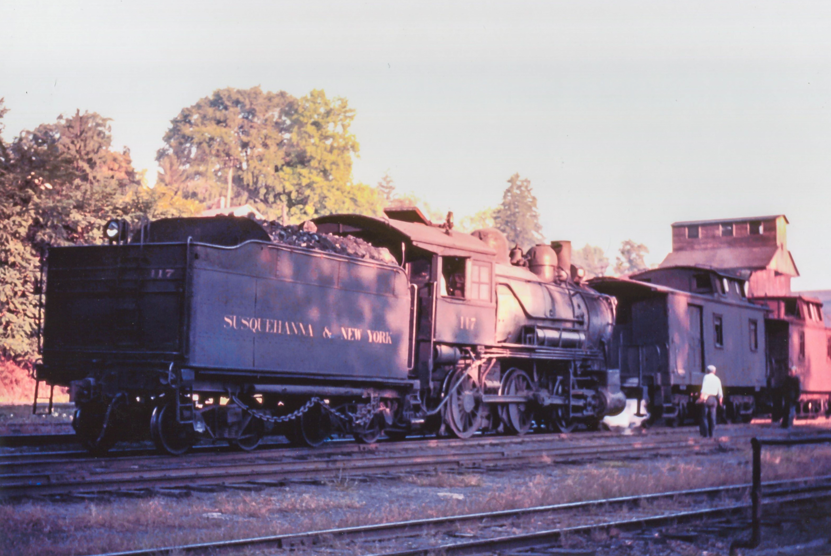
This view looks in the opposite direction southward, and of course was taken in a much warmer season. A northward bound SNY freight is leaving the Elmira branch onto home rails and will enter Marsh Hill yard in a moment. The SNY station is behind the viewer, and the PRR Bergan tower is on the south side of the bridge, hidden behind SNY #115.
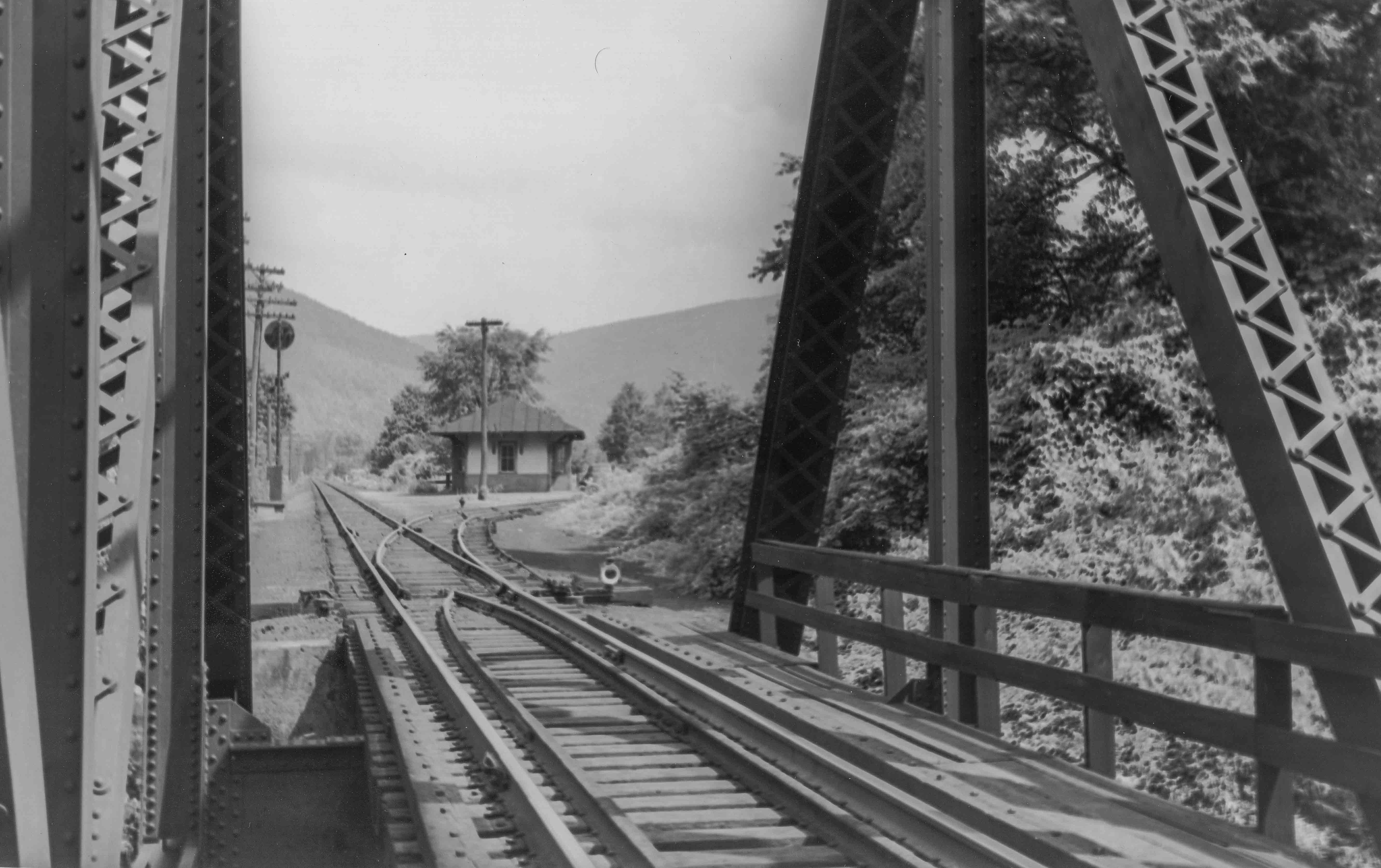
Bill Caloroso – Cal’s Classics
Next, we have a very nice view from the PRR Pleasant Stream bridge looking northward at the SNY Marsh Hill station. We can see the SNY track curving off to the right to the Marsh Hill yard. The low target lamps appear to be controlled remotely from Bergan tower via the wooden rail-side relay cases seen in the second photo above, and hidden by the left side of the bridge in this view. In the distance we can see the position-light signals controlling a passing siding on the south end of the bridge, which extends southward from Bergan tower.
Update 8/7/2014: Northward-looking view of Bergan tower, PRR Lycoming Creek bridge, Marsh Hill junction, and S&NY Marsh Hill station in the distance. Photo courtesy Mr. Jim Anderson.
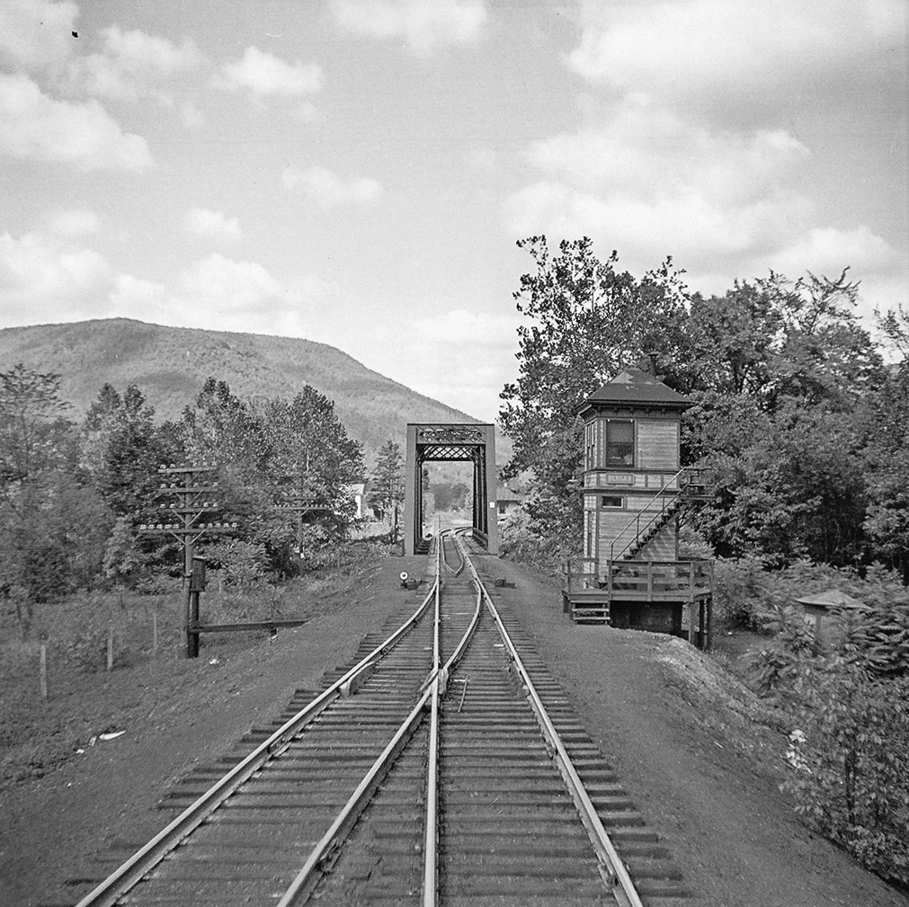
Photo Courtesy Jim Anderson
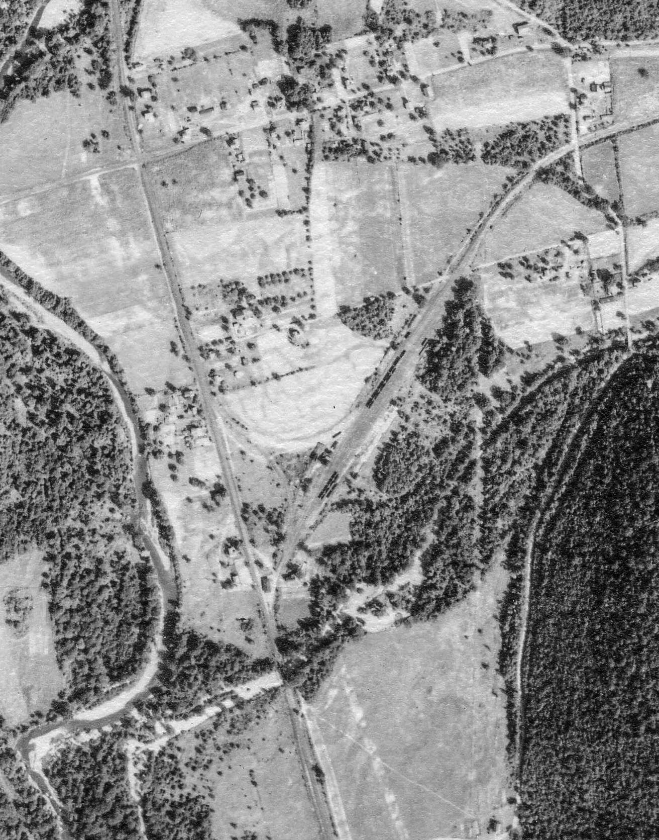
PSU – Penn Pilot
Last is an aerial view of the Marsh Hill area circa 1938. The SNY Marsh Hill station is in the lower middle, above the Pleasant Stream bridge hidden by the nearby trees. A shadow cast by a structure in the lower center south of the bridge I believe is the location of Bergan tower. The SNY Marsh Hill yard curves off to the right, while the PRR Elmira Branch runs generally north-south along the meandering Lycoming Creek.
Today, this area is private ground and is fairly heavily wooded. One would be hard-pressed to find any traces of either railroad that once crossed this bridge, and even the bridge itself is long gone.
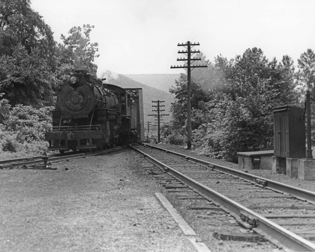
The last bridge project I have for now is the deck girder bridge at the apex of the “Masten Loop”. This was a long, looping curve on a grade east of the sawmill town of Masten, PA by which the S&NY crossed from one side of Pleasant Stream to another while gaining altitude out of the Pleasant Stream valley. From there, the route looped back toward Masten before turning northeast to reach the summit of the grade between Ellenton and Wheelerville, PA.
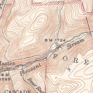
1944 USGS topo map, 1927 Survey, Canton quadrangle
I do not know the actual degree of curvature of the loop, however according to 1925 S&NY employee timetable No. 43, Special Instruction 23c.,”speed of trains around Loop Curve north of Masten is restricted to 12 miles per hour.”
Below is a postcard view of the bridge over Pleasant Stream near the apex of the Loop, shortly after construction in 1906:
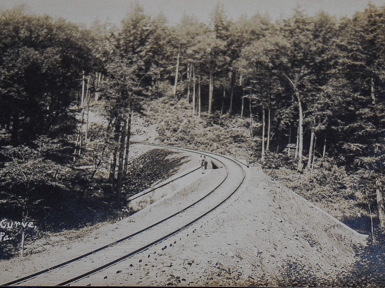
Postcard view of Loop Curve near Masten, PA ca. 1906
Compare the pristine abutments in the above view with the crumbling remains visible through the saplings in 2000:
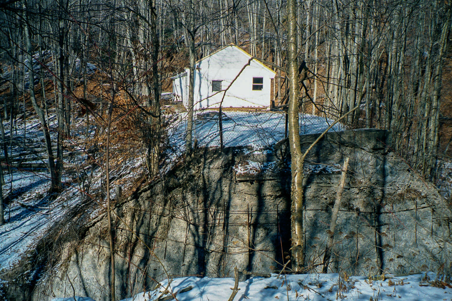
Photo by author
The rebar “cage” is presumably to prevent chunks of disintegrating concrete from falling onto the dirt road below. Note someone has built a camp directly on the old roadbed. I wonder if they are ever awakened in the dead of night by phantom trains blasting from out of the past through the kitchen, ghostly whistles shrieking….
The Masten Loop Curve and bridge is a major scenic “Layout Design Element” (LDE) on my model version of the S&NY, and conveniently located at a turnback curve at the end of a benchwork peninsula. Model railroaders often bemoan the difficulty of disguising these peninsular turnbacks ( I believe Tony Koester tongue-in-cheek referred to a common solution as “Mandatory Trestle over Cliché Creek), however in this case the real thing IS the solution.
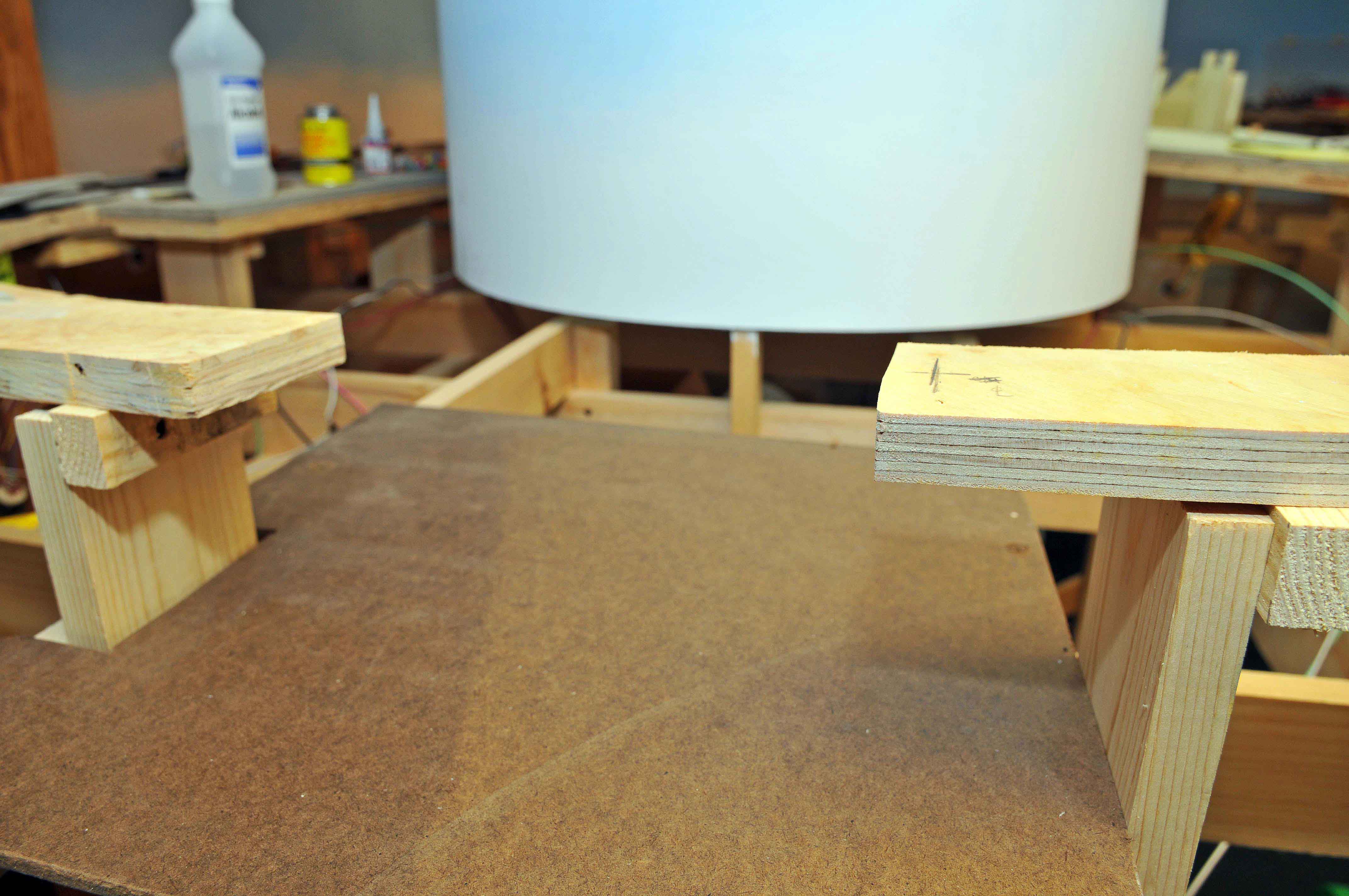
Photo by author
Here is the site for the model bridge at the apex of Loop Curve.
Since the bridge is on a grade (never again!) I wanted to ensure good alignment between the roadbed ends and the bridge deck. I used a technique I found online where the bridge itself is built over an aluminum channel that is anchored, in this case by epoxy, to the roadbed at either end. As it turned out, I ended up with a small vertical curve at the right-hand side of the bridge. Hopefully this will not prove to be a major problem in operation, as redoing the bridge would involve major surgery.
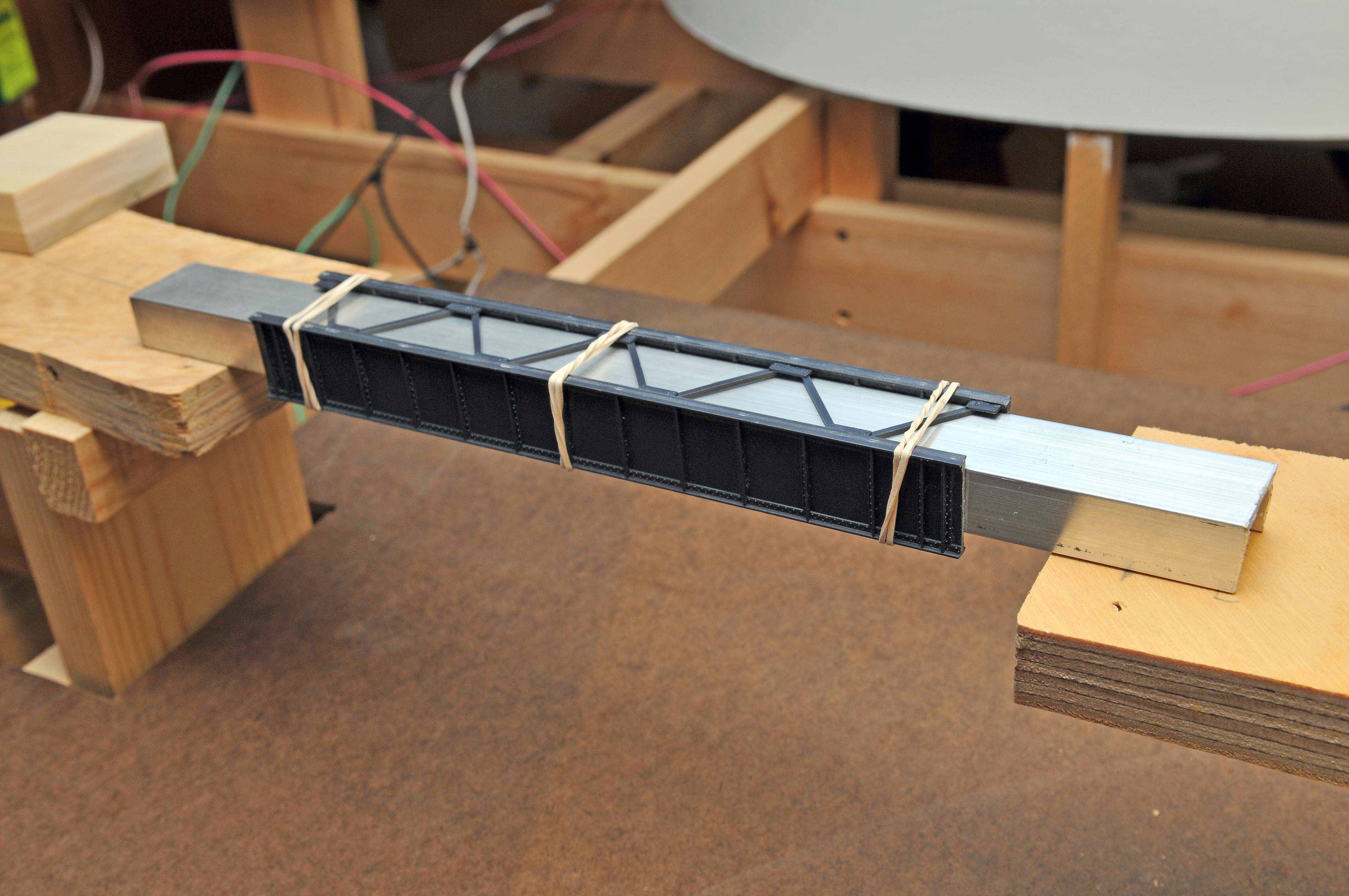
Photo by author
Here the channel with the Micro Engineering deck girder bridge sides in place for a test fit.
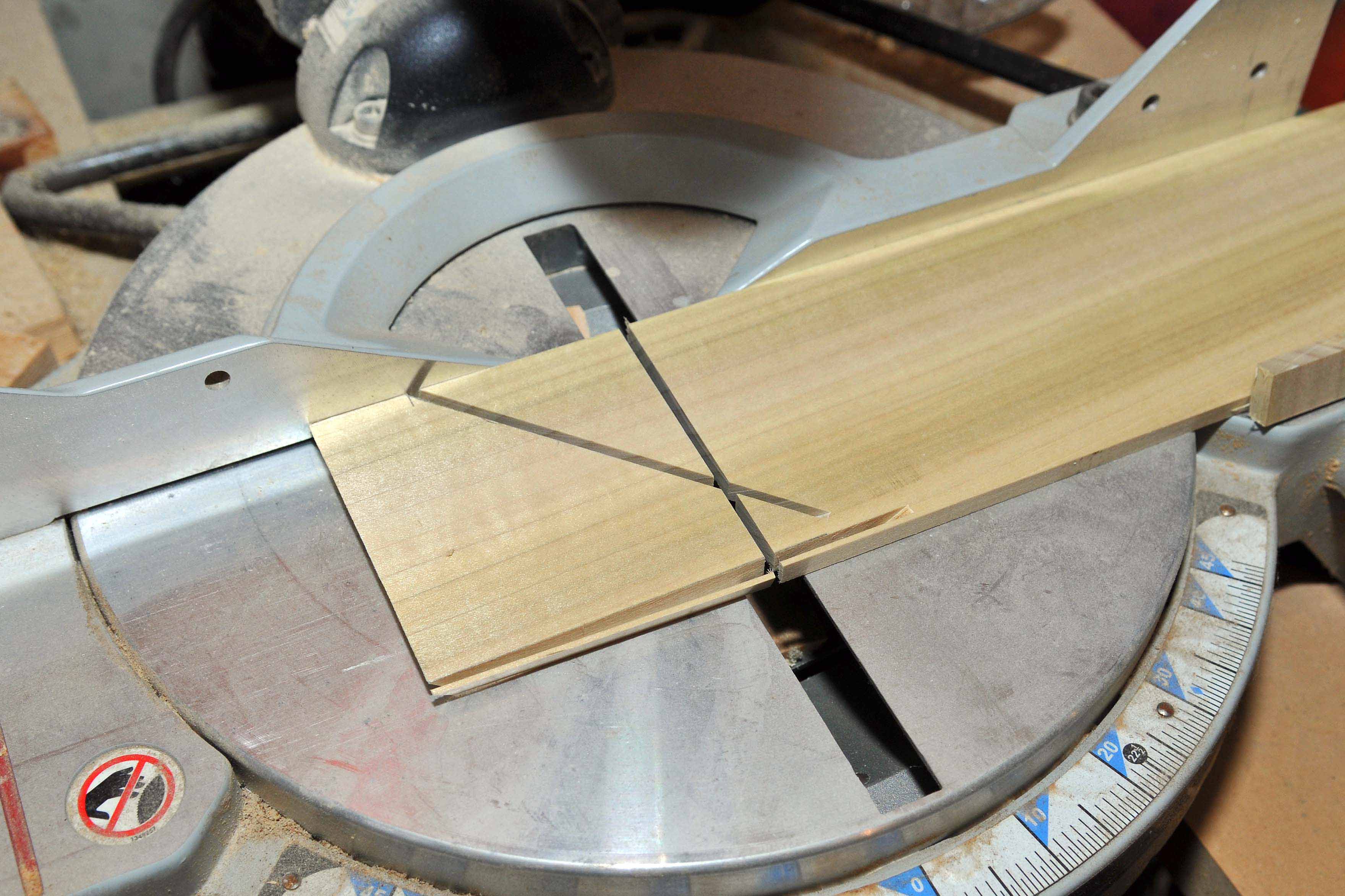
Photo by author
The abutments were scratchbuilt from thin poplar and styrene. There is a niche for someone to produce a line of concrete abutments tailored for the various Micro Engineering bridges. Chooch Enterprises has a limited number, but they are mostly not suitable.
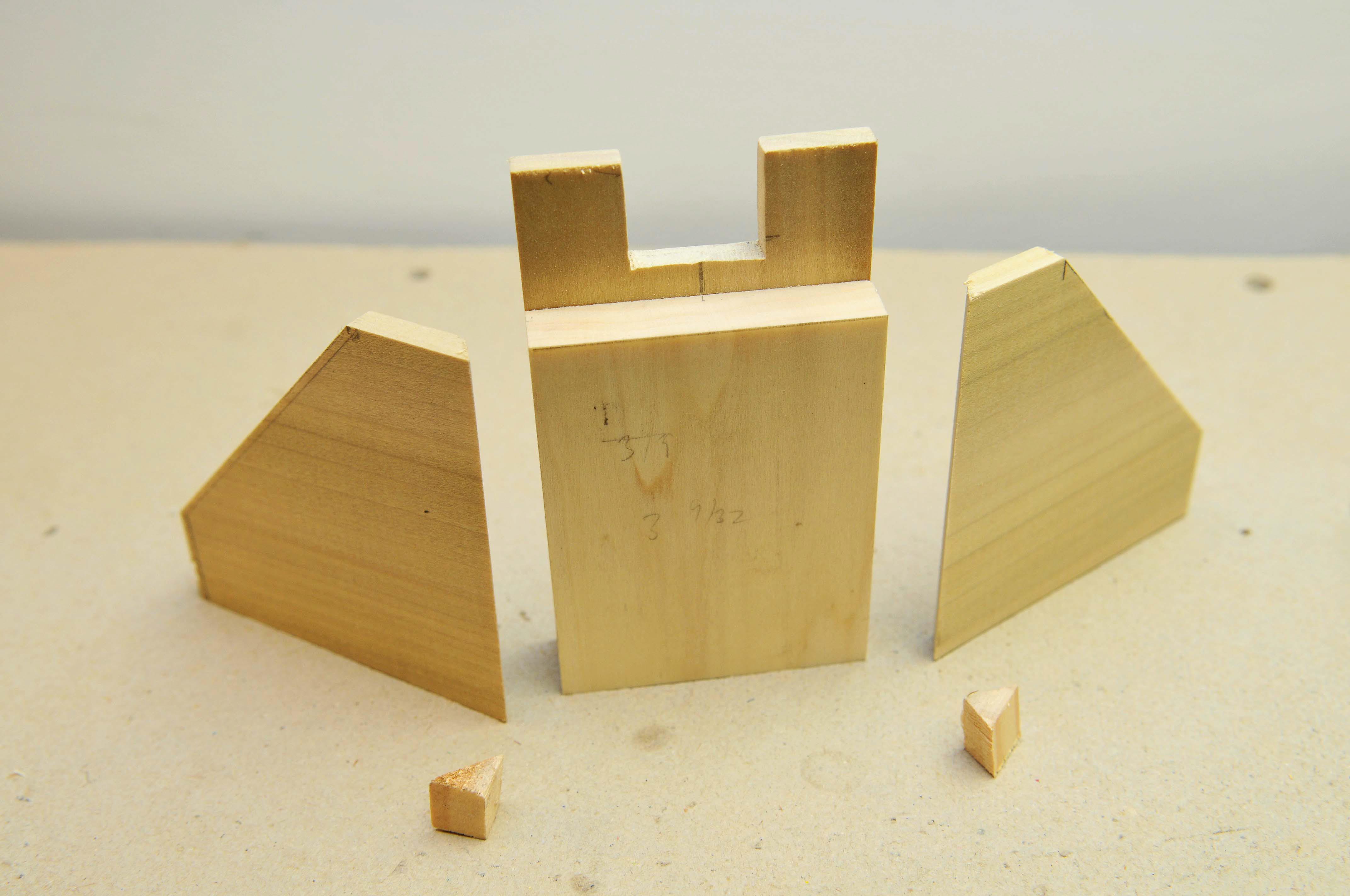
Photo by author
The abutments were sanded and primed, then coated in vinyl spackle and the impressions of the wood formers simulated by drawing a styrene “comb” across the spackle. The spackle was allowed to dry, then sanded enough to allow just a faint hint to remain. Following this, they were painted a concrete color and weathered.
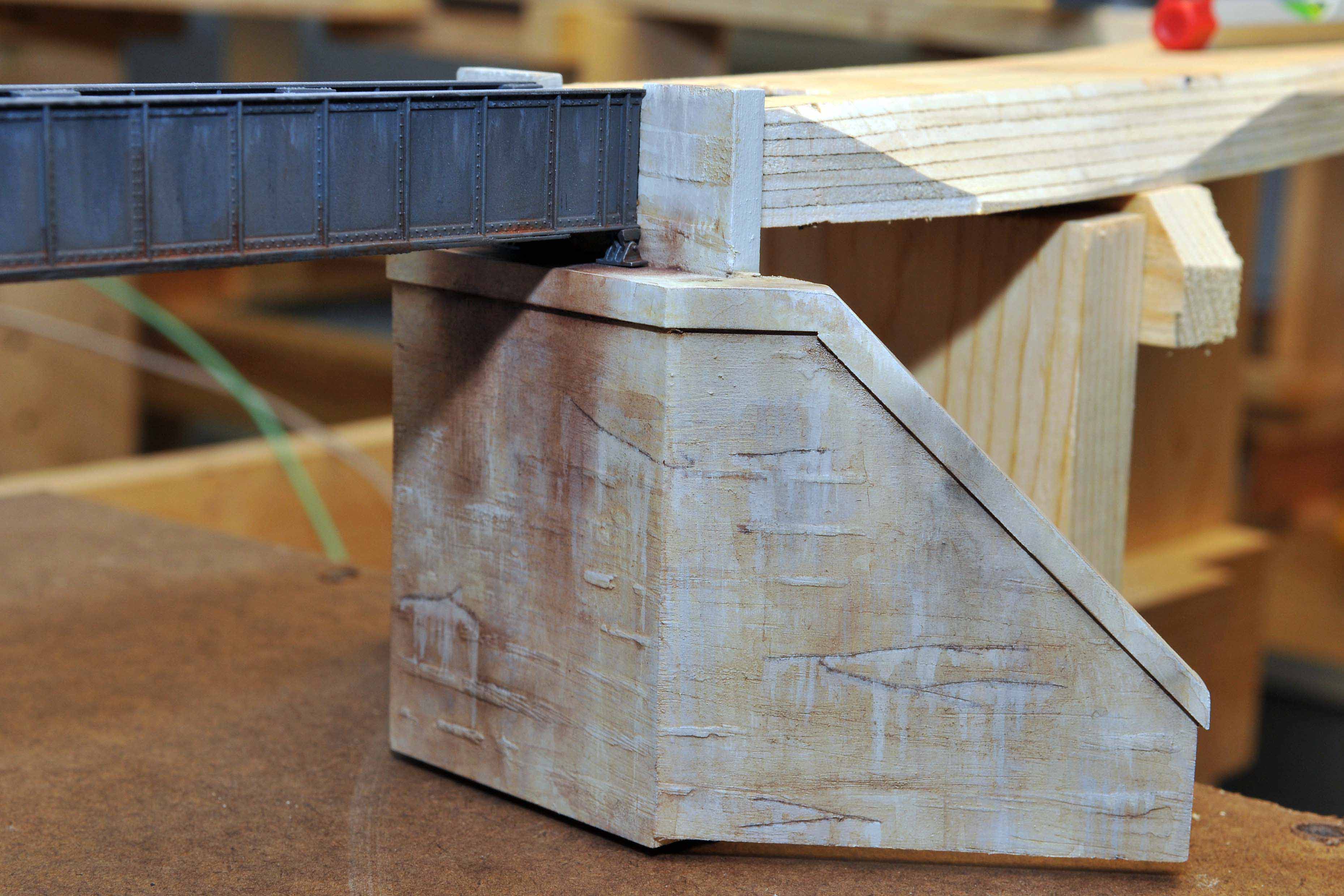
Photo by author
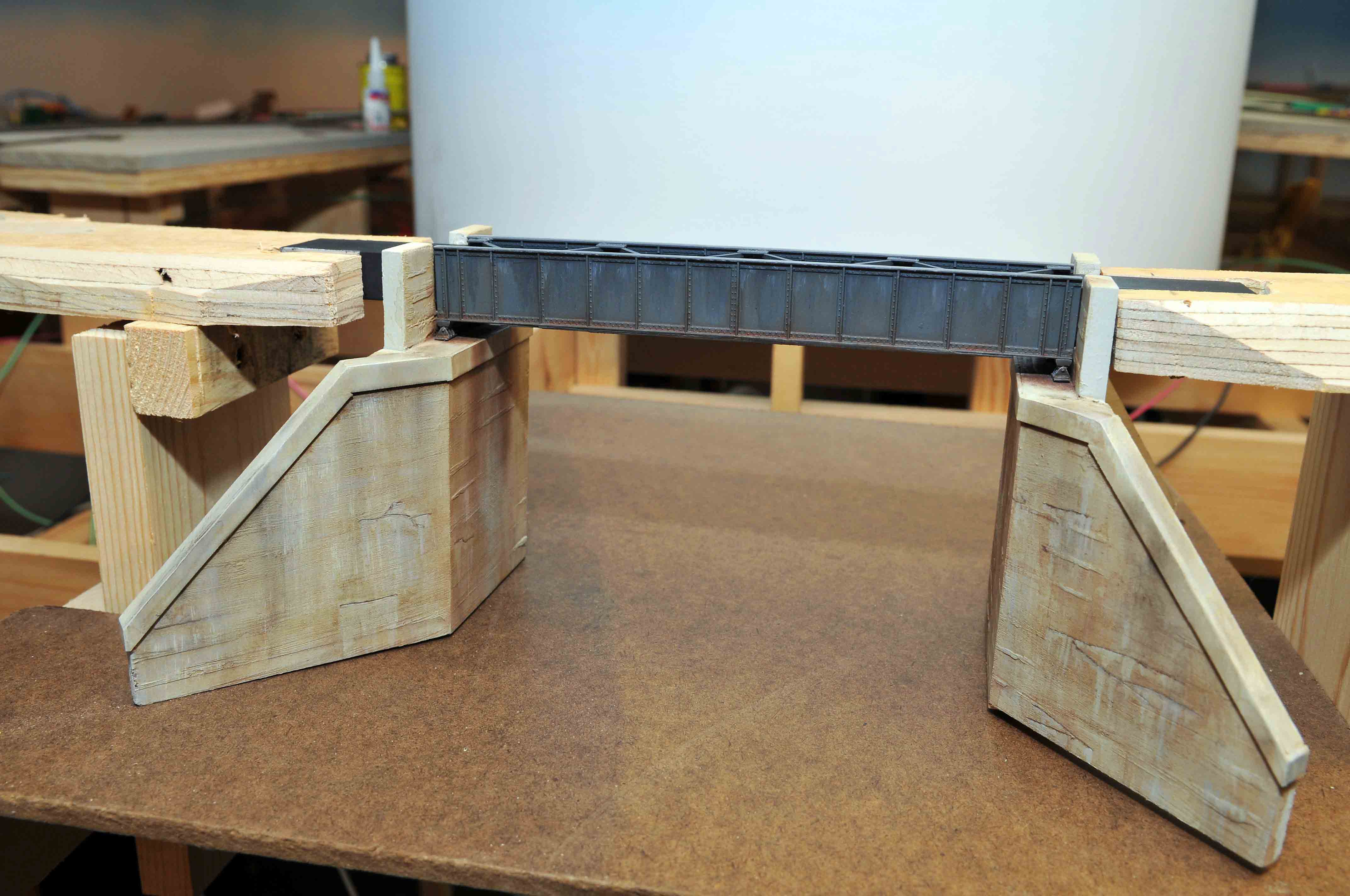
Photo by author
The finished product.
Scenery has yet to be installed, but the fascia has been put in place. I tried to create a semi-“Bellina-drop” with the fascia panels as view-blocks to limit viewers from getting a look at an entire train as it climbs around the Loop. Hopefully this will subconsciously add to the impression of the railroad struggling to work its way through the narrow mountain valleys, and make the run seem longer to operating crews.
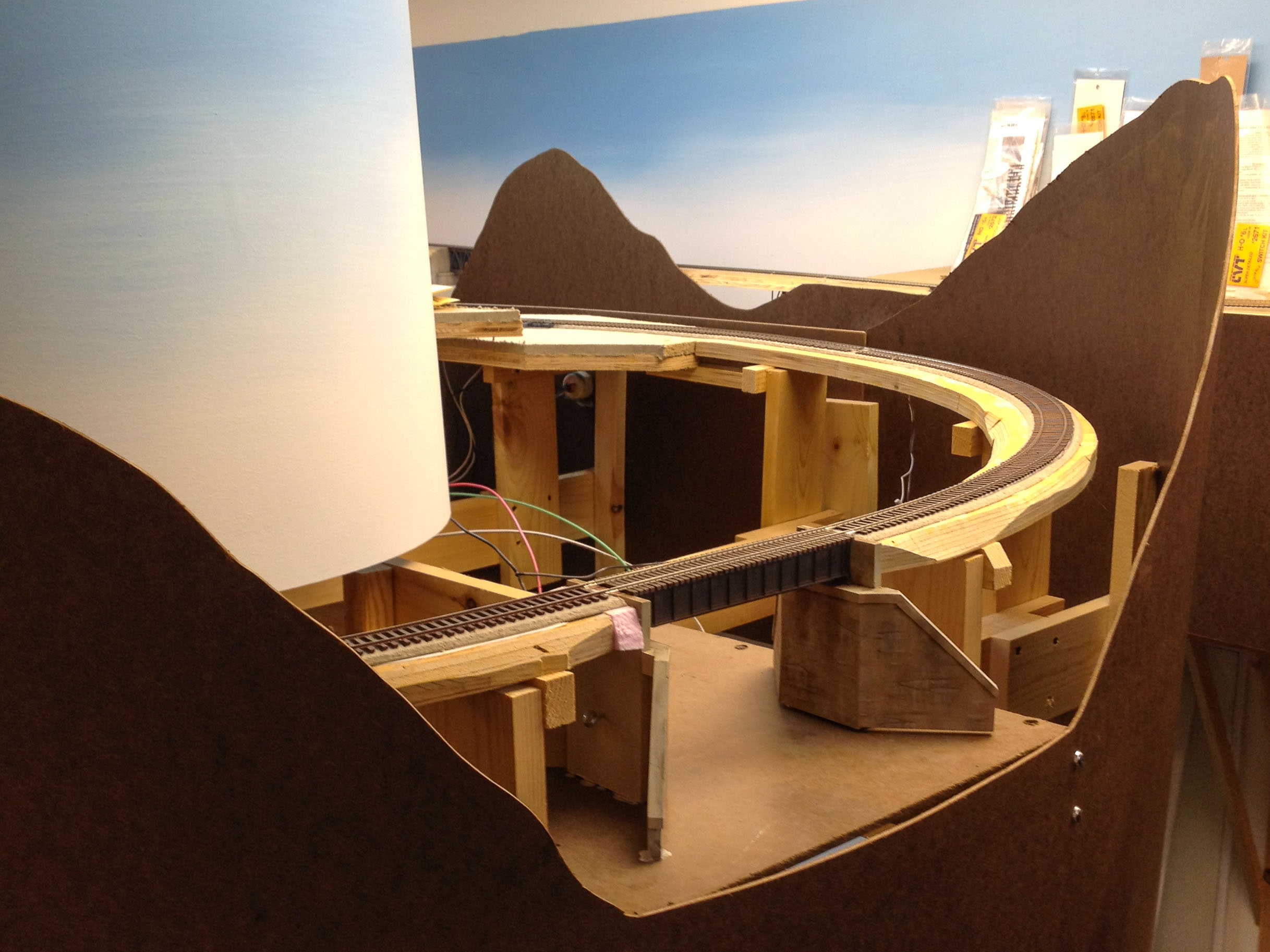
Photo by author
Time will tell if this is a success.
Recent Comments