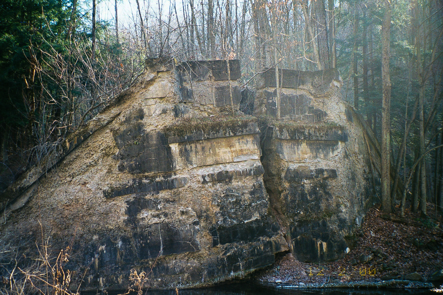
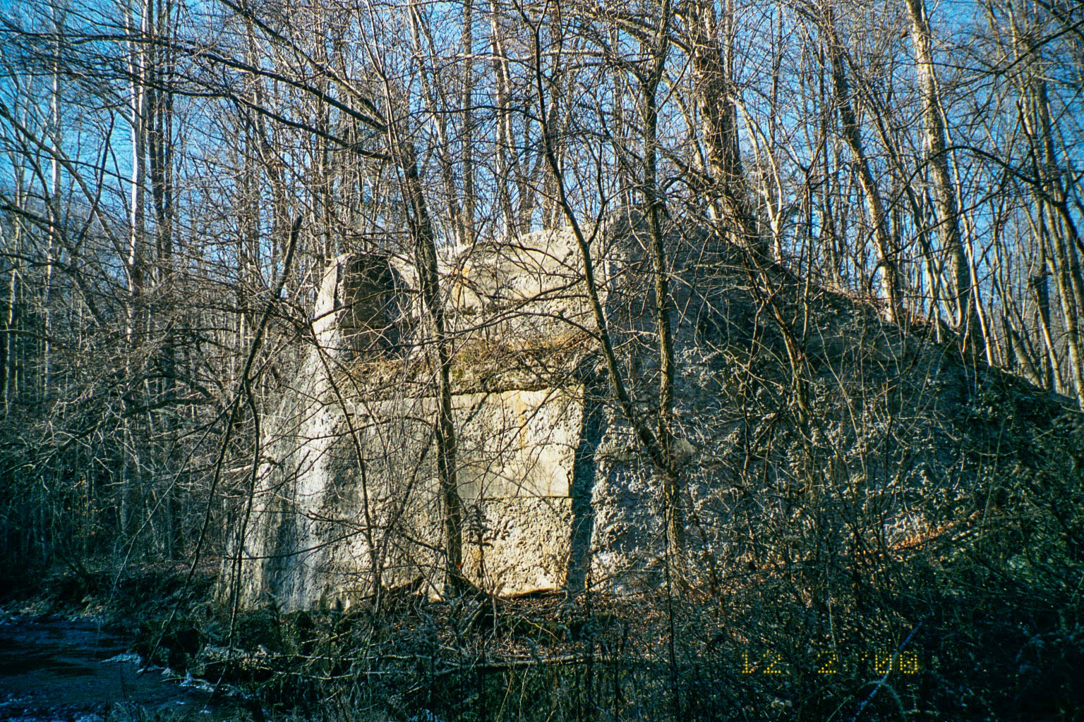
While we are on the subject of bridges, I’ll make a brief mention of another bridge project, this one the SNY bridge over Carbon Run just east of Laquin, PA. Below is a topographic map of the area from 1945. Note the S&NY railroad is not there, but the roadbed follows the course of the unimproved road ( and IS the road in places) seen on the map. When I visited this area in 2000, the State game lands and township roads were in many places on top of the old SNY roadbed. Since the recent flooding in this area, this may no longer hold true, and the old R-O-W may have been obliterated in places.
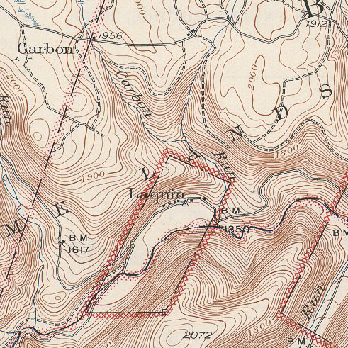
USGS Map 1945. Powell Quadrangle
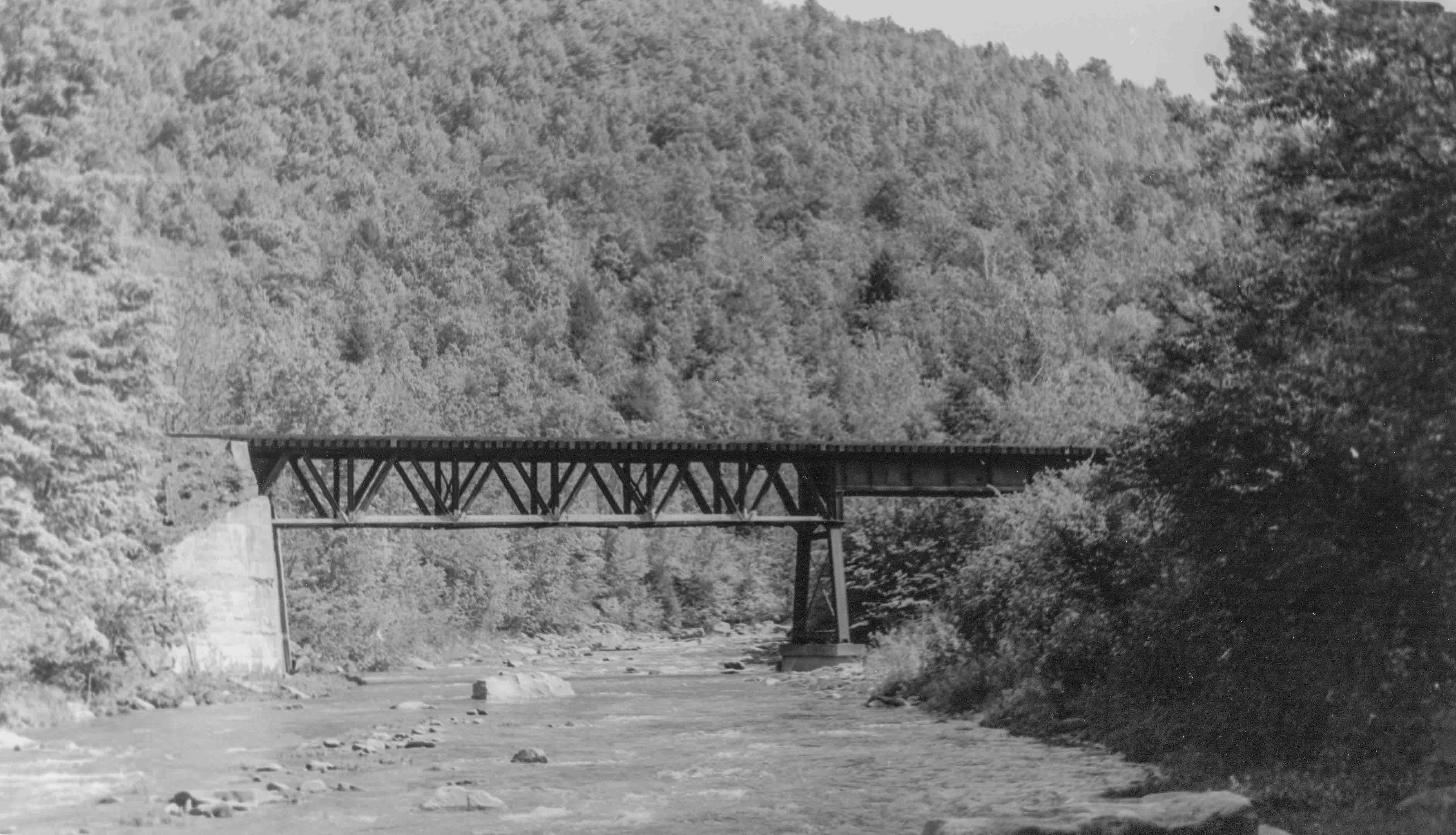
Below is a photo of the Carbon Run bridge from my field trip in 2000:
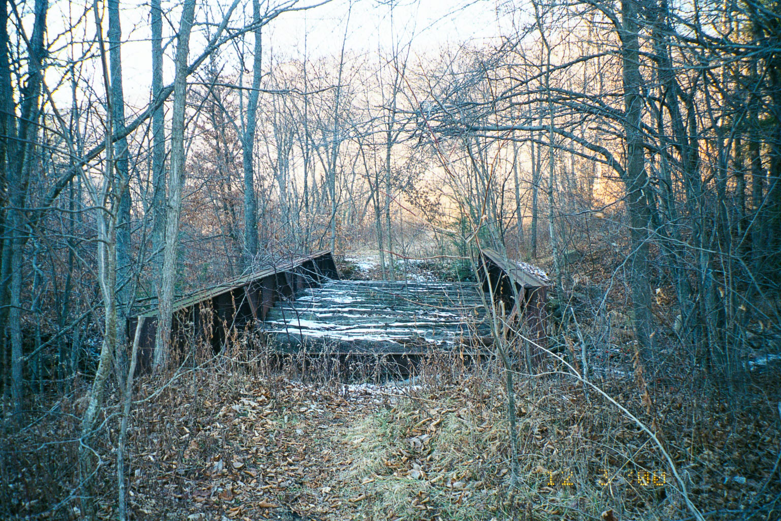
Photo by Author
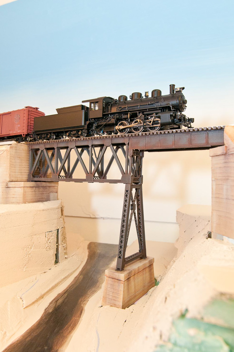
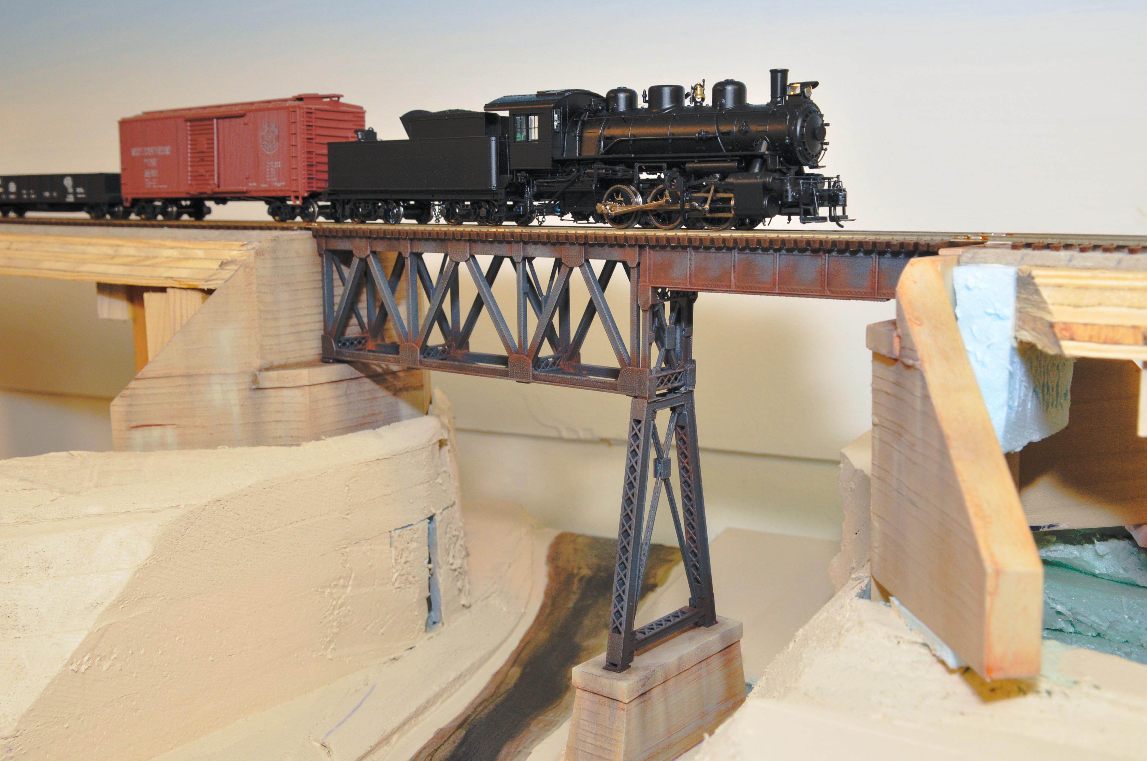
I had room for a representative model of the bridge at the east end of the model version of Laquin:
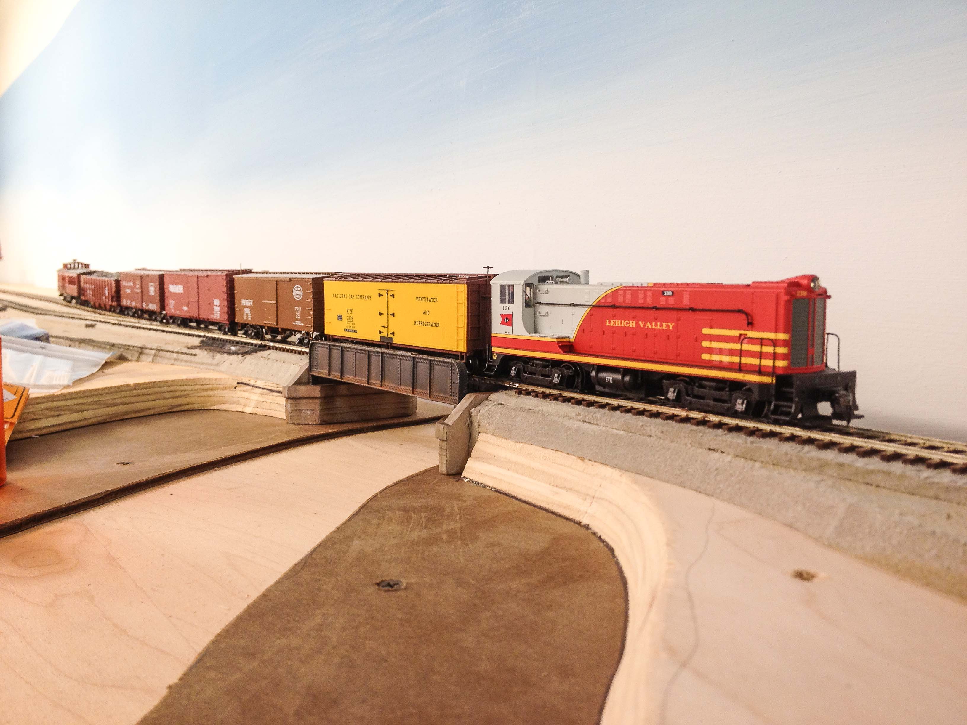
Photo by Author
The model version is a stock Walthers through-girder bridge on scratchbuilt abutments, and is quite a bit larger than the real bridge. However, the goal is an operational model railroad, and in this instance a reasonable stand-in was put in place, rather than take the time attempting to scratchbuild a more accurate model. I hope this will be a reasaonable compromise once scenery is in place.
Recent Comments