Ralston, PA is a small town nestled in the mountains along the Lycoming Creek, some 30 miles north of Williamsport. Ralston was an important crew-change point and helper station along the PRR’s Elmira Branch until the late 1920’s. The town’s importance to the PRR declined after this time, as larger, more powerful locomotives were developed that could make a through run from Tyrone or Altoona to Southport yard in Elmira, NY in a 16 hour crew day, obviating the need to exchange crews that were about to “outlaw” on hours-of-service for rested crews that had been stationed in Ralston. For a more detailed look at PRR activities in Ralston, see the excellent book “Set Up Running – The Life of a Pennsylvania Railroad Engineman” by John W. Orr. The book also includes a map of Ralston and the PRR facilities there.
Ralston was relatively less important to the SNY, but was served by a short branch from Marsh Hill yard. A large tannery, operated by the Elk Tanning Company, was located there. I have heard from other sources that there were several other smaller industries in Ralston in the early and mid-20th century, most notably a brick yard and a baseball bat factory, but I have no hard sources for that information.
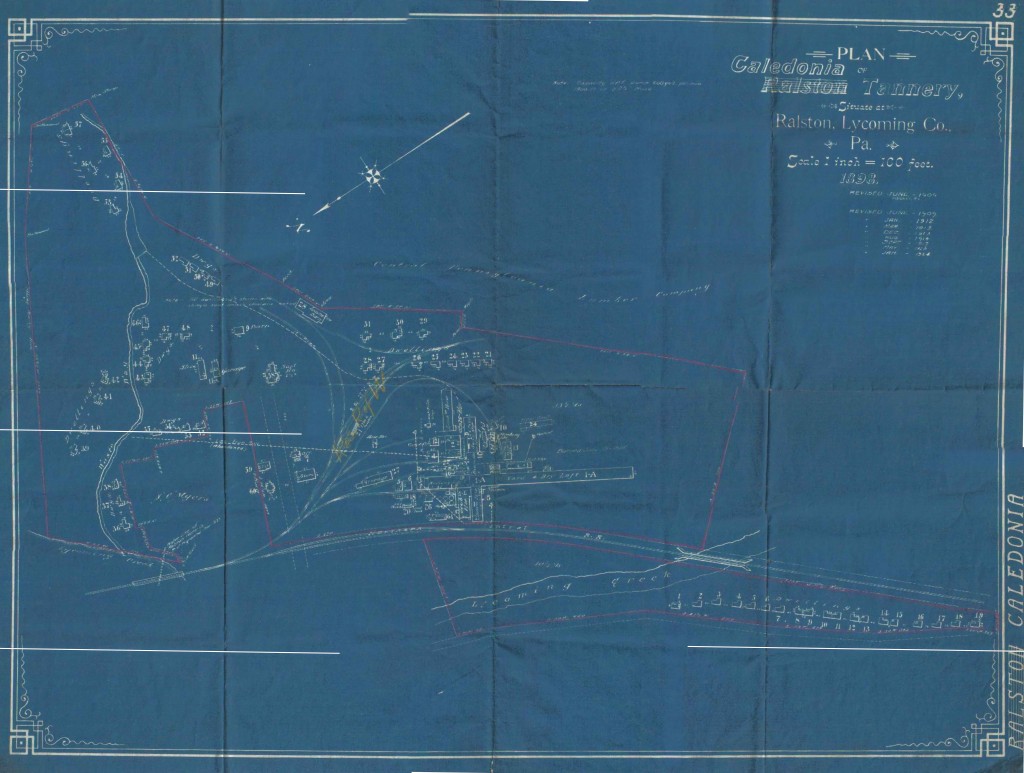
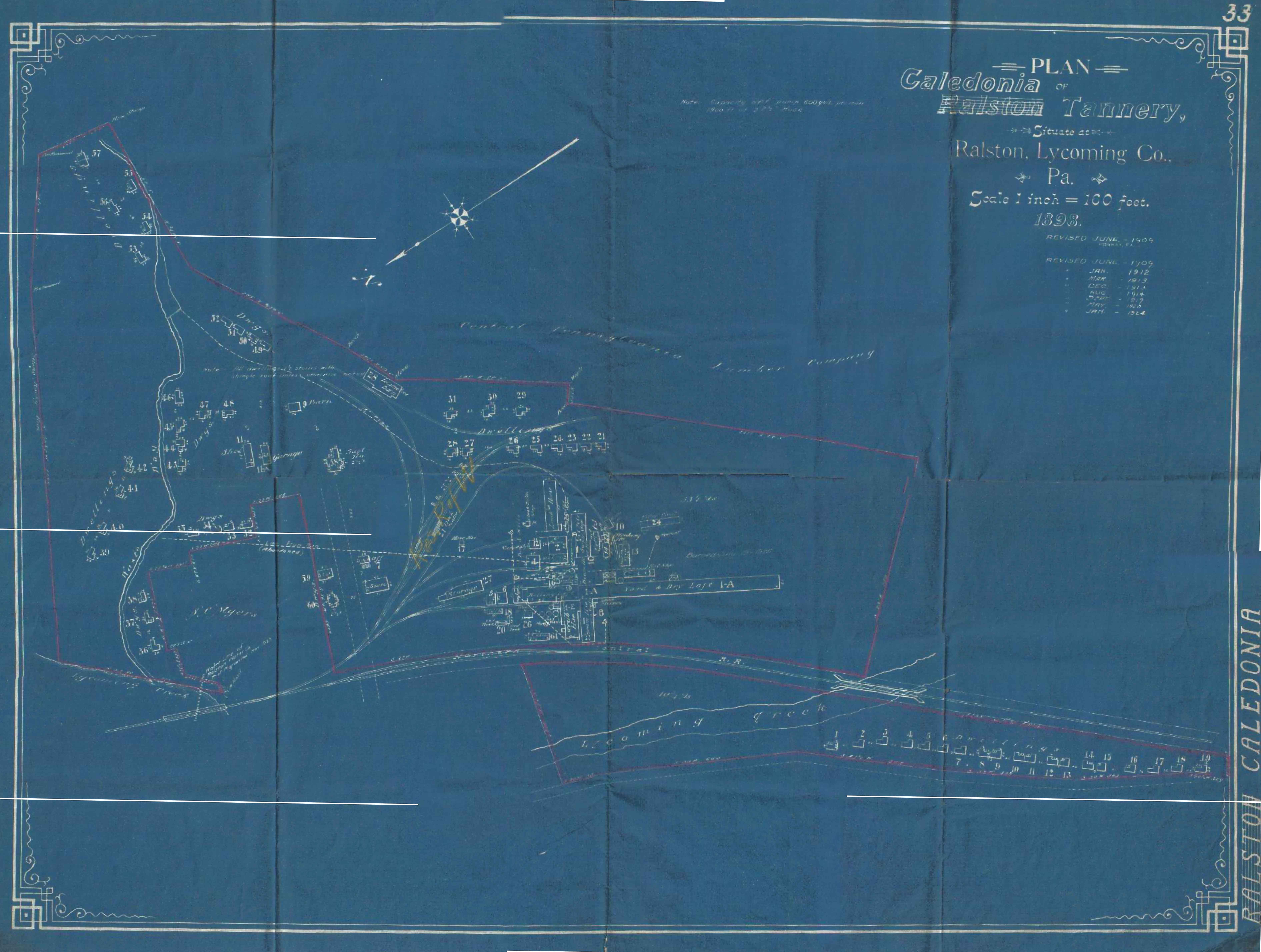
Map Courtesy Roy Breon via the “Elmira Branch” Yahoo Group
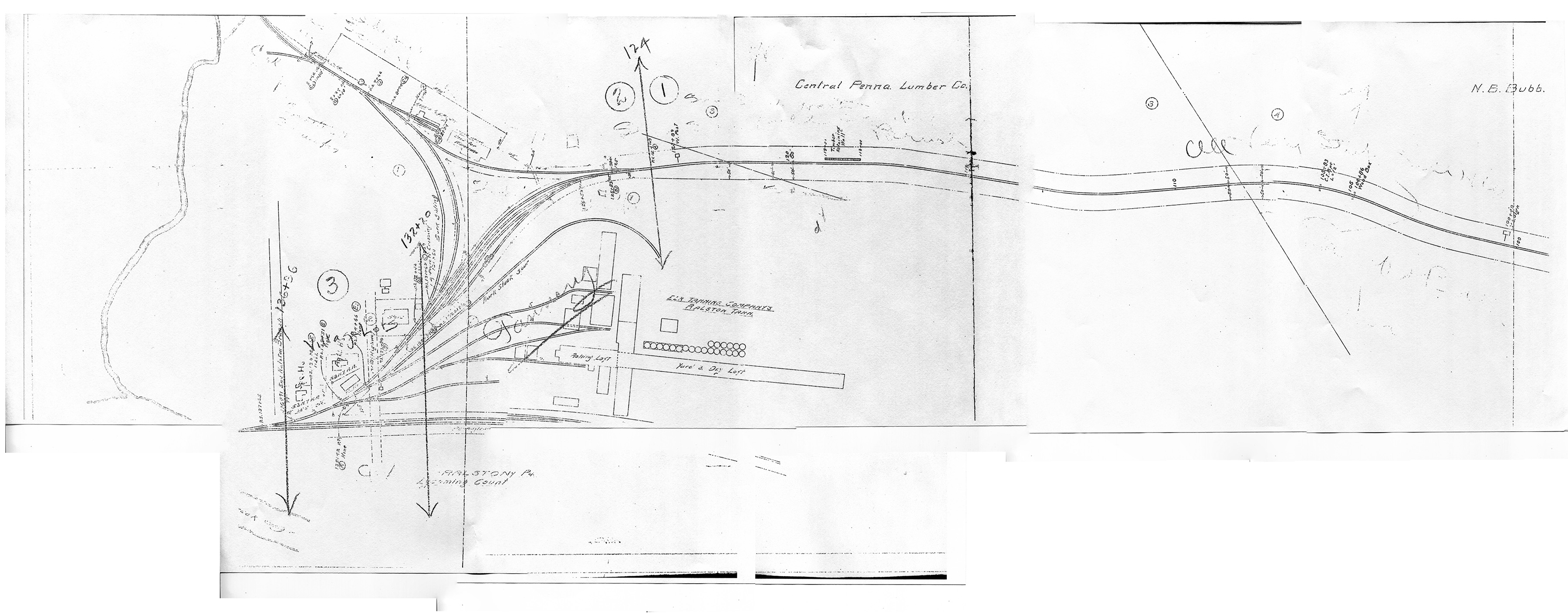
Above is a scan from a valuation map of Ralston posted to the “Elmira Branch” group on Yahoo. This map dates from 1898 (with periodic revisions noted, the last dated 1924), prior to the existence of the SNY. The SNY did not come into being until 1902, and did not reach its western terminus at Ralston until September 1903. It can be assumed that the tannery was probably served by the Northern Central Railroad (precursor to the PRR in this area) prior to the arrival of the SNY in 1903. Indeed, part of the impetus for completion of the SNY was to service tanneries owned via various corporate entities by the United States Leather Company. Most of the timberland along the SNY route was owned by the Keystone Lumber Co., another subsidiary corporation of US Leather; and the SNY railroad itself was owned ultimately by the US Leather Company as well. This large conglomerate most likely did not want freight revenue to “leave the family”, so to speak; so why not build its own railroad to capture the revenue instead of paying the Northern Central.
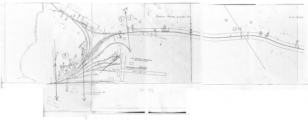
Map Courtesy of Charlie Marvin
Above is a valuation map, circa 1918, provided by Charlie Marvin. North is to the viewer’s left. We can now see by this time that the SNY enters the area from the south along Lycoming Creek. However, the western terminus of the SNY is no longer at Ralston, as the railroad decided to construct a new yard and engine service facilities further south at Marsh Hill as part of the railroad’s plans to expand south to connections at Newberry, PA. However, there were still a few customers to be served in Ralston, and the SNY ran local trains up the branch from Marsh Hill to service them. I believe I had read in one source that the tannery had burned down by the mid-1920’s and was not rebuilt, as the hemlock bark used in the process had been pretty much exhausted from the area forests, all the hemlock having been timbered. One of these industries was apparently a “wildcat” coal mine that produced a few cars a week. The struggle the SNY had to get cars upgrade to this mine is described vividly in “Set Up Running”. I believe most of this coal was probably used as locomotive fuel by the SNY itself, and not much was likely interchanged offline.
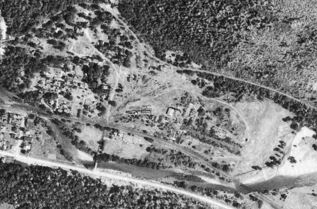
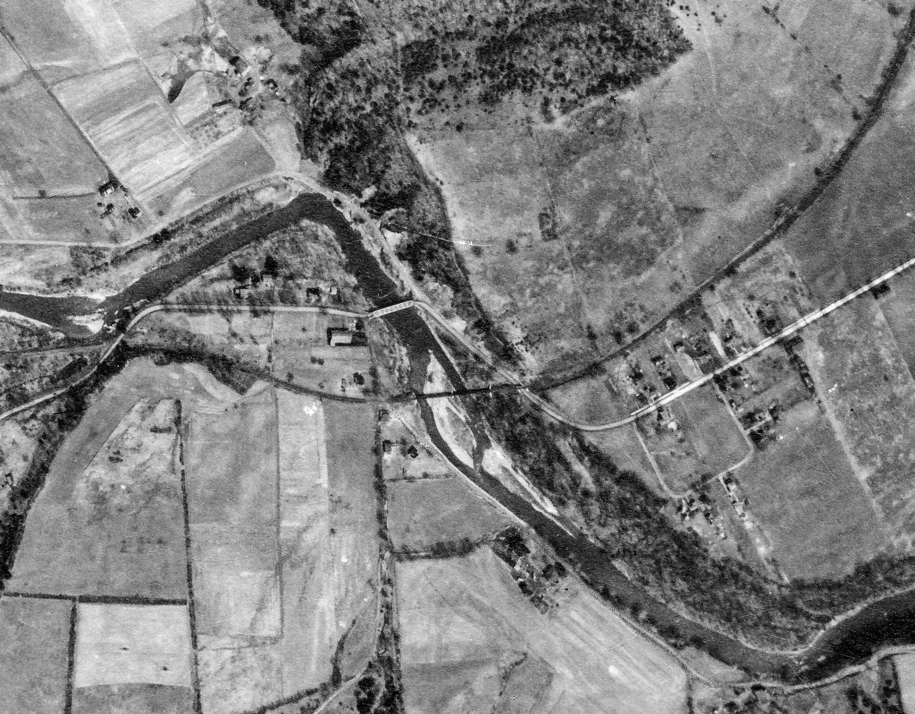
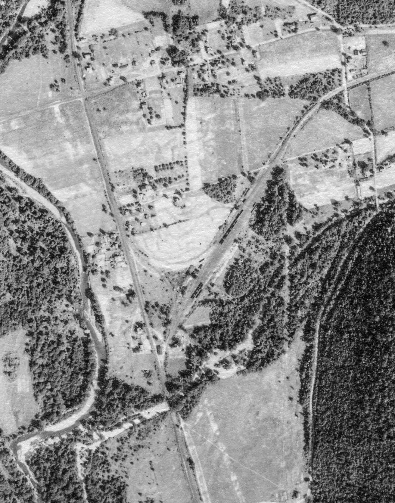
Penn Pilot – Penn State
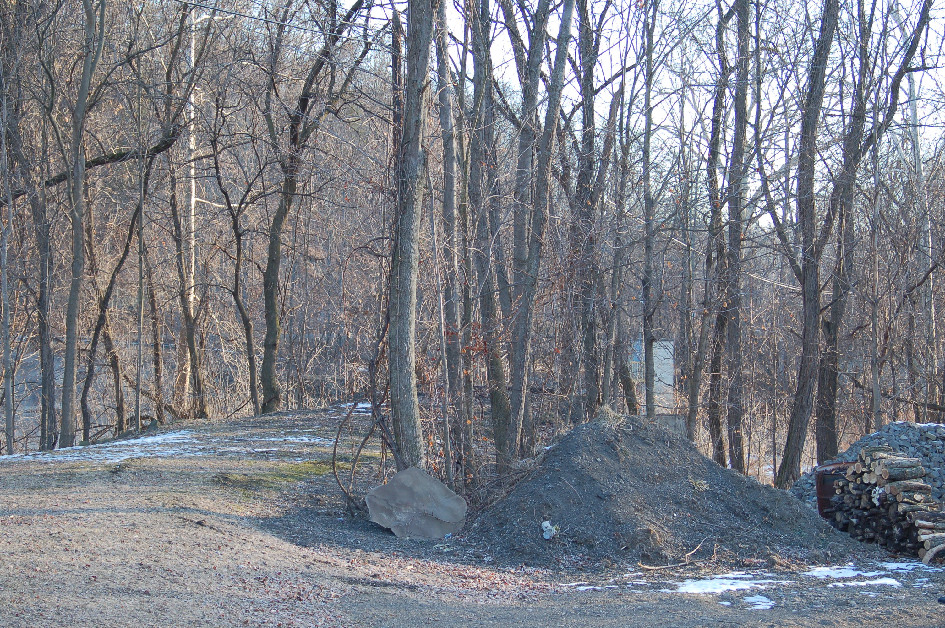
Above is a 1938 aerial view from Penn State’s Penn Pilot site. I have cropped and rotated the original to match the valuation maps above. We can see the SNY branch to Marsh Hill heading off to the viewer’s right, and the SNY wye, and remains of the tannery buildings in the center. At the lower center is the PRR Elmira Branch running right to left, with two bridges crossing Lycoming Creek at the middle and south end of town.
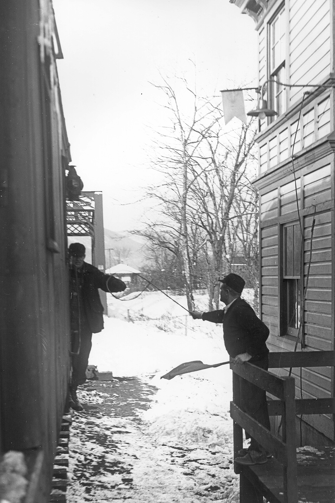
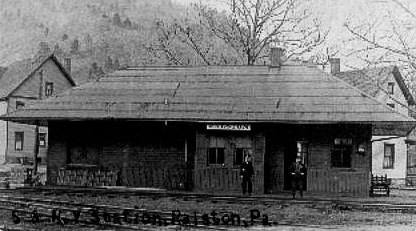 Above is a poor quality scan from the ‘net of the SNY station at Ralston. This is the only photo of SNY structures in Ralston I have come across. I believe it was probably located at the north end of the SNY wye trackage, near Lycoming Creek and the Northern Central (later PRR).

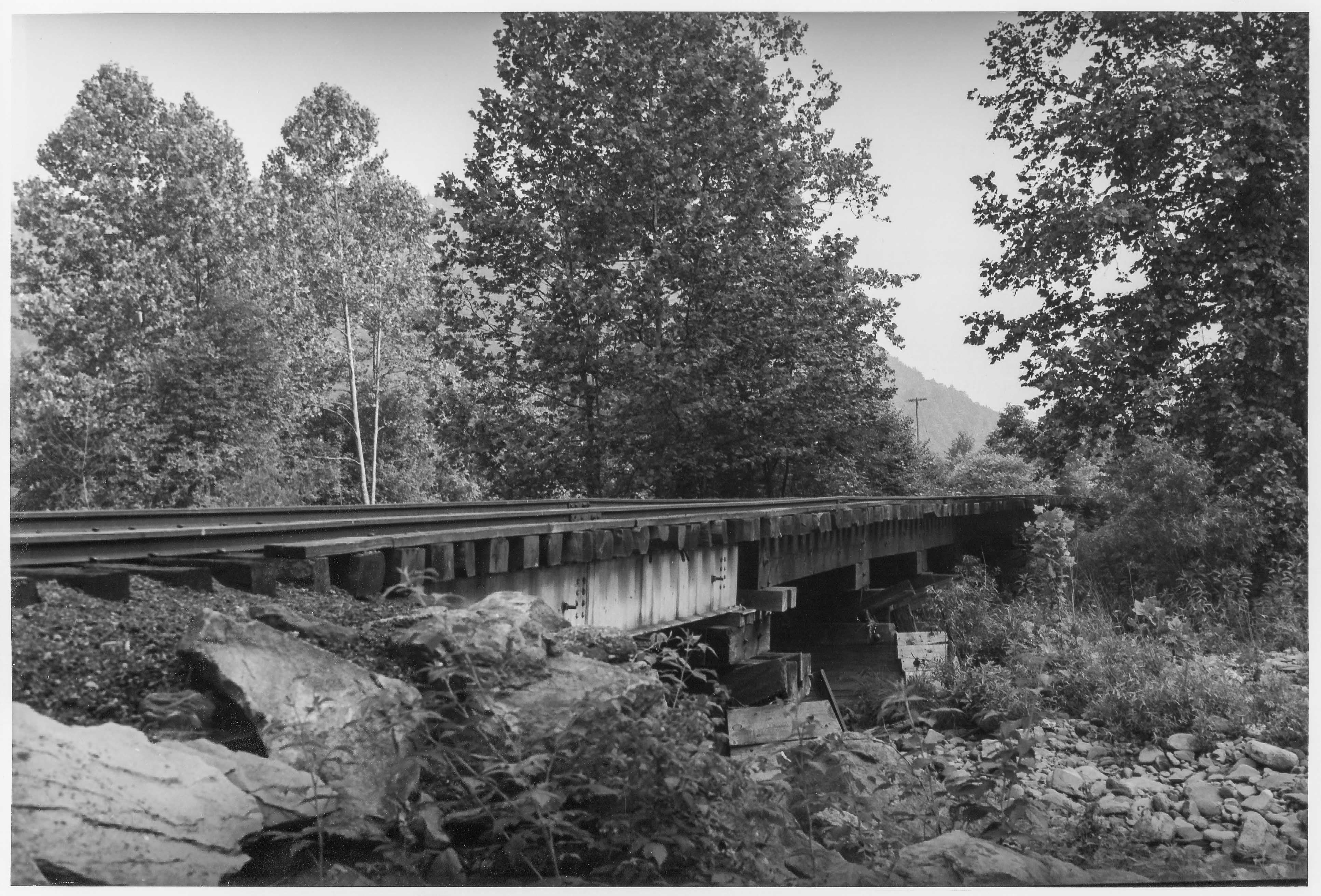
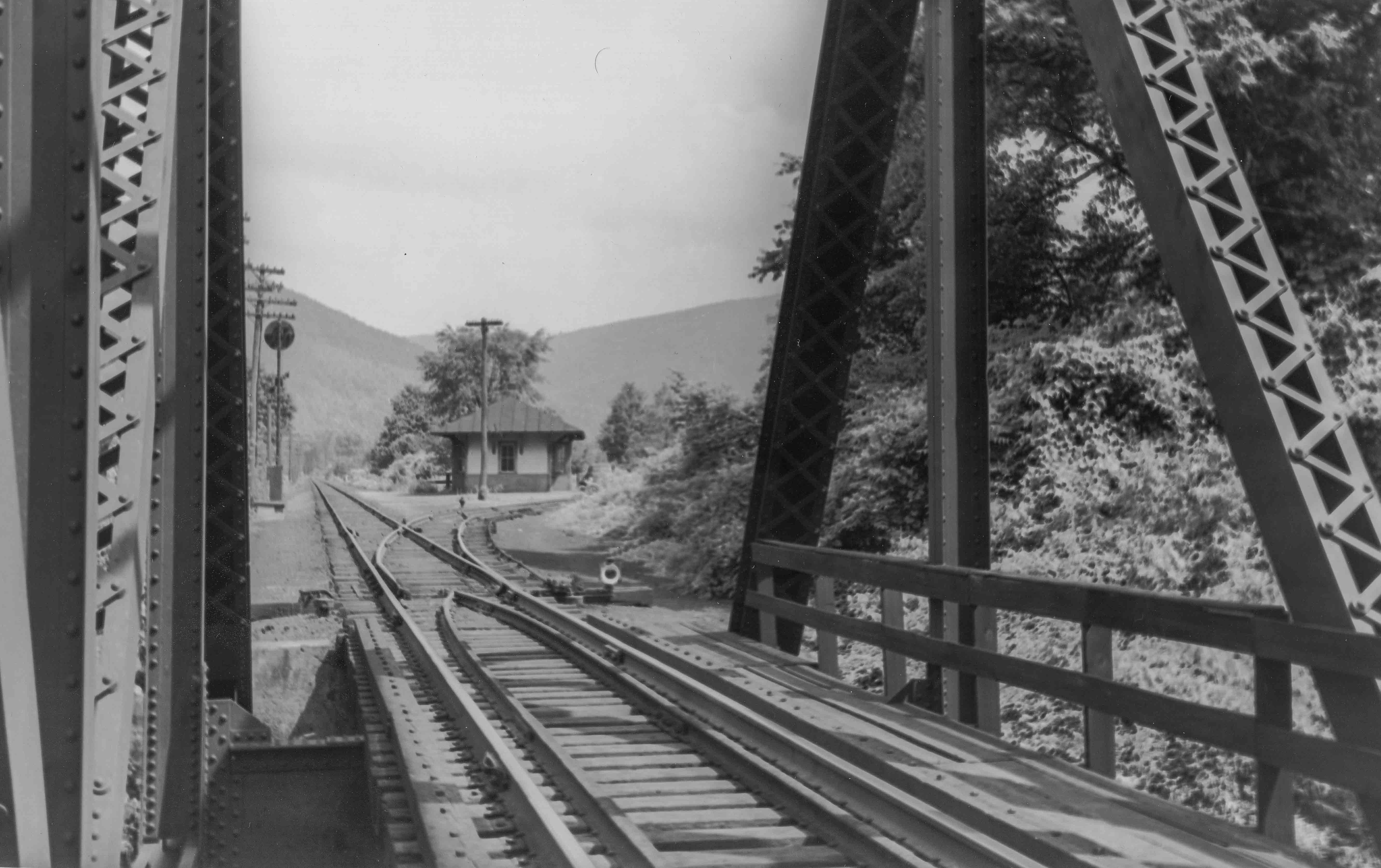
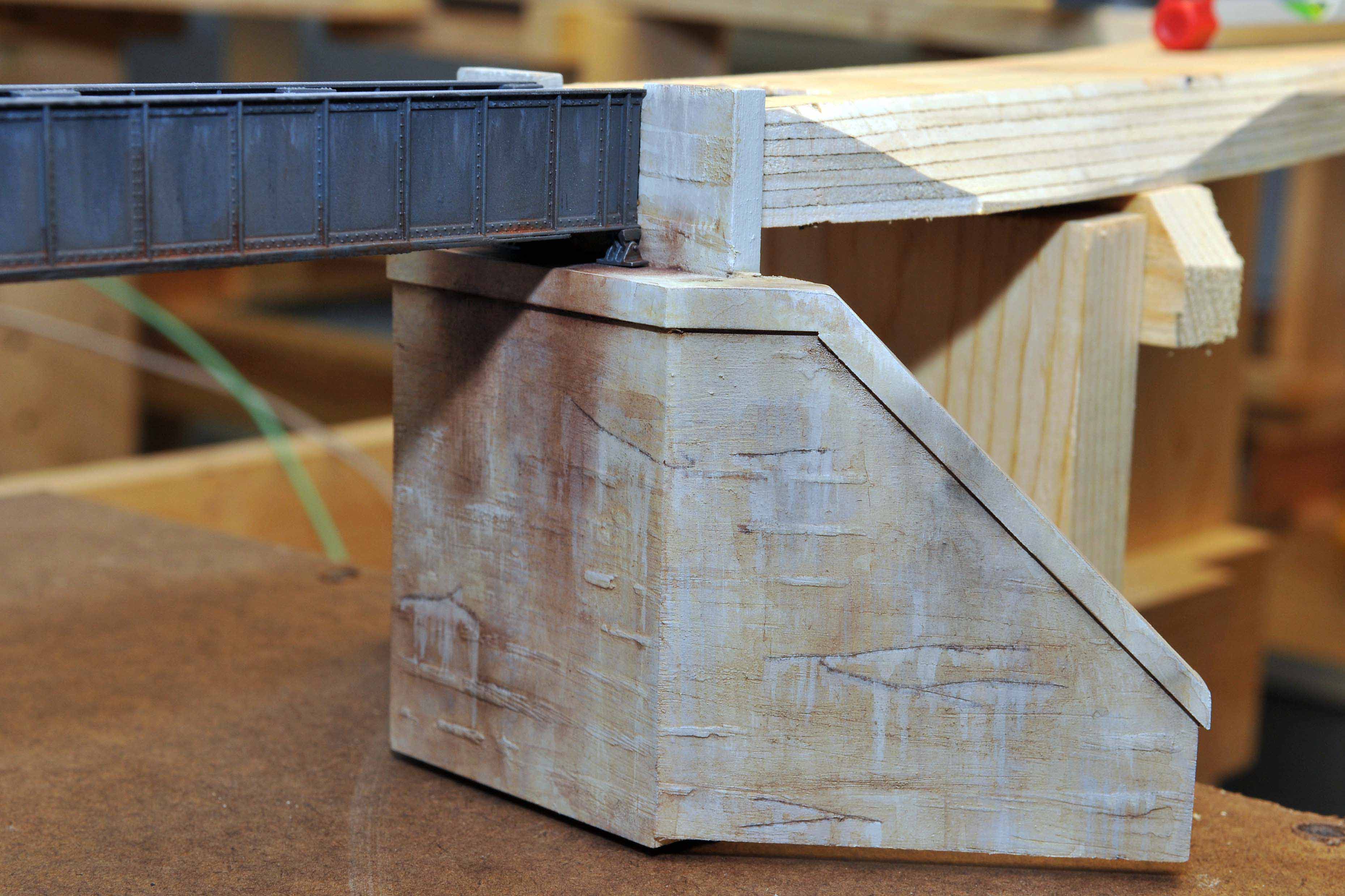
Photo by Author
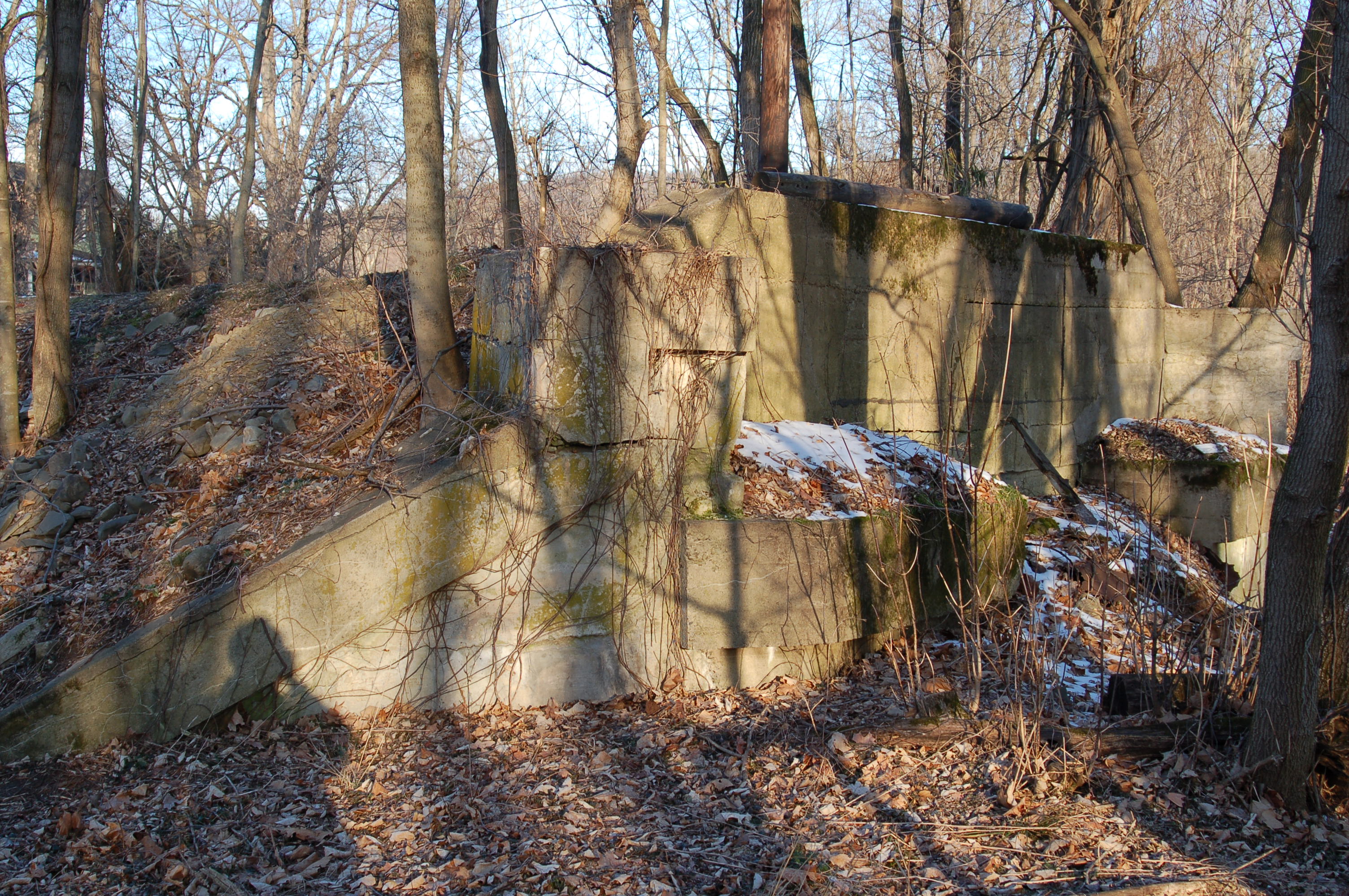
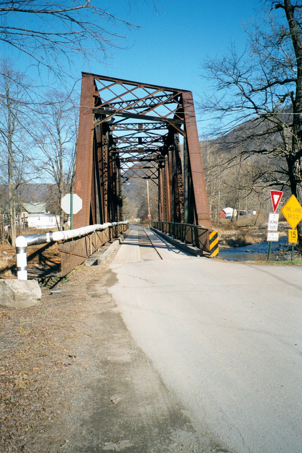
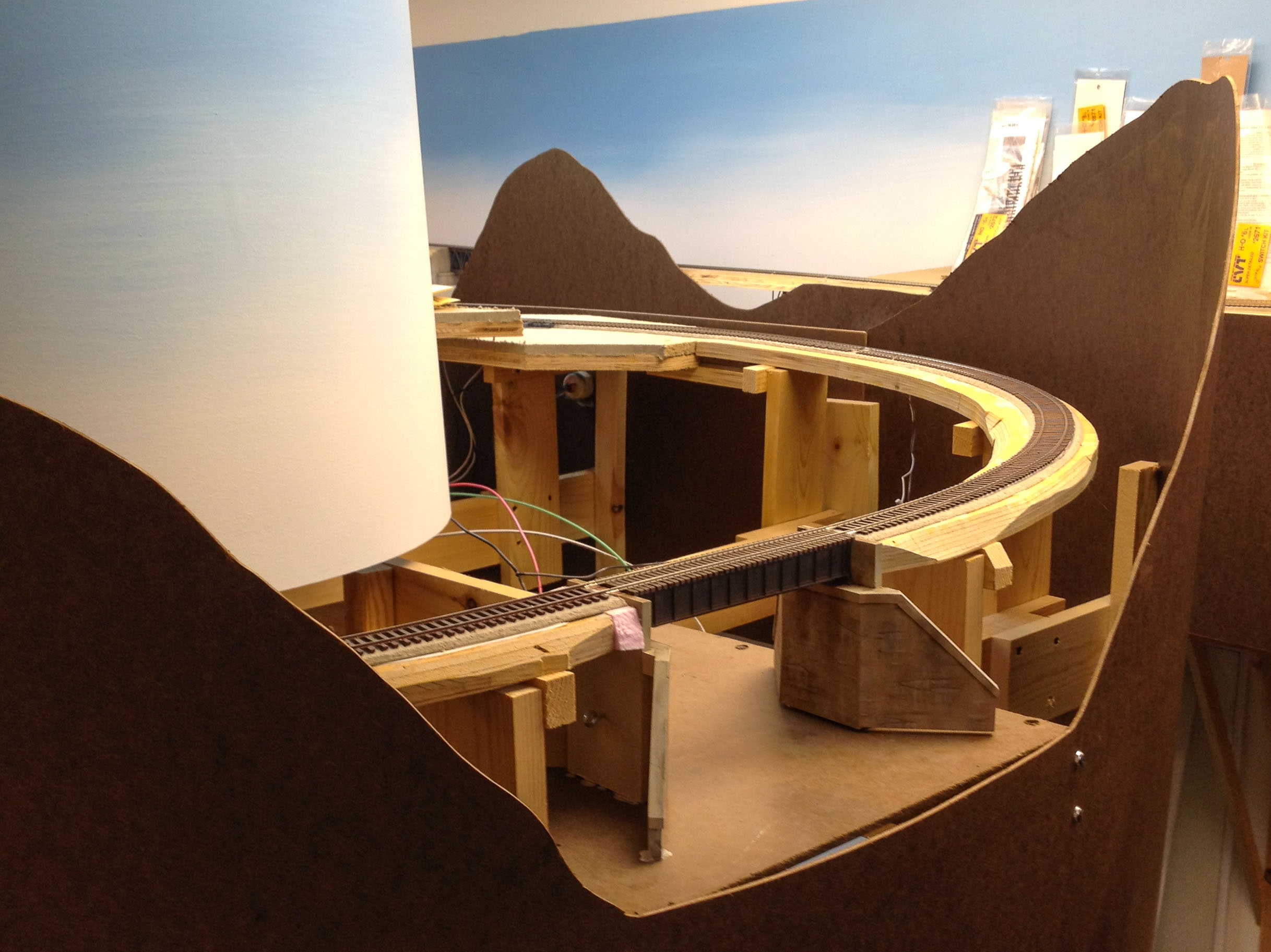
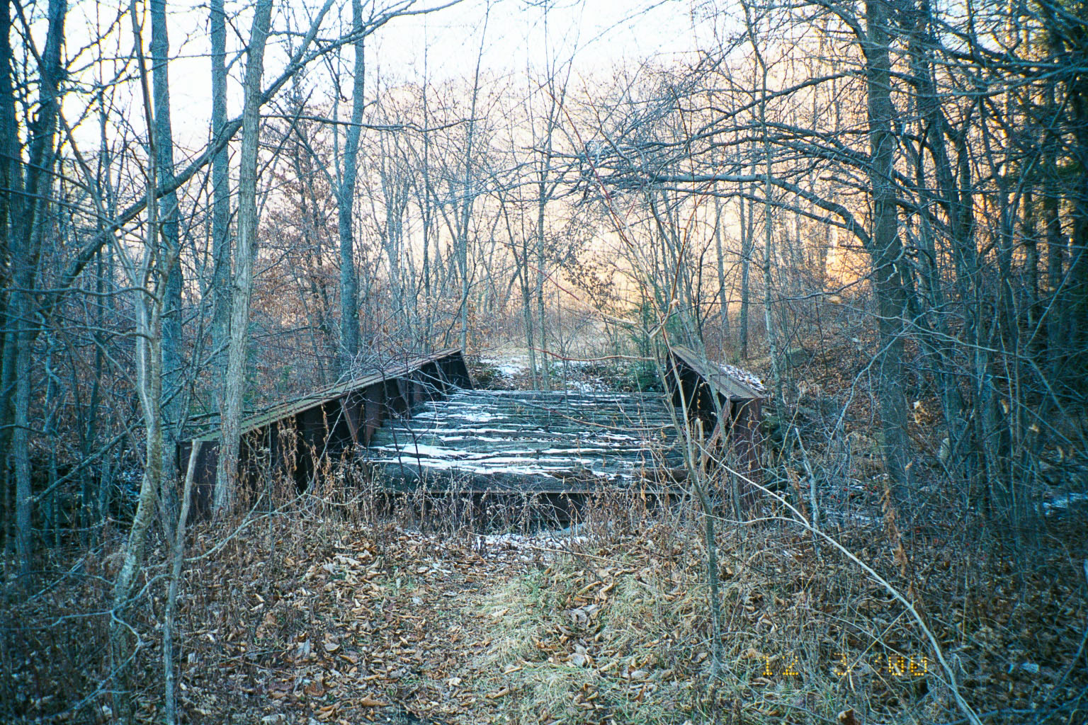
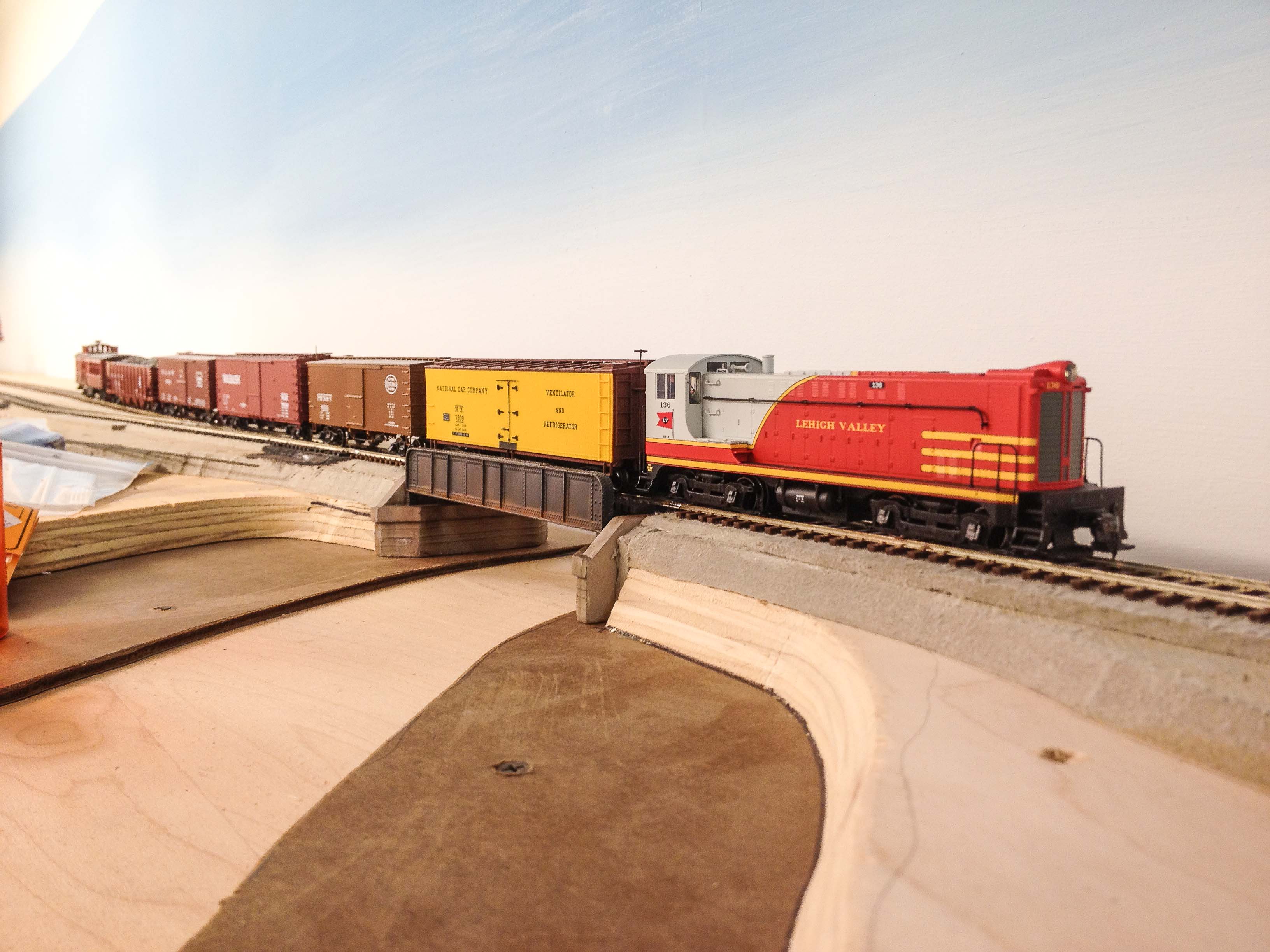
Above is a view looking northward, of the second of three PRR bridges in Ralston (At the viewer’s left lower center in the 1938 aerial view above). This bridge survived the flooding during Hurricane Agnes in 1972, but was abandoned by Penn Central since the flooding wiped out many of the branch’s other Lycoming Creek bridges. Later taken over by the town of Ralston and used as a road bridge after more floods in 1996 destroyed the nearby road bridge, it was finally removed in 2002 after a modern concrete road bridge was built by the county immediately adjacent.
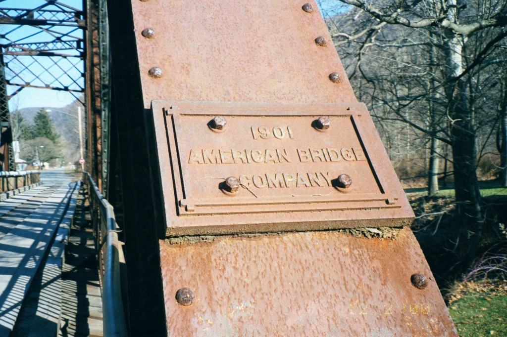
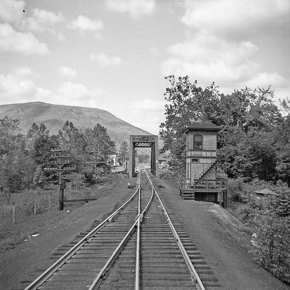
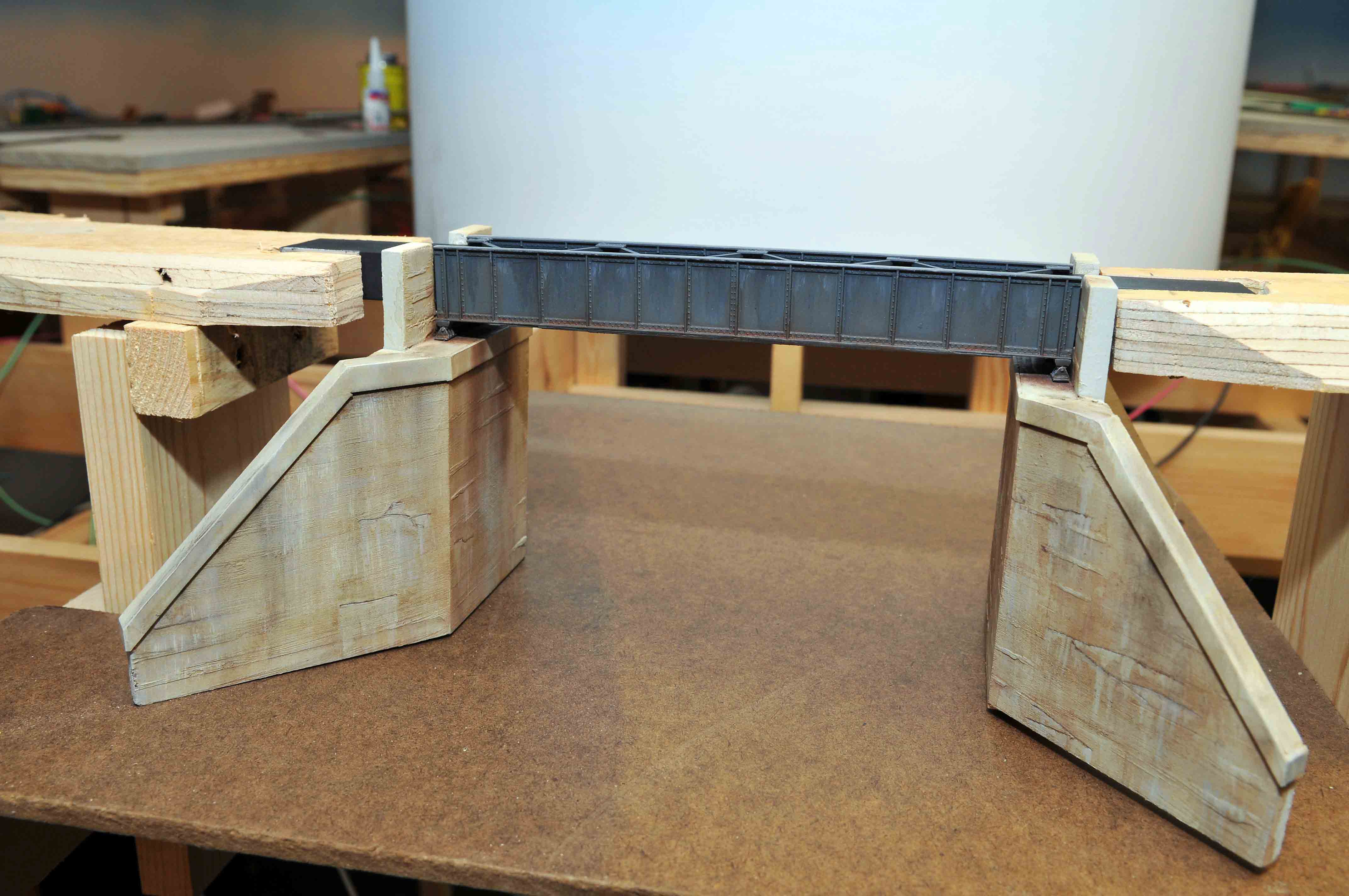
Photo by Author
Detail view of the bridge, built in 1901. Ironic to note that this bridge actually dated to the Northern Central Railroad era, and pre-dated the arrival in Ralston of both the PRR (the NC was not completely absorbed by the PRR until 1917), and the SNY (which did not arrive until 1903), yet outlived them both.
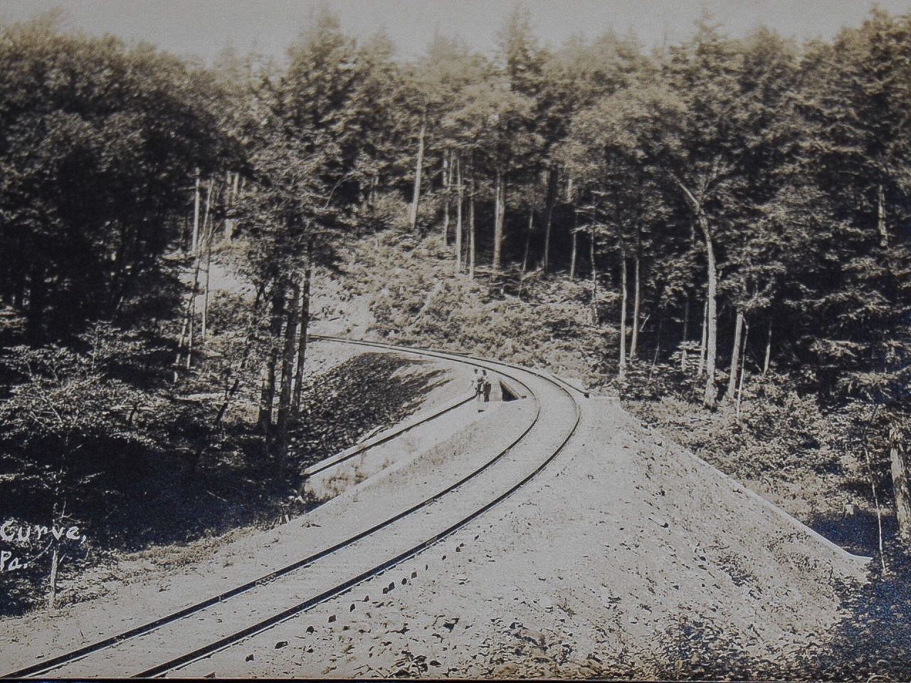
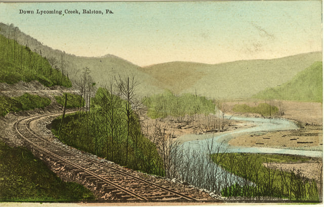 Above is a scan of a postcard view of the Lycoming Creek valley near Ralston from the early part of the 20th century. Aside from the size of the trees, Lycoming Creek in most spots does not look much different today.
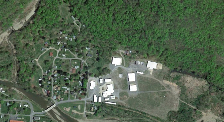
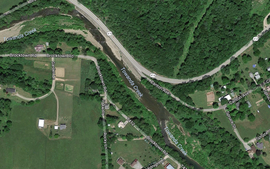
Google Earth
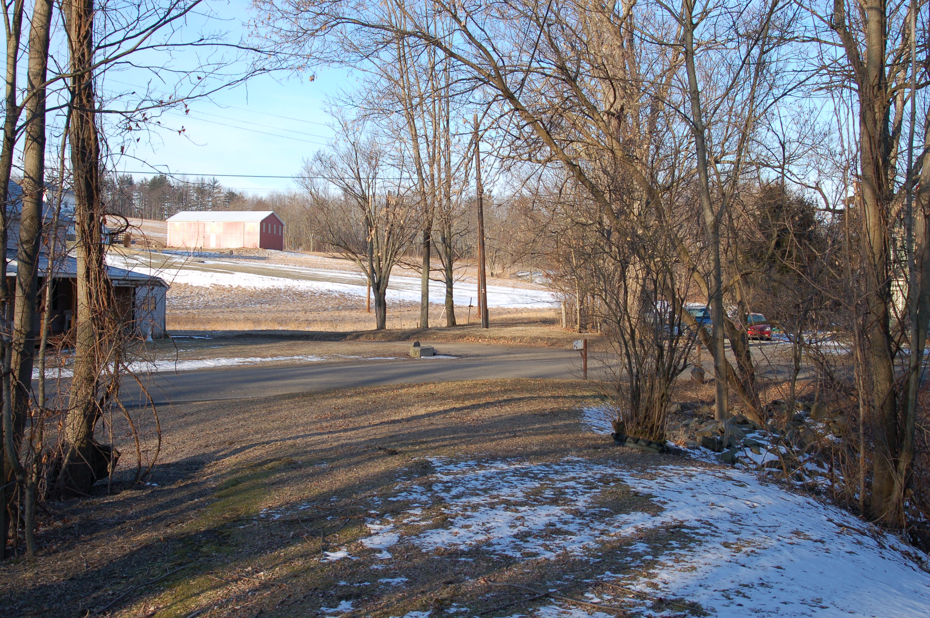
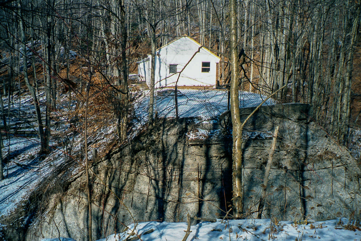
Lastly, above is a modern satellite view of Ralston from Google Earth, again oriented with north to the viewer’s left . The modern bridge which replaced the hundred year-old Northern Central bridge can be seen in the lower left corner, and is just downstream from the site of the old bridge. A modern wood-products plant is sited on the footprint of the old tannery. Time, floods, trees, and newer construction have pretty much obliterated any trace of the SNY, though the old Elmira Branch roadbed can still be faintly seen curving just west of the new factory.
Update 11/29/13:
Reader George Lane provided a link (http://www.loc.gov/pictures/item/2008677185/) to a stereoscopic view of the Northern Central station at Ralston ca. 1870 from the Library of Congress. I would guess the view is looking north with the northern-most of the three bridges over Lycoming Creek in the background. I am not sure of the identity or precise location of the colonnaded building in the background:
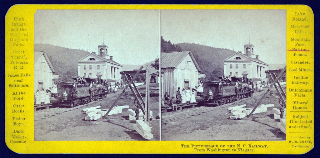
Library of Congress


Recent Comments