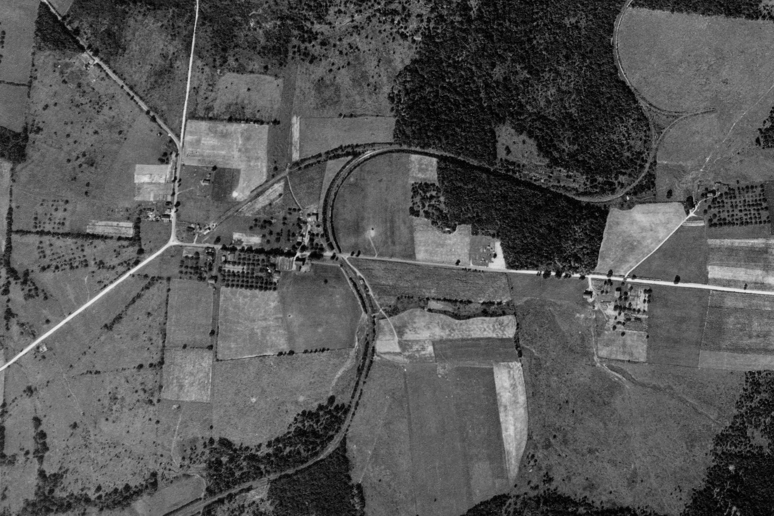
Ellenton was a small crossroads near the summit of the railroad, between the Pleasant Stream and Schrader Creek valleys. The SNY was disadvantaged by having to climb steep grades both ways between Marsh Hill and Towanda, coming and going. On the aerial view from circa 1938, a wye track is visible north east of Ellenton, used to turn helper engines.
PSU – Penn Pilot
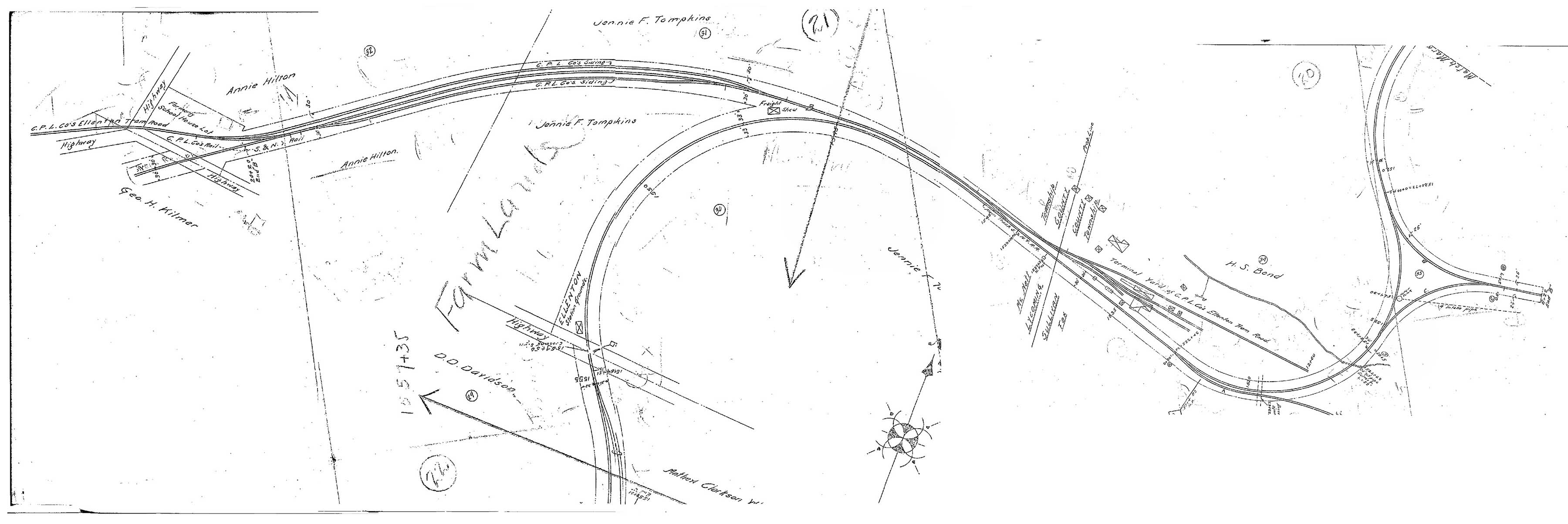 Above is a scan of SNY valuation maps, kindly provided by reader Charlie Marvin, and stitched together by the author in Photoshop. I had wondered what the long spur was north of Ellenton, but we can see from the map that is actually the remnants of the Central Pennsylvania Logging Co. logging railroad and the original S&NY alignment to Masten. (Updated 8/3/15)
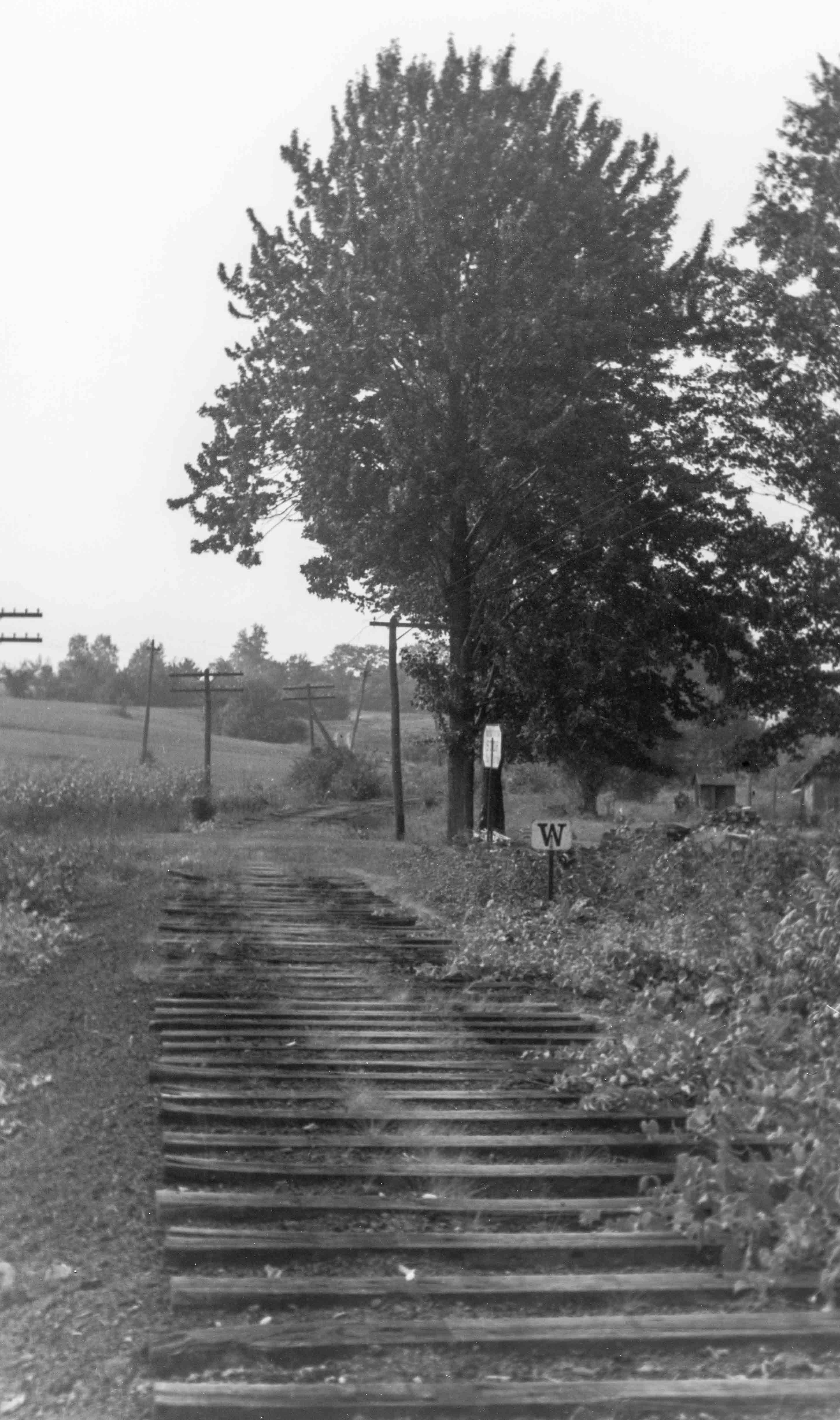
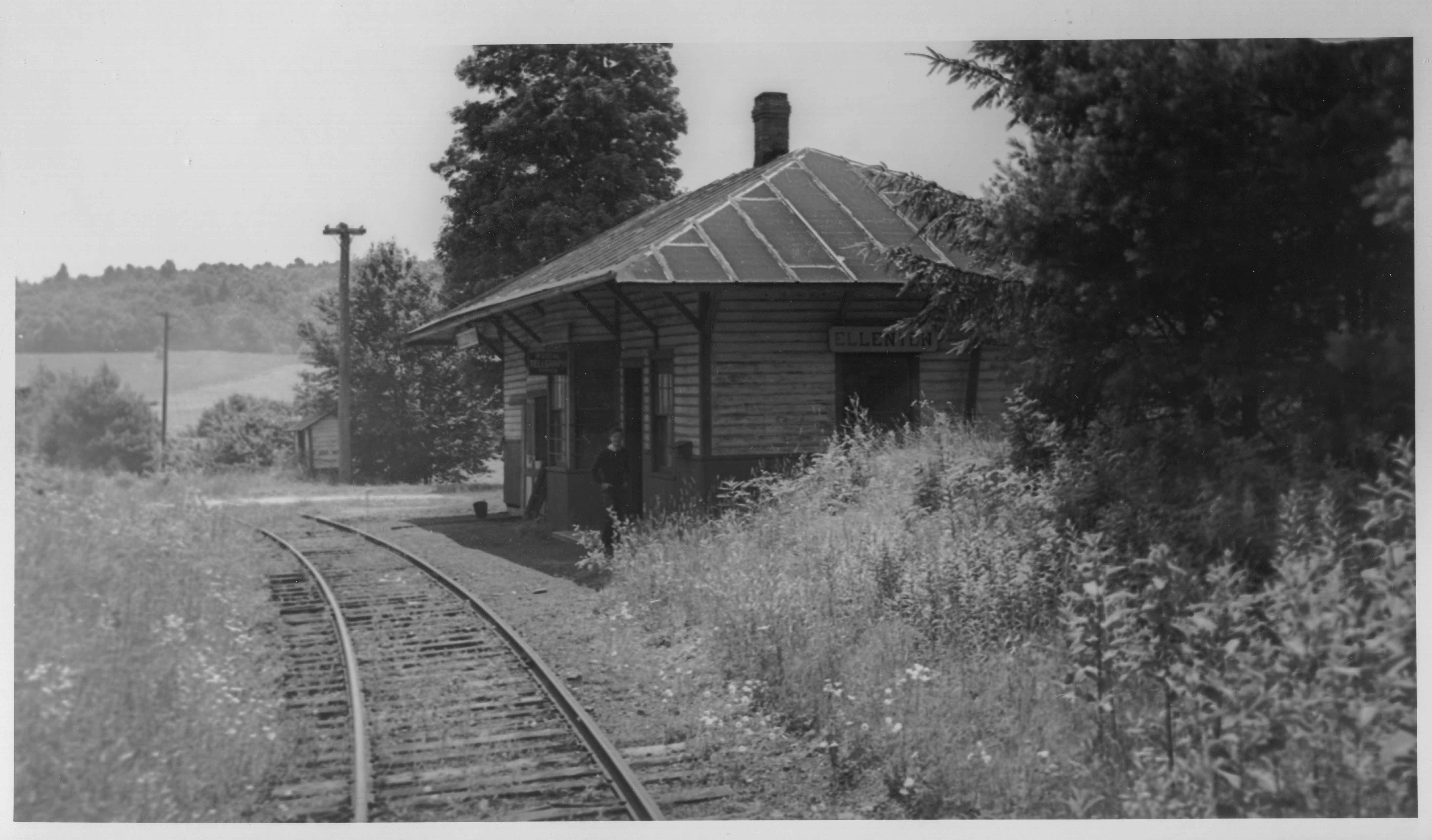
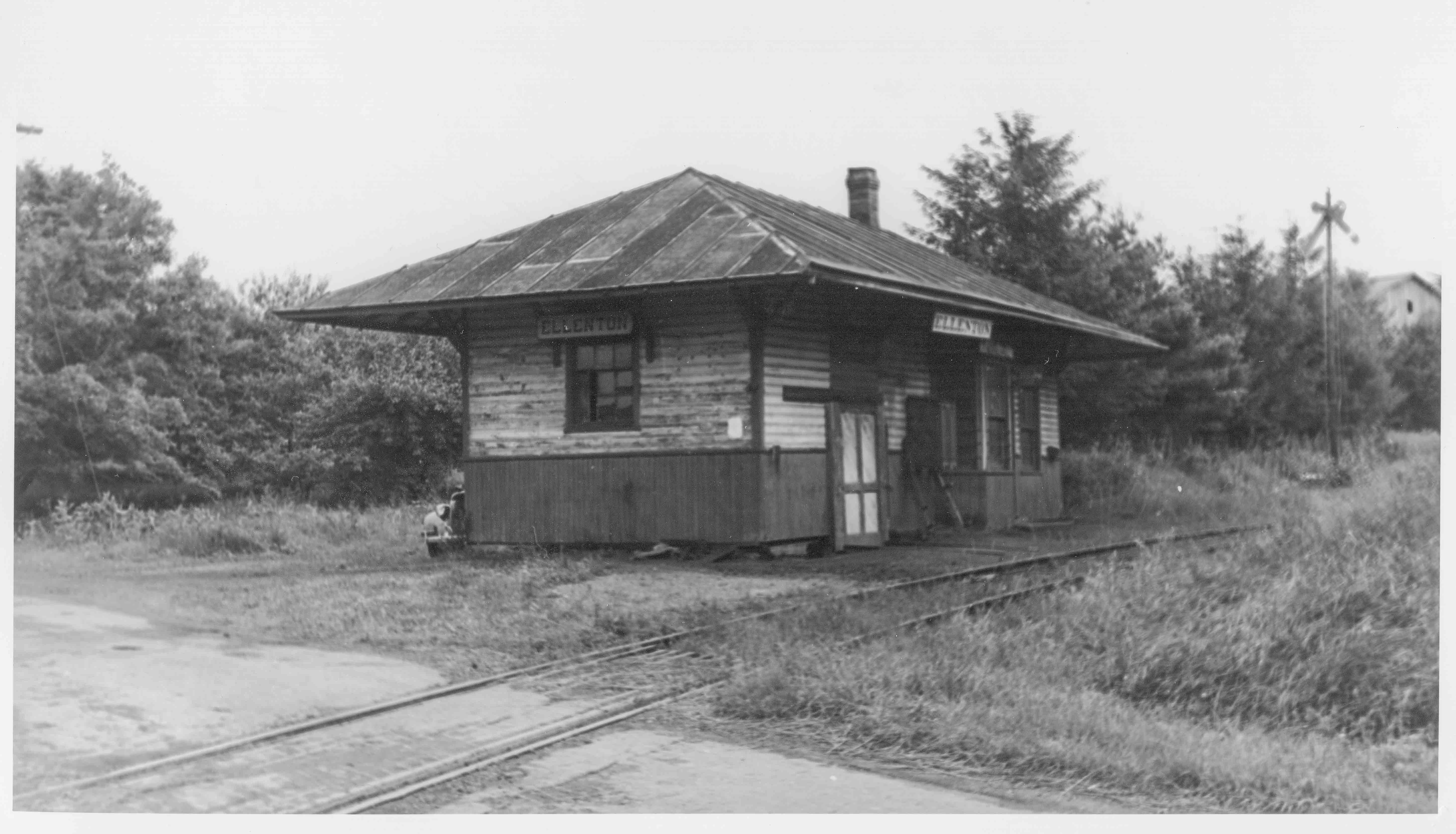
Here is a view of the SNY roadbed at Ellenton, PA, probably taken during abandonment operations in 1942. This view is looking downgrade and roughly southwest towards Masten.:
Bill Caloroso – Cal’s Classics
Bill Caloroso – Cal’s Classics
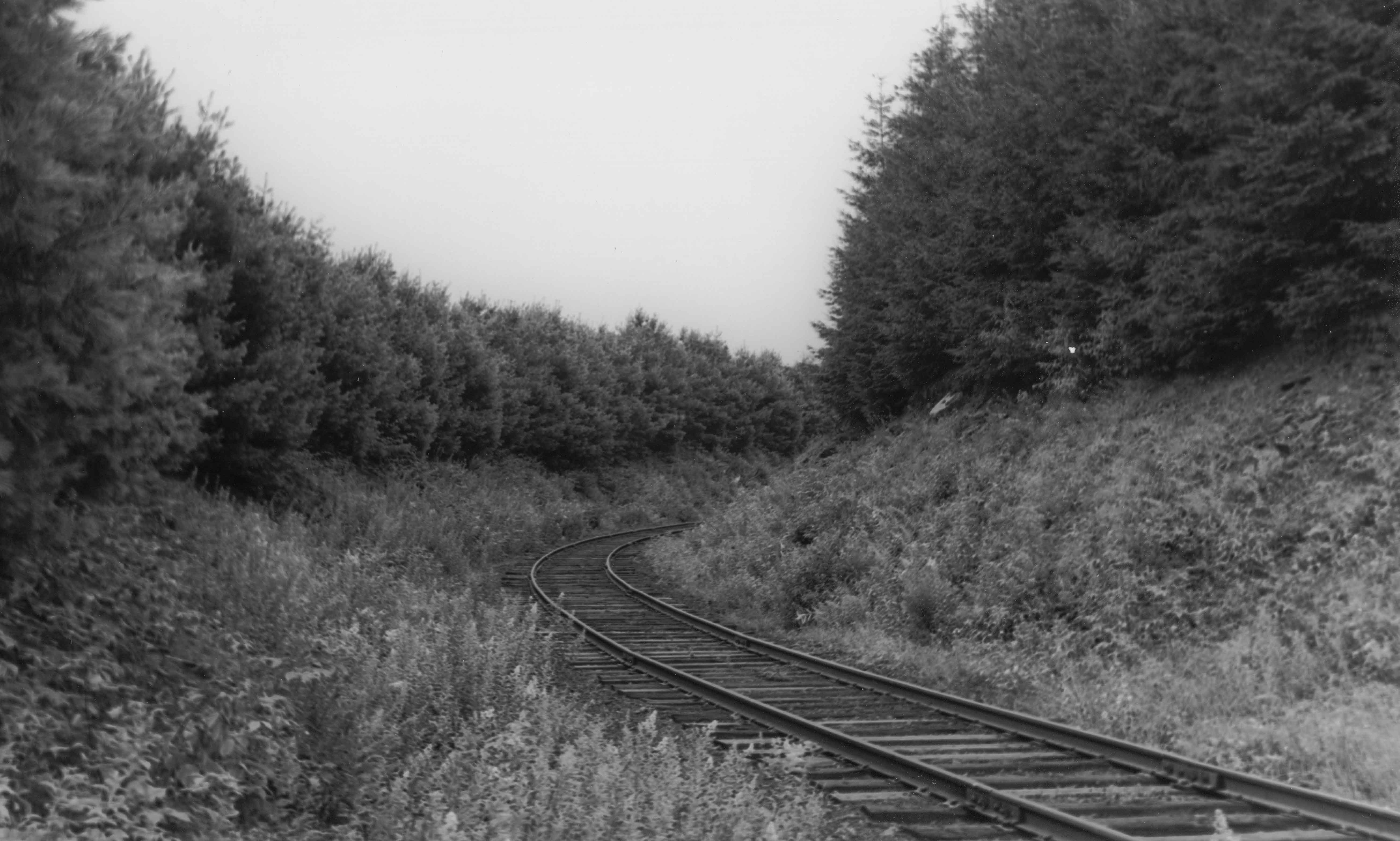
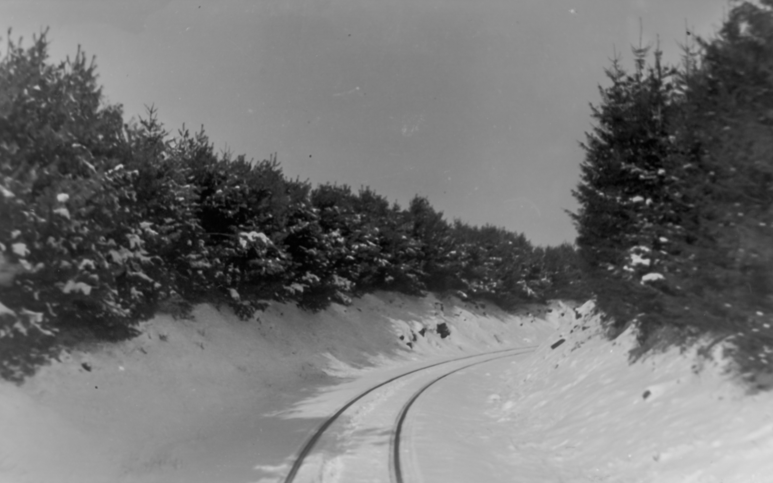
The above view is looking roughly northeast towards the true summit and wye track. The pine trees were reportedly planted to help diminish drifting and blowing snow from closing the cut.
Bill Caloroso – Cal’s Classics
Here is a view of the same area, possibly during the winter of 1941-1942. The modern views below show the area in the early winter 2000. We can see how the trees have grown up over the intervening 58 years.The old roadbed crosses the road at the “dip” just beyond the largest trees along the right side of the road. The photographer in the second view above would have been standing in the roadbed off to the right, albeit some 58 years earlier in time. The road ( according to Bing maps McIlwain Rd.; PA Route 4002), paved in the 2000 photo, appears to be dirt or gravel in the 1942 view. Interestingly, the SNY roadbed is labeled “S&NY Road” on Bing maps.
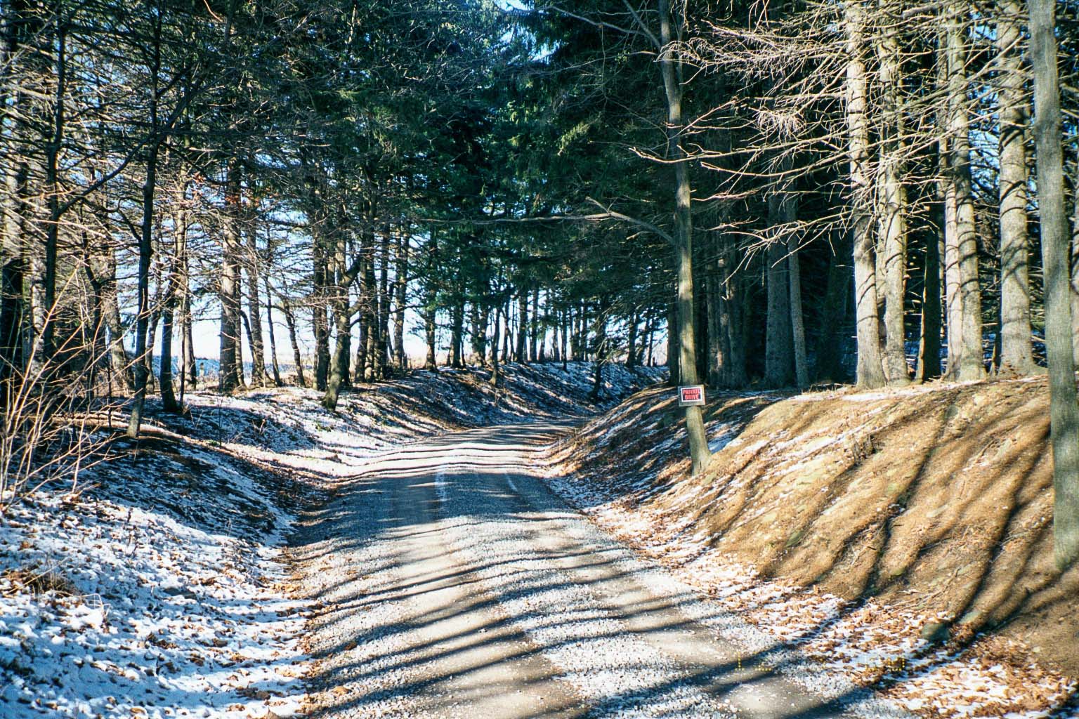
Photo by author
Photo by author
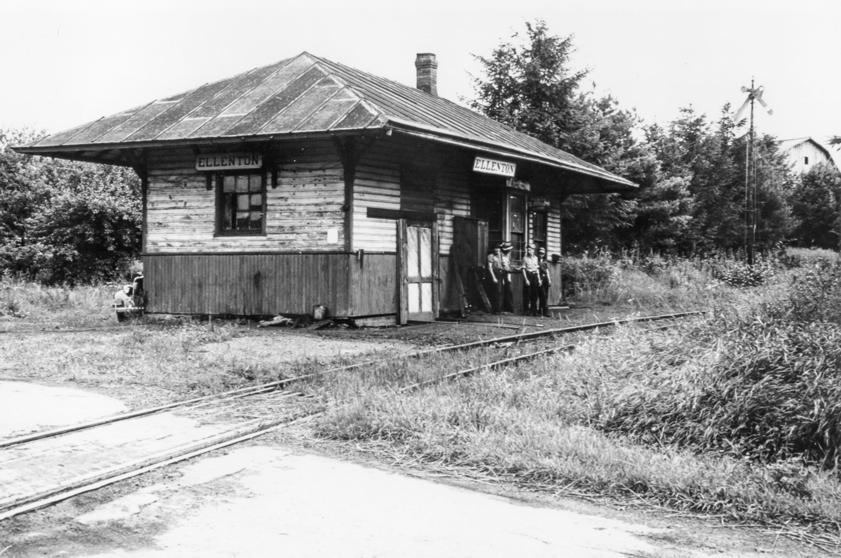
Below are three views of the station at Ellenton. The first is looking downgrade toward Masten, similar to the abandonment view above, albeit earlier in time, perhaps the mid-1930’s. The second and third look roughly northward in the opposite direction, probably near the end of the SNY in late 1941 or ’42. The station looks to be in pretty rough shape in the last two photos.
Bill Caloroso – Cal’s Classics
Bill Caloroso – Cal’s Classics
Bill Caloroso – Cal’s Classics
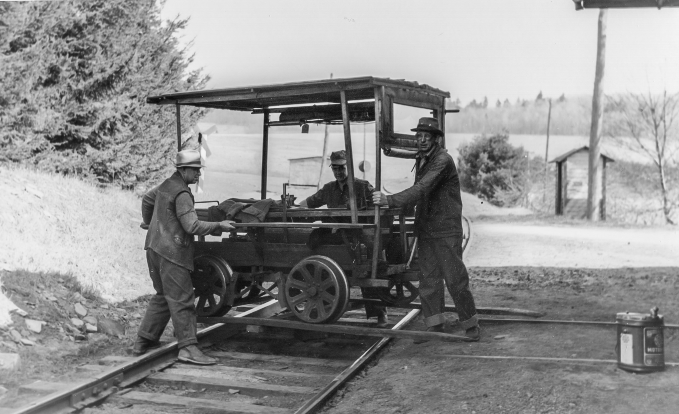
The station was also apparently used as a section house, and the section hands stored a speeder car in the station in the part behind the wooden door seen to the left in the above photos. In the photos below, the section crew is man-handling the speeder onto the rails. Anyone know the identity of the gentlemen in the photo?
Bill Caloroso – Cal’s Classics

Bill Caloroso – Cal’s Classics
I do not know the function of the smaller building in the background, although it appears to be a similar paint scheme to the Ellenton station. Perhaps a phone box, or flag-stop passenger shelter? A passing siding coming upgrade from Masten can be seen ending at the switch in the background of the above two photos, and I think a phone box so crews in the siding can call the dispatcher is the more likely explanation. This structure is not evident on the valuation map from 1919, and must necessarily be newer than that date.
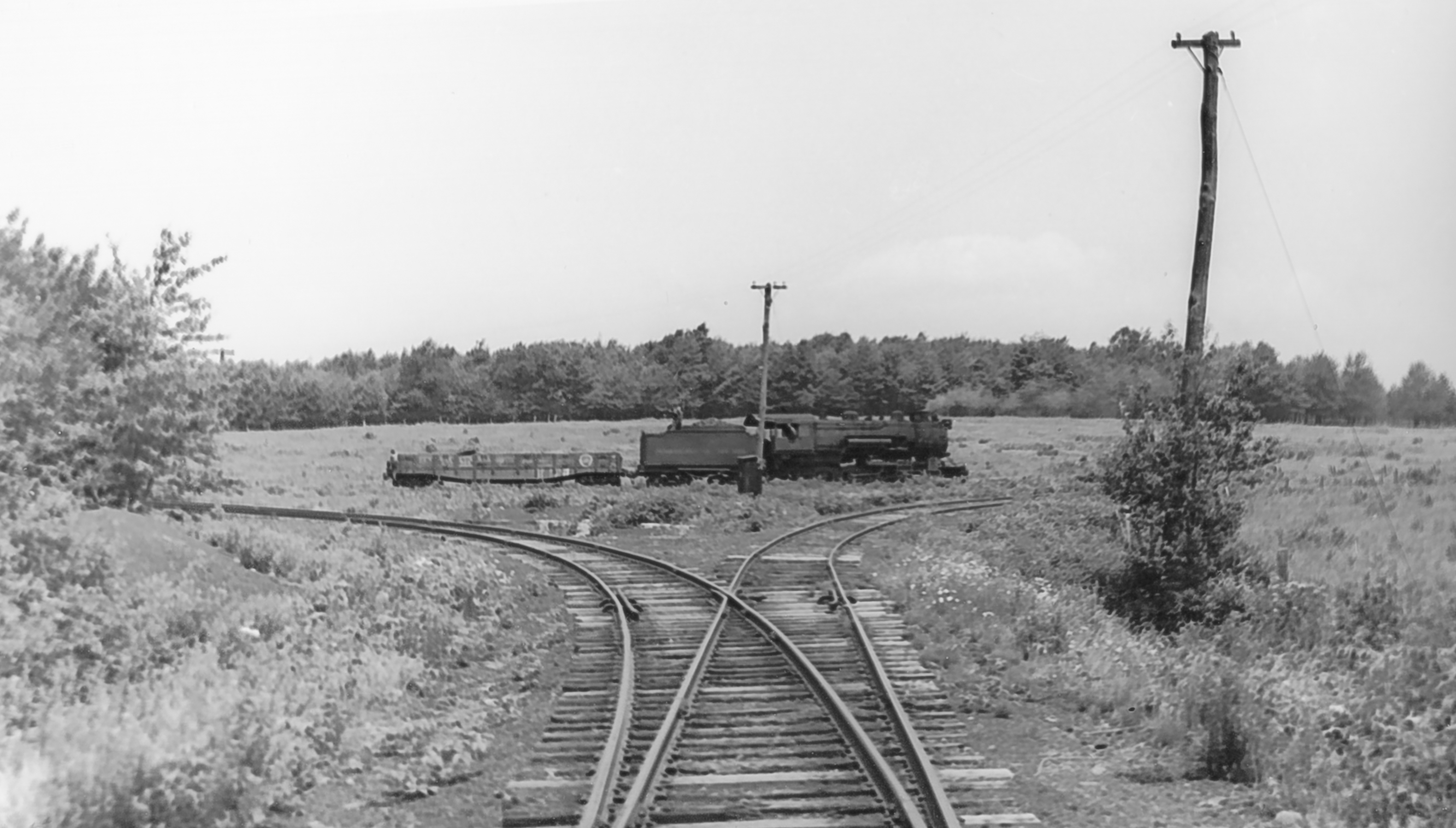
Update 8/7/2014: Scanned a view of the Ellenton Wye. Note the PRR GRA gondola. A lot of interesting detail in this view; including the call box in the center of the wye track, the weathered ties on the cinder right-of-way, and the weeds and wildflowers:
Bill Caloroso – Cal’s Classics
Update 2/24/2014: I have been in email correspondence with Ms. Ferne Gochnauer, who lived on the farm adjacent to the site of the Ellenton station from 1965 to 1989. She kindly provided a number of photos from her own research of the Ellenton area:
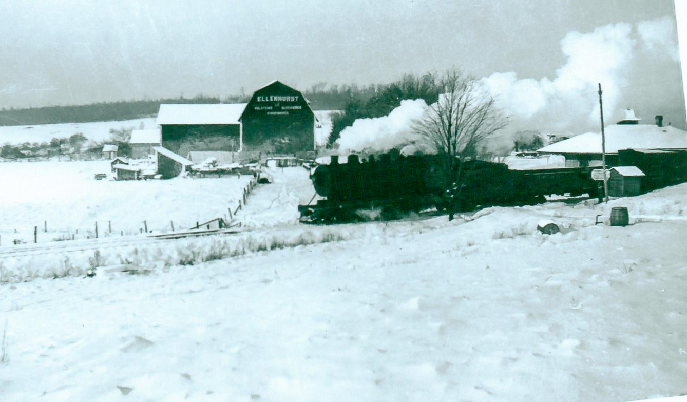
Photo courtesy Ferne Gochnauer
An SNY freight passes by the Ellenton station enroute to Masten, downgrade to the left in this view. Compare this photo with the view from 2000 above. This view may significantly pre-date some of the views taken closer to the 1942 abandonment, given the absence of trees behind the station. The small shed across from the station also does not appear in the other images above, but rather is located across the road on the same side of the tracks as the station in the Caloroso photos.
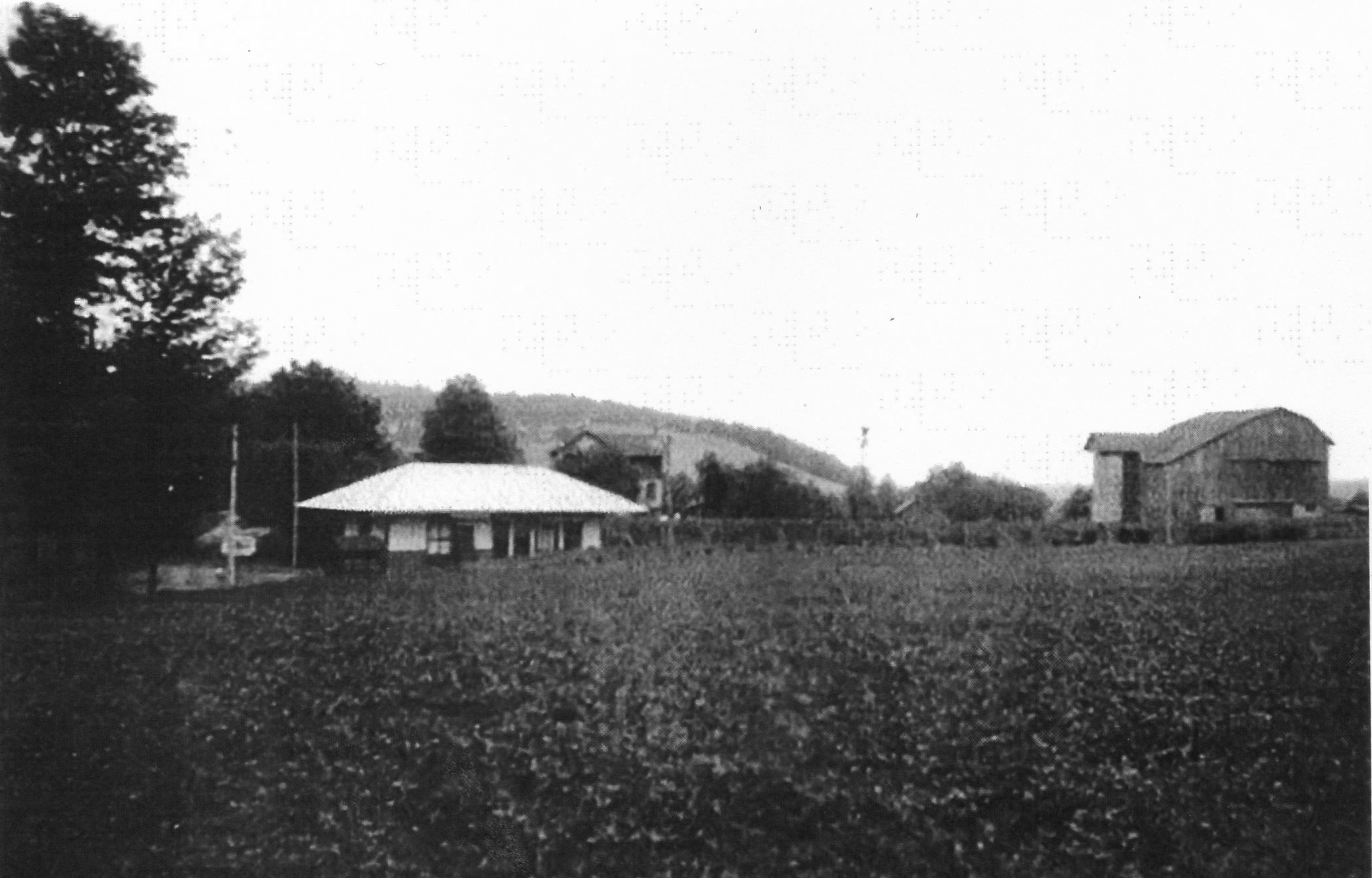
Photo courtesy Ferne Gochnauer
In this undated view, we can see the small barn whose roof is visible in the background of the Caloroso images above. Also note the trees planted along the edge of the shallow cut between the station and the barn. According to Kaseman, these were planted in the 1920’s to act as a snow fence, so the photo must date from that time. See the later photos above, when the trees were much larger.
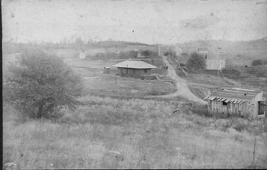
Photo courtesy Ferne Gochnauer
This photo dates prior to the 1918-1919 valuation map, likely shortly after the SNY was completed, probably ca. 1905. This eastward view shows the original alignment of the SNY mainline to Masten (to the right in this view) and the original location of the station near the road intersection and the CPL tramroad, seen further to the west on the valuation map and the Penn Pilot aerial view. We can see the opposite side of the large barn in the middle distance seen in the center of the 2000 view and the earlier view provided by Ms. Gochnauer.
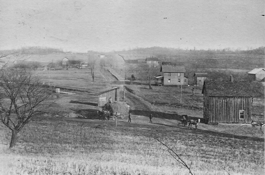
Photo courtesy Ferne Gochnauer
The Ellenton station has now been moved to its final location after the re-alignment of the SNY mainline, and can be partially seen as a low, light-colored structure in the left middle distance. The “old” SNY alignment can be seen crossing the road from left to right behind the nearest structures.
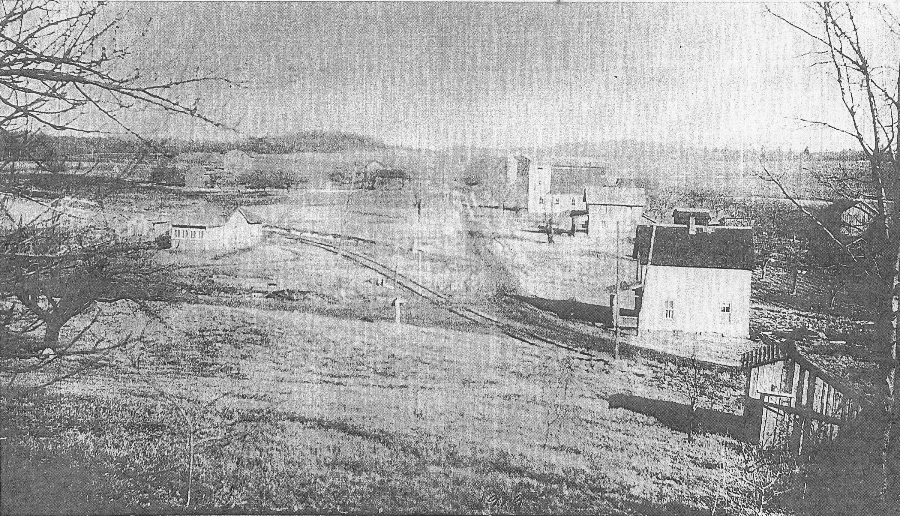
Photo courtesy Ferne Gochnauer
A house or other structure has now been built on the original site of the Ellenton station, and the Central Pennsylvania Lumber Co. tracks now join the old SNY mainline just in front of the new structure. These tracks are seen on the 1918 valuation map labeled “CPL tramroad”.
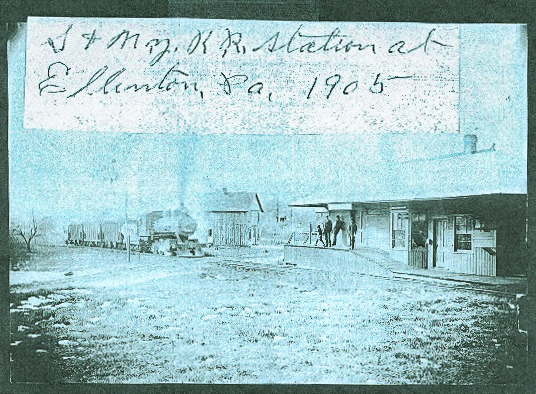
Photo courtesy Ferne Gochnauer
This is a southwestward view of the Ellenton station at the original location ca. 1905 . The small house next to the tracks on the last two views above can be seen behind the locomotive. The road junction can be partially made out behind the elevated station platform and the gentlemen standing upon it.
I had no idea that the Ellenton station had originally been at a different location, and subsequently moved, until Ms. Gochnauer provided that information.
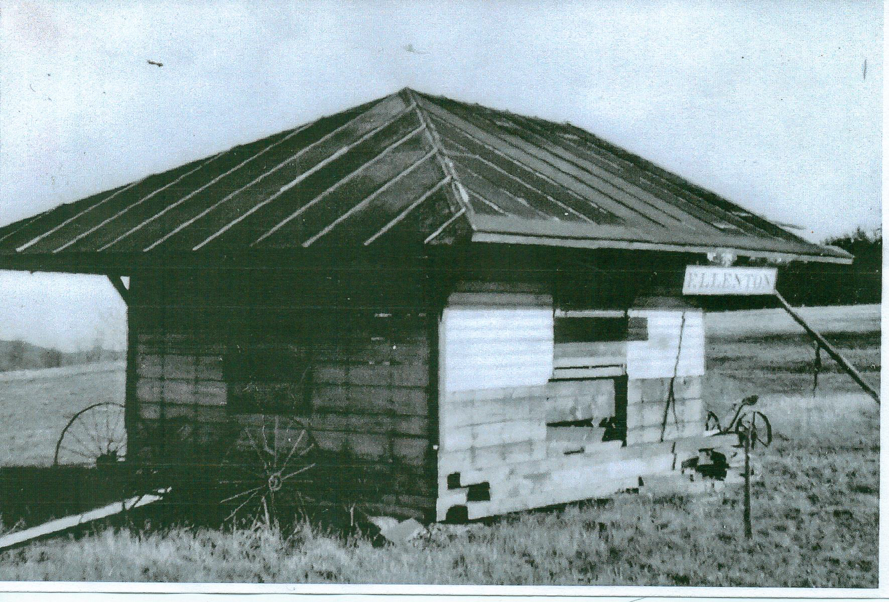
Photo courtesy Ferne Gochnauer
Lastly is a view of the remnants of the station after it was partially torn down and moved to a nearby field after the SNY abandonment. according to Ms. Gochnauer, one of the Ellenton station signs still exists and is in the possession of a local resident.
In the 1st of Ellenton station (looking downgrade toward Masten) there is a small (railroad related?) shed in the distance across the road. Do you know it’s function if it is a railroad structure?
Ernie,
I put up a couple more photos of Ellenton in which this small structure is visible. My best guess is that it is a phone call box for the end of the passing siding coming up grade from Masten. Just a guess, though. Why there would be a call box so close to the station is a mystery, though maybe the station was not manned after hours? Alternatively, it might be a flag-stop shelter?
Since we’re guessing, the call box is the most logical one. But I would have expected the crews to have a key to the station when it was unmaned. Could it have been an outhouse though that is a bold location for such a facility? Indoor plumbing is a surprisingly recent innovation. Photos are great, thank you.
The small structure in the pictures above appears to be three sided, with the side facing the tracks open. Did the S&NY carry milk? If so, then this could have been a milk pick-up stop. Any thoughts?
Is there any interest in forming a “Susquehanna & New York Railroad Historical Society”?
Milk stop is also a good thought, though why would it be down by the passing siding switch, and not up at the station? It is closer to the road though.
I think there was a creamery in Wheelerville, and there was also a Dairymen’s League Co-op in Towanda according to a Sanborn map I have from around 1927, so maybe you are right about a milk stop. I plan on having a couple of “can cars” once I get the model railroad running to add operating interest.
As far as a “SNY Historical Society”, I think there is probably only a handful of people who might be interested, but I am open to any possibilities.
It may have been more convenient to drop off milk/pick up empty cans from the road rather than the station, particularly if the milk was delivered to the site by horse and wagon. Another thought is that the farmer owning the land next to the railroad donated the site for that purpose, and maybe even paid for the erection of the shelter – to ship his milk?
Al
Re: The milk station, it was typical but not universal for milk “sheds” to have loading platforms trackside which is missing here. Still, a milk station is a good guess. I don’t know where the dairy in Wheelerville was located but included one there on my model. Also put one in Ellenton as I like milk traffic and intend to run some milk cars (can and bulk). There were several dairies in Towanda including a large one on the LV. There was no way to get the milk to market with the scarce roads.
As far as a historical society, can we just talk about the SNY here? As long as the web owner doesn’t mind? I already belong to a half dozen of them and have problems keeping up.
I have no problem with that. I started the site to gradually put what I have collected “out there” for whoever is interested, so feel free to discuss away. The SNY is pretty obscure, so I doubt bandwidth will be a problem…:)
Thank you, we appreciate the offer.
BTW, Roy Breon just posted a PRR track chart on the Yahoo group site, PRR Elmira Branch. It shows the SNY trackage in Ralston.
Yep, saw it, downloaded it, and now it’s in my queue to scan and stitch together in Photoshop. Was working on a diagram of the ditcher last night, but I had trouble getting the pieces to line up. Gonna try again this evening if I get time.
I’ve got to get up to speed in Photoshop, one of these days.
Looking at Ellenton today….where would the RR station have been?
Looking at Google maps, I believe it would have been at the west corner of McIlwain Rd. and Baumunk Rd. Baumunk/ Masten Rd. is the old S&NY right-of-way.
Were there two places where the train crossed the road? Some of the pictures look like the tracks cross after the church close to Masten Rd…before the corner on Elleton Mtn Rd. The other picture does look like Baumack Rd. I’ll check it out today when I drive by. . Also…was the general store in use at the time?
Yes, sorry. The original site of the station was slightly west of the Ellenton Chapel where McIlwain Rd. makes a sharp bend and becomes Ellenton Mountain Rd. and joins Masten Rd. The station was moved from there slightly east to the corner of what is now McIlwain Rd. and Baumunk Rd. sometime after 1905-06. The railroad grade at the old location was both S&NY and Central Pennsylvania Lumber Co. logging railroad, I believe.
Not sure about the general store.
All of a sudden it’s raining photos, thank you, thank you..I did not know of the Ellenton rerouting and especially enjoyed the Ellenton wye shot. In my loose interpretation of the SNY, CPL has reversed it’s cutting sequence, doing Hoagland, Cascade and then Rock Run so that I can retain the water tank at Ellenton wye and some semblance of their operations there in the 1930’s period I model. The water tank in the wye was just right of the switch in the foreground of the wye photo. The light colored rocks (?) may be foundation pilings of the tank legs. I also like milk traffic and have included dairies at Ellenton, Wheelerville and Towanda and a milk shed at Short Run. It enables those “milk mixed’ trains. I have used the SNY as a “guide” as I cant’ control the creative urge.
My father’s family grew up around in Ellenton, just west and on top of the mountain from the lumber town of Masten. They ran a dairy farm not far from the tracks. My father told about loading milk on the train and taking it to Masten to sell. Then they would return on the train. I believe it was a whistle stop. I’m not sure about the frequency, but I suspect this was a less than daily trip since they had a farm to run. He was born in 1916, so would have been selling milk in Masten during the 1920s.
He told us that one day, he road the train to Masten and most of the houses were gone. I think this would have been 1930, so he would have been about 13/14 years old. Probably made a big impression on him. I never knew there was a station in Ellenton, but possibly one or more of my cousins had more detail on the whistle stop process. when visiting Ellenton, we would hike down the road from Ellenton to Masten and look at the remaining foundations.
Then there is another story .. at least one summer, my grandfather gathered a number of the older children and road the train north to a valley south of LaPorte (?). They spend the day picking huckleberries and flagged down the train and rode it back to Ellenton that evening. This seems a little confusing unless there was a morning and afternoon train going each direction. I don’t know if this was an annual event or one that just happened one year.