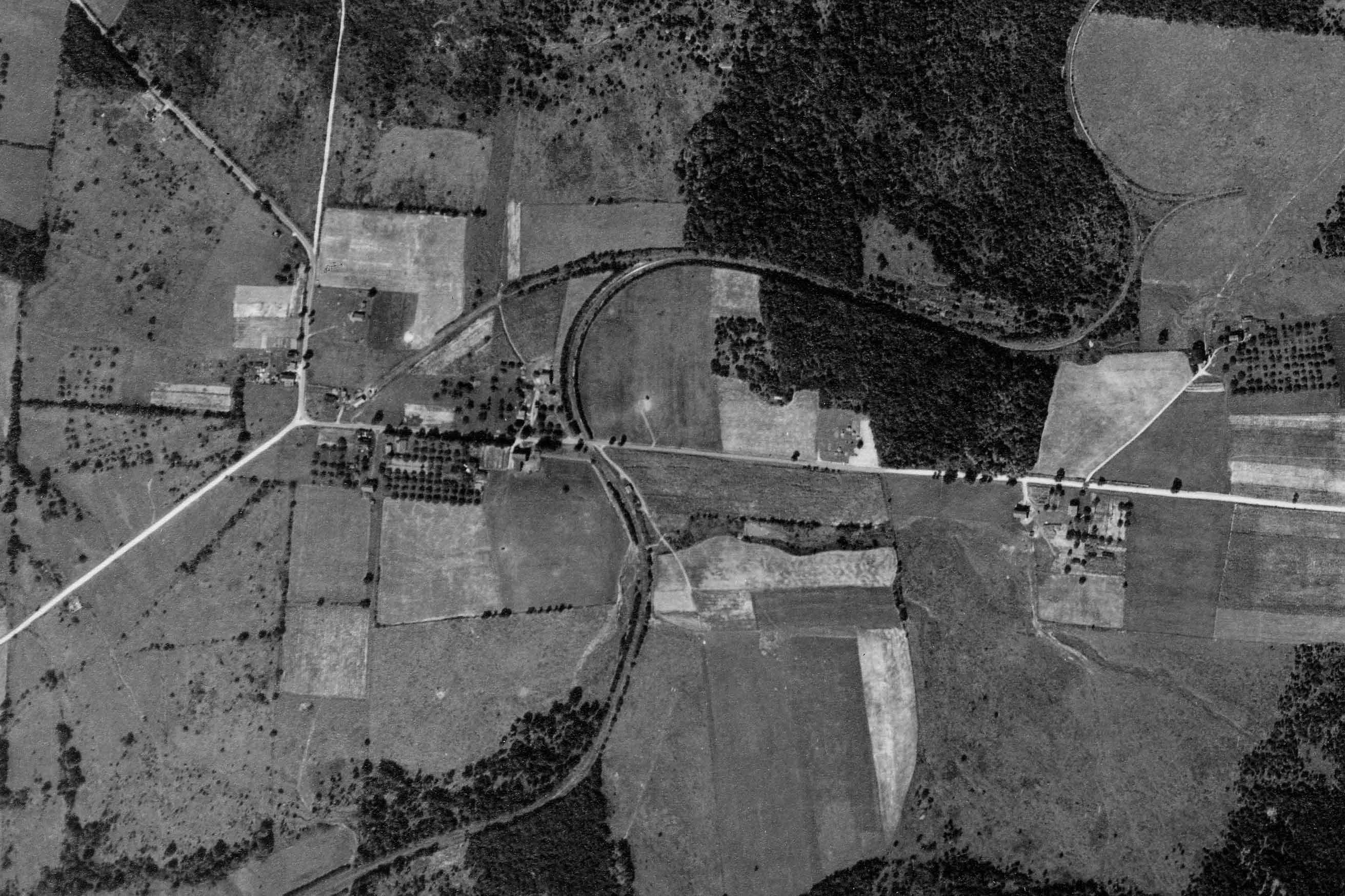
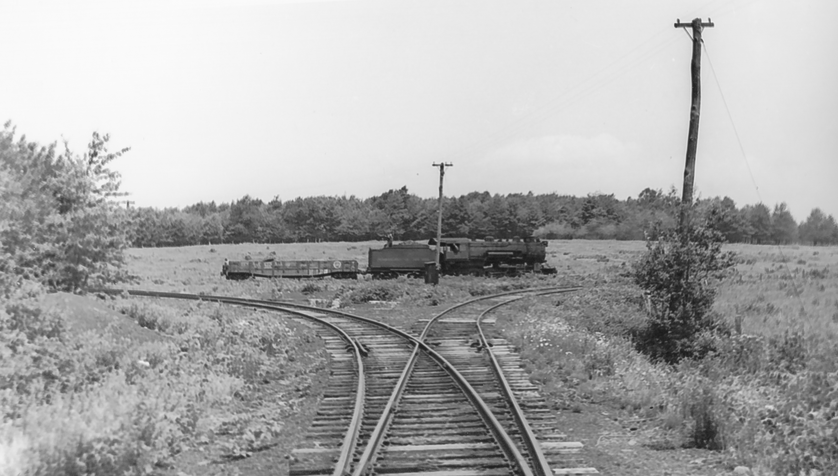
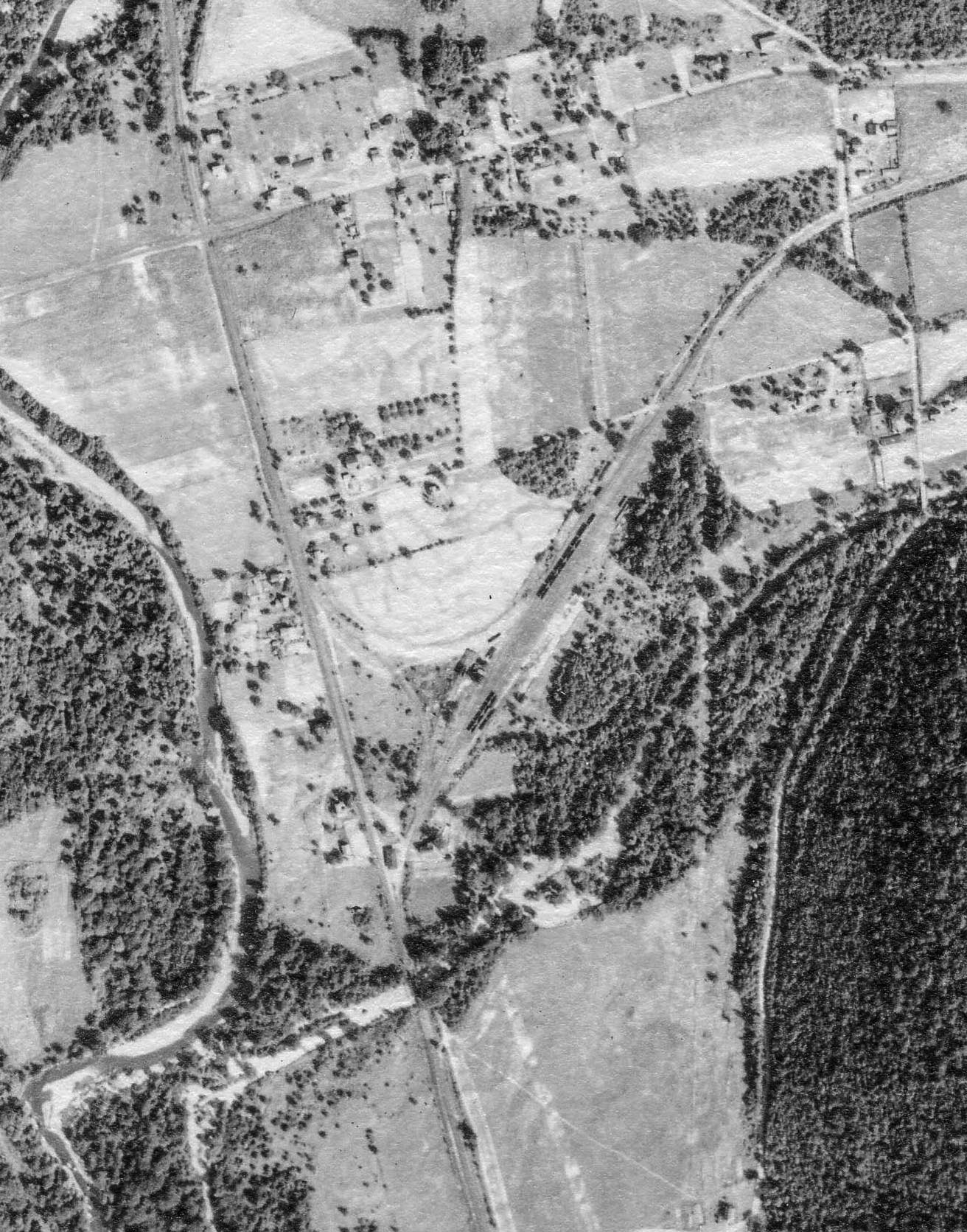
Ellenton was a small crossroads near the summit of the railroad, between the Pleasant Stream and Schrader Creek valleys. The SNY was disadvantaged by having to climb steep grades both ways between Marsh Hill and Towanda, coming and going. On the aerial view from circa 1938, a wye track is visible north east of Ellenton, used to turn helper engines.
PSU – Penn Pilot
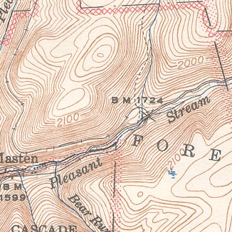
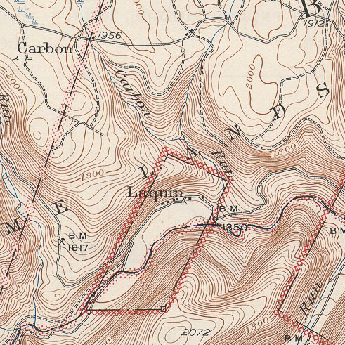
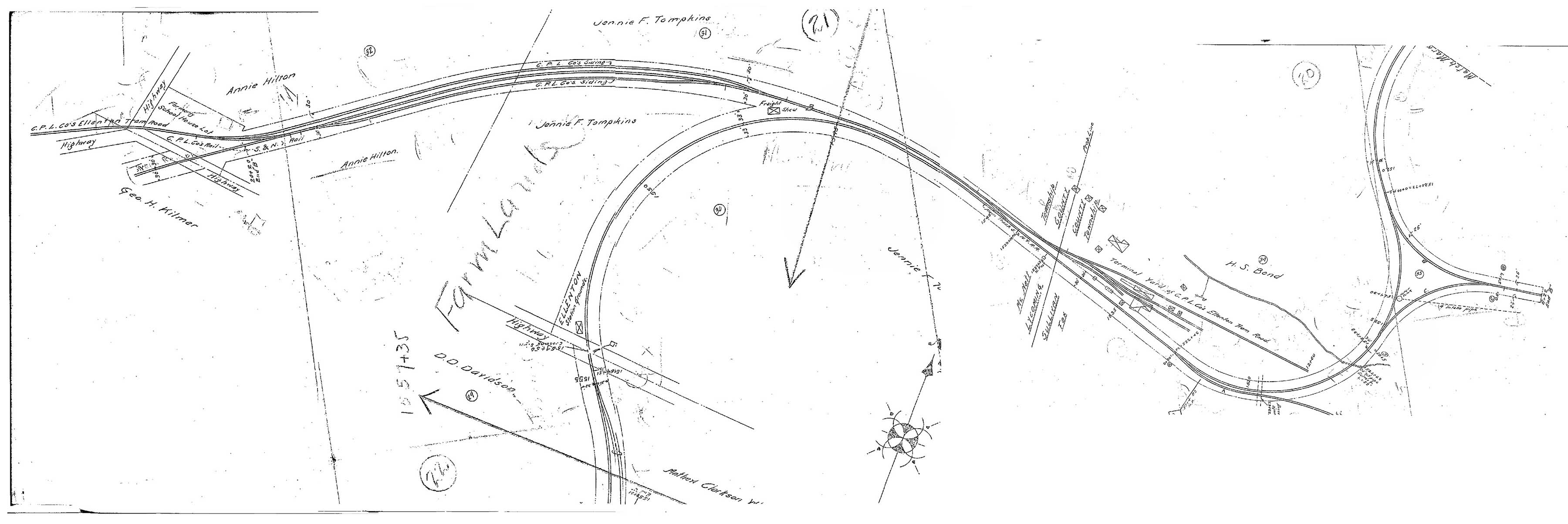 Above is a scan of SNY valuation maps, kindly provided by reader Charlie Marvin, and stitched together by the author in Photoshop. I had wondered what the long spur was north of Ellenton, but we can see from the map that is actually the remnants of the Central Pennsylvania Logging Co. logging railroad and the original S&NY alignment to Masten. (Updated 8/3/15)
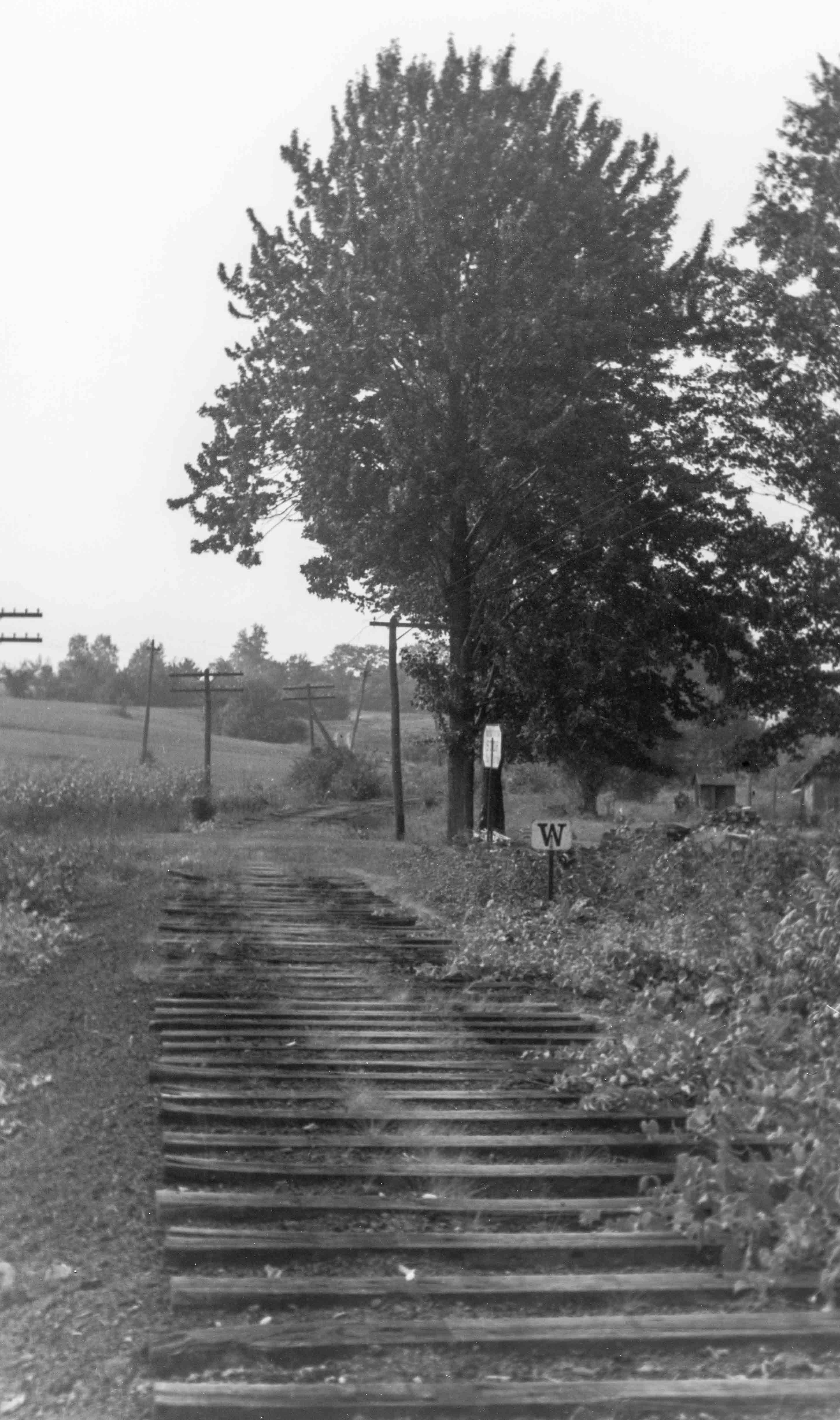
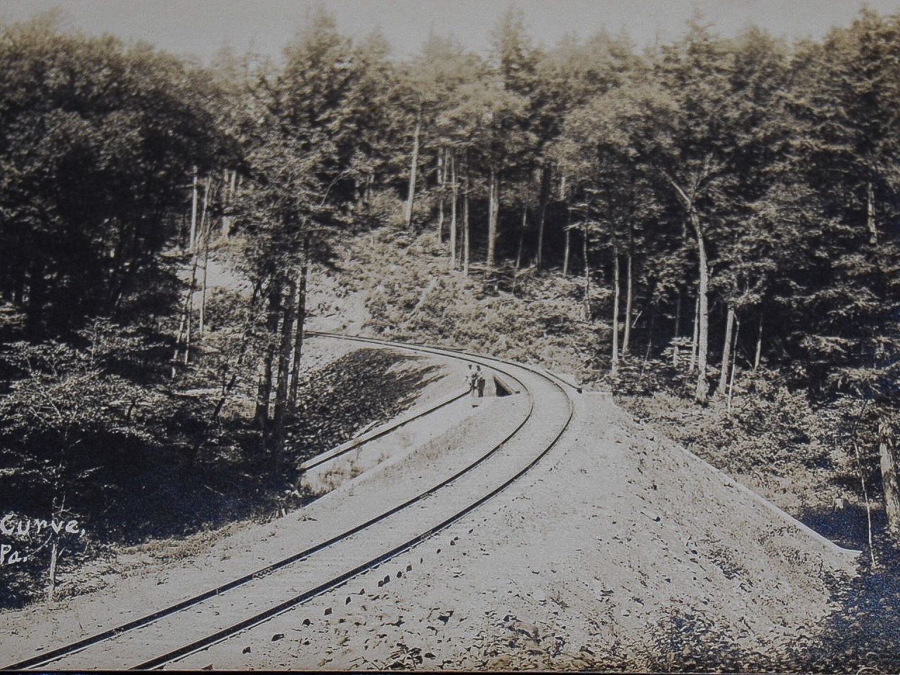
Here is a view of the SNY roadbed at Ellenton, PA, probably taken during abandonment operations in 1942. This view is looking downgrade and roughly southwest towards Masten.:
Bill Caloroso – Cal’s Classics
Bill Caloroso – Cal’s Classics
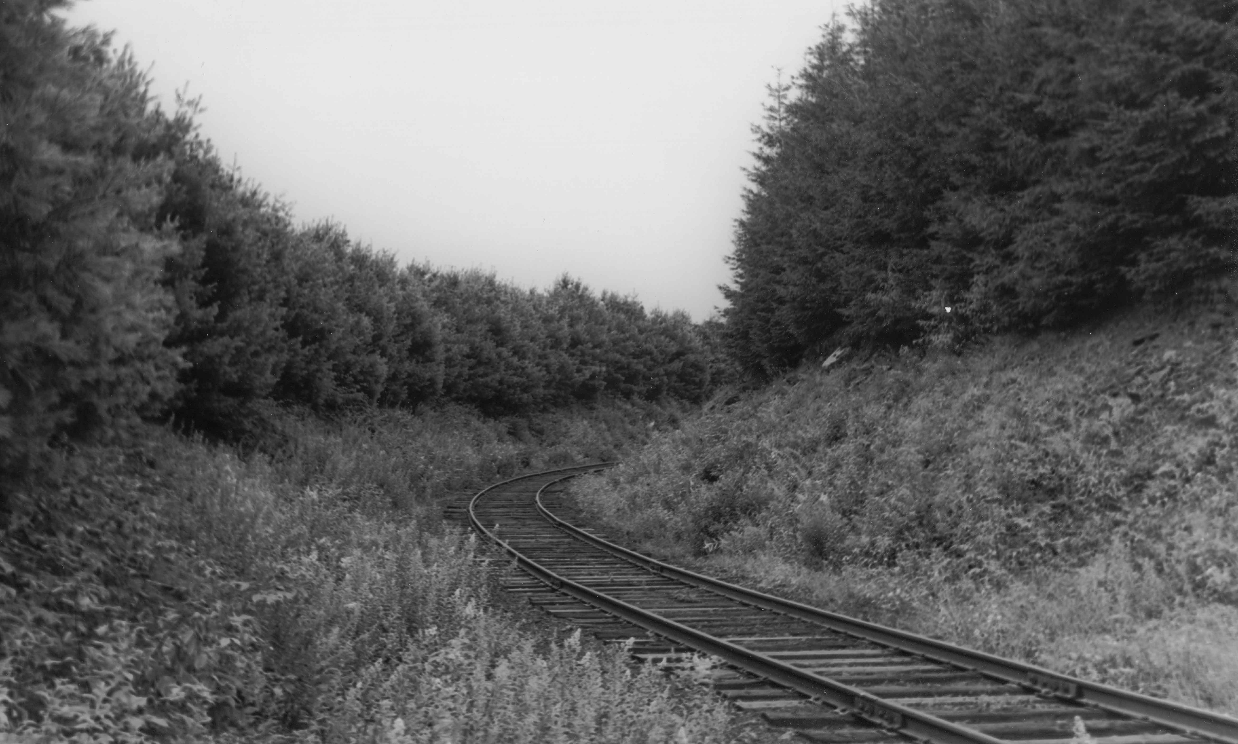
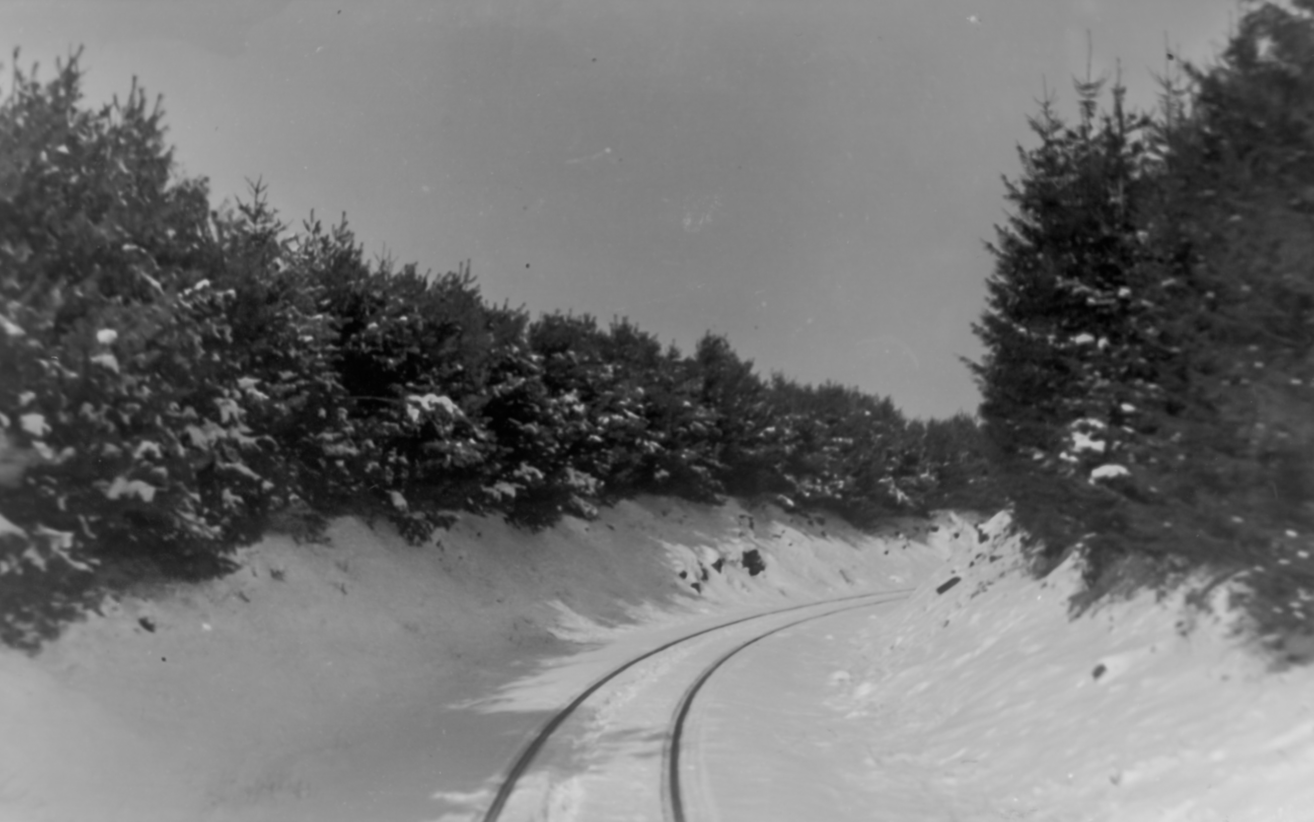
The above view is looking roughly northeast towards the true summit and wye track. The pine trees were reportedly planted to help diminish drifting and blowing snow from closing the cut.
Bill Caloroso – Cal’s Classics
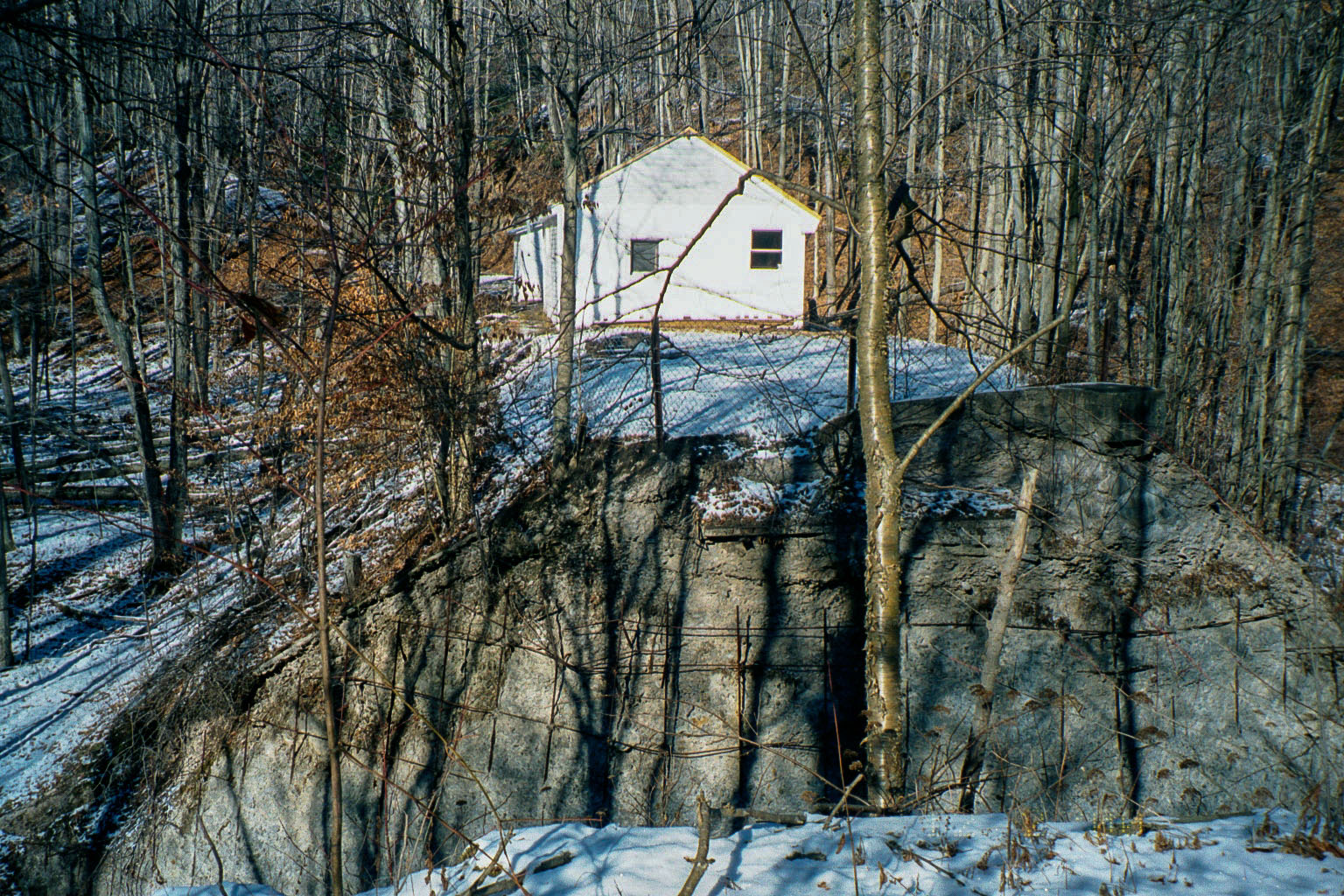
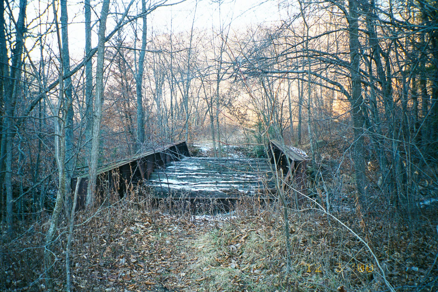
Here is a view of the same area, possibly during the winter of 1941-1942. The modern views below show the area in the early winter 2000. We can see how the trees have grown up over the intervening 58 years.The old roadbed crosses the road at the “dip” just beyond the largest trees along the right side of the road. The photographer in the second view above would have been standing in the roadbed off to the right, albeit some 58 years earlier in time. The road ( according to Bing maps McIlwain Rd.; PA Route 4002), paved in the 2000 photo, appears to be dirt or gravel in the 1942 view. Interestingly, the SNY roadbed is labeled “S&NY Road” on Bing maps.
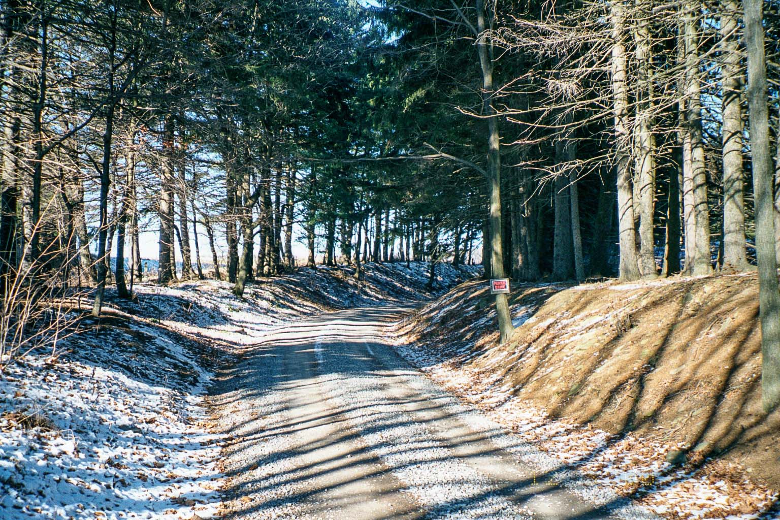
Photo by author
Photo by author
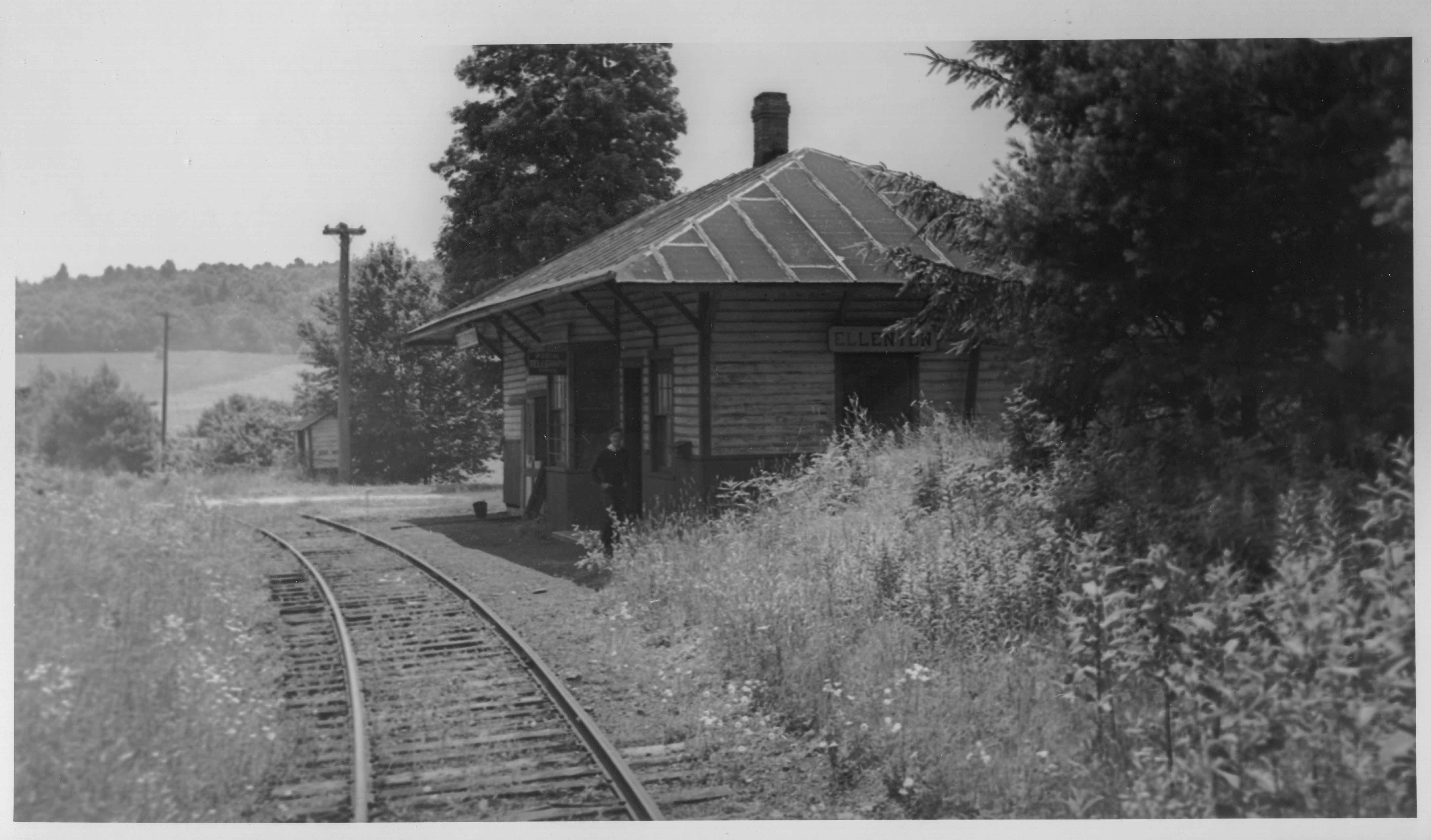
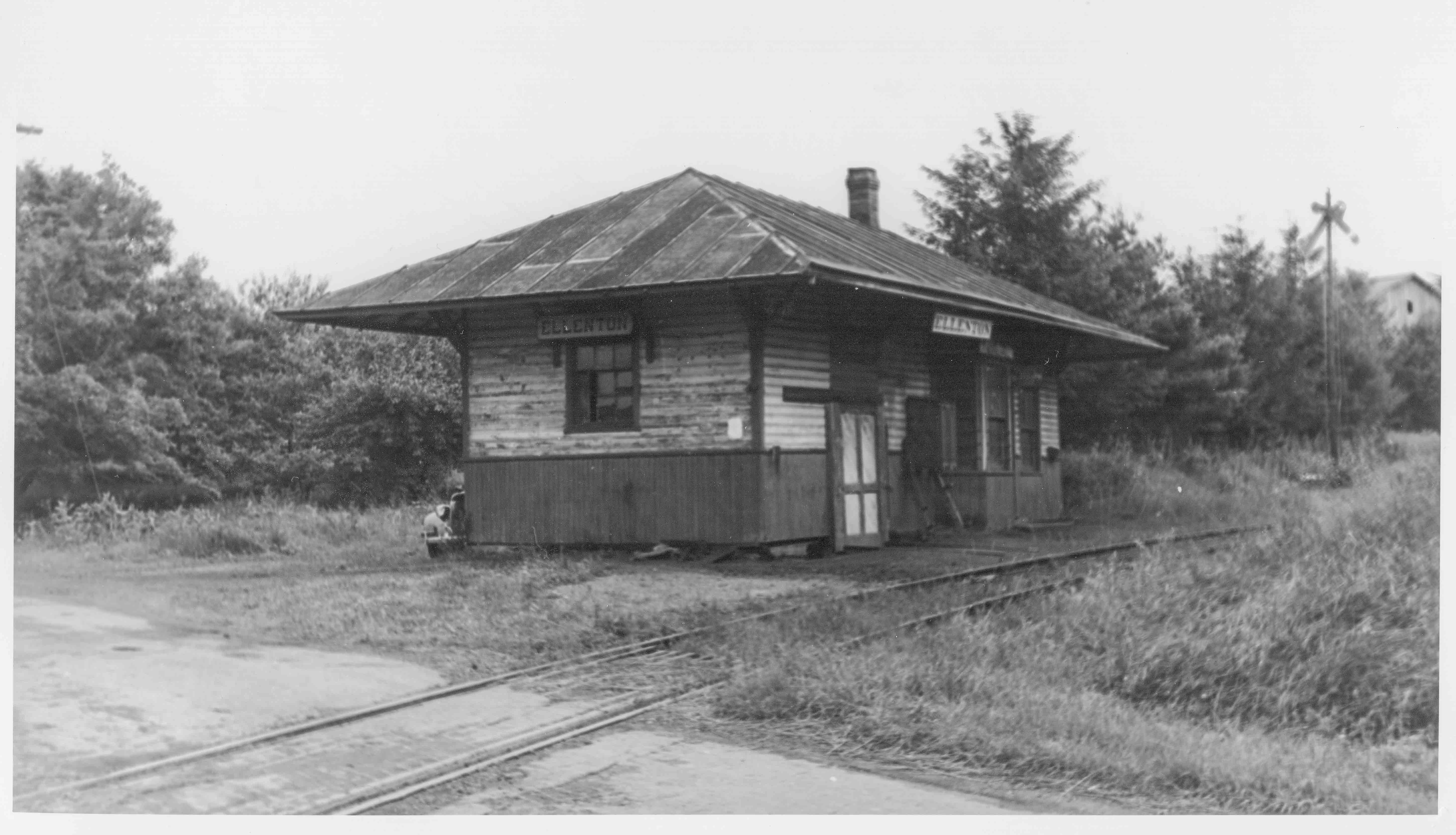
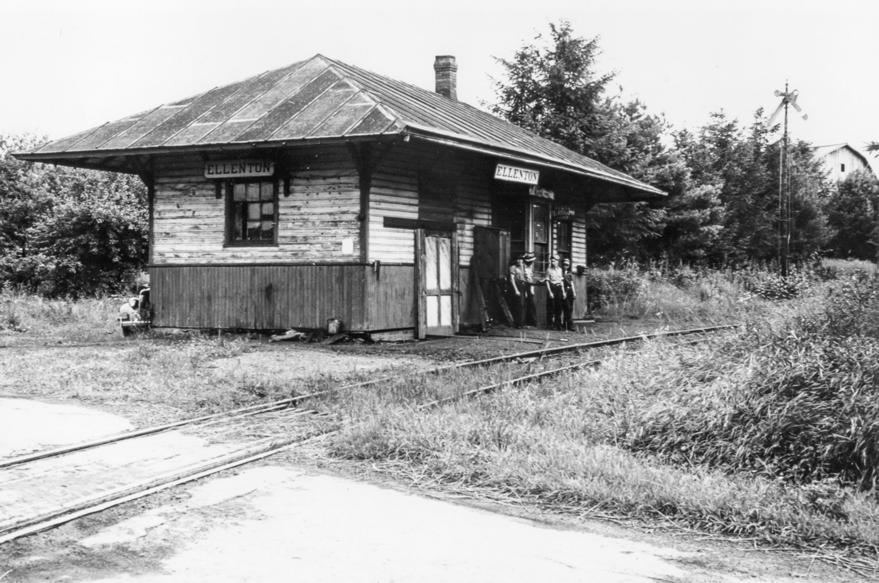
Below are three views of the station at Ellenton. The first is looking downgrade toward Masten, similar to the abandonment view above, albeit earlier in time, perhaps the mid-1930’s. The second and third look roughly northward in the opposite direction, probably near the end of the SNY in late 1941 or ’42. The station looks to be in pretty rough shape in the last two photos.
Bill Caloroso – Cal’s Classics
Bill Caloroso – Cal’s Classics
Bill Caloroso – Cal’s Classics
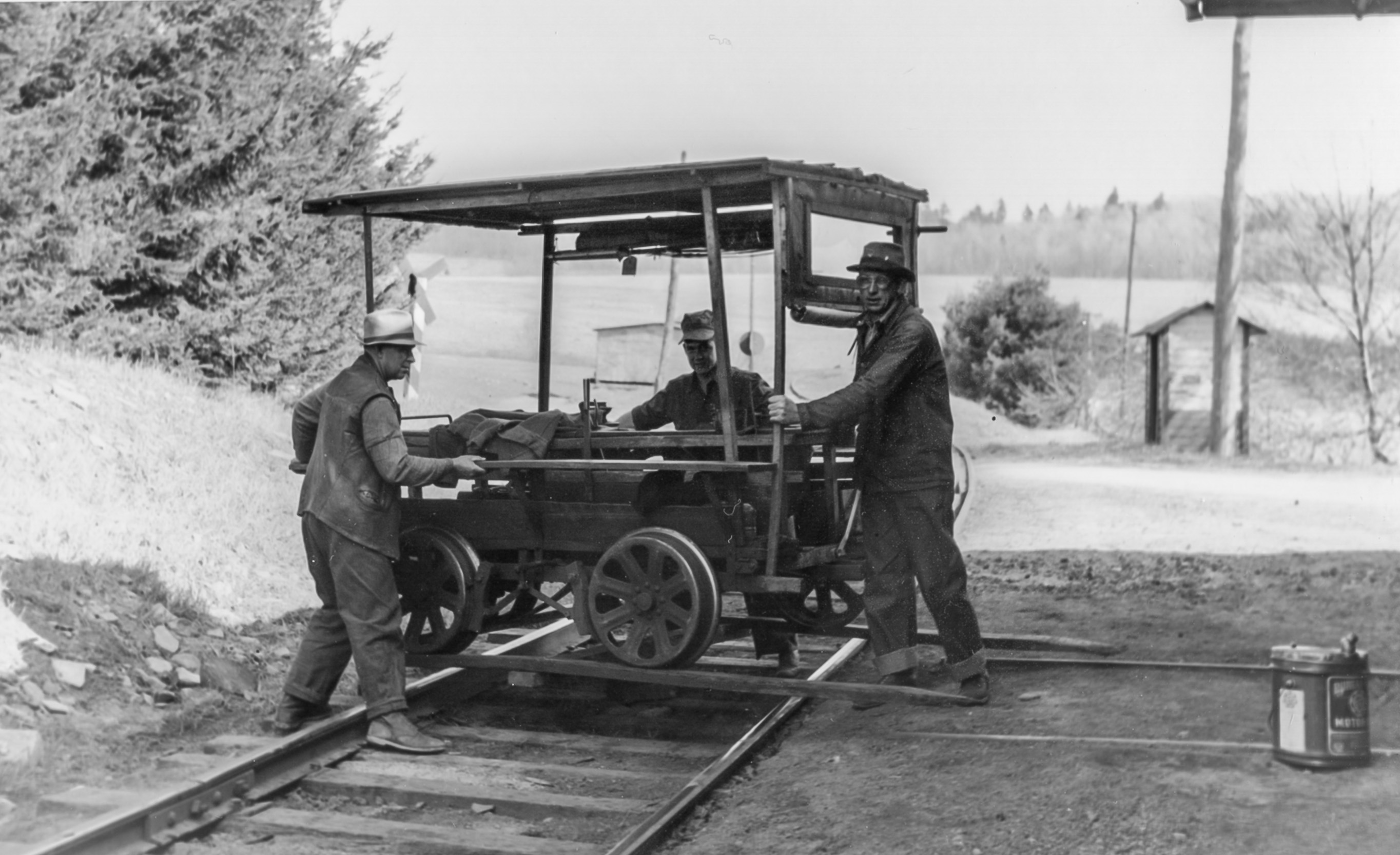
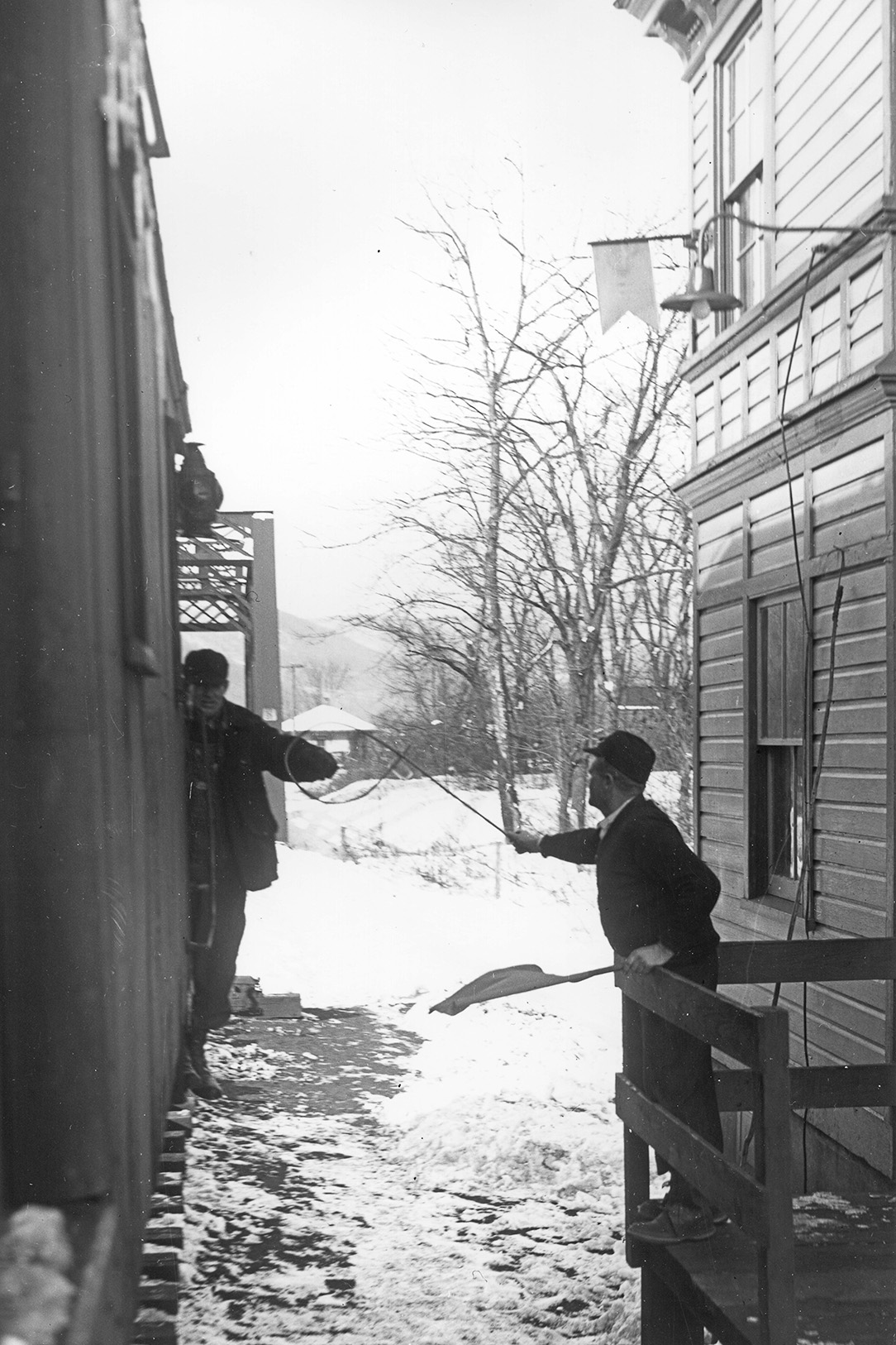
The station was also apparently used as a section house, and the section hands stored a speeder car in the station in the part behind the wooden door seen to the left in the above photos. In the photos below, the section crew is man-handling the speeder onto the rails. Anyone know the identity of the gentlemen in the photo?
Bill Caloroso – Cal’s Classics

Bill Caloroso – Cal’s Classics
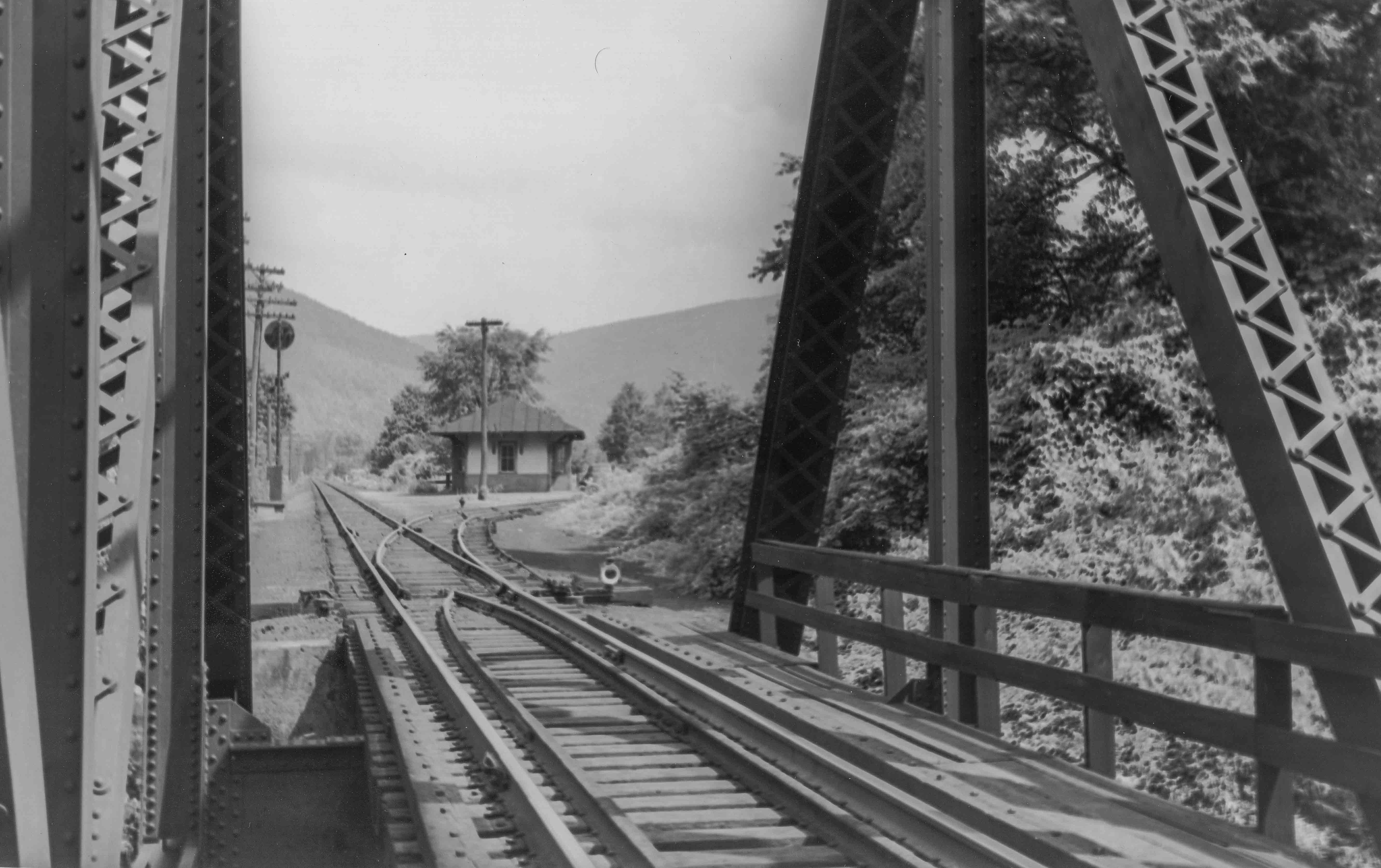
I do not know the function of the smaller building in the background, although it appears to be a similar paint scheme to the Ellenton station. Perhaps a phone box, or flag-stop passenger shelter? A passing siding coming upgrade from Masten can be seen ending at the switch in the background of the above two photos, and I think a phone box so crews in the siding can call the dispatcher is the more likely explanation. This structure is not evident on the valuation map from 1919, and must necessarily be newer than that date.
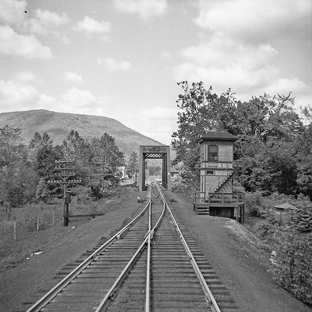
Update 8/7/2014: Scanned a view of the Ellenton Wye. Note the PRR GRA gondola. A lot of interesting detail in this view; including the call box in the center of the wye track, the weathered ties on the cinder right-of-way, and the weeds and wildflowers:
Bill Caloroso – Cal’s Classics
Update 2/24/2014: I have been in email correspondence with Ms. Ferne Gochnauer, who lived on the farm adjacent to the site of the Ellenton station from 1965 to 1989. She kindly provided a number of photos from her own research of the Ellenton area:
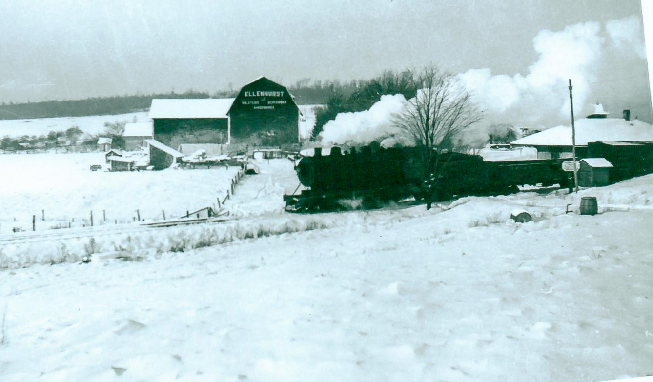
Photo courtesy Ferne Gochnauer
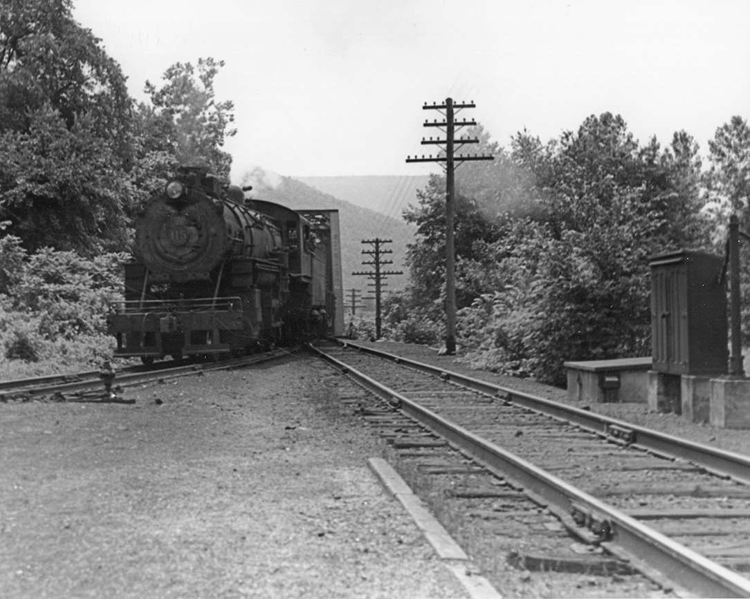
An SNY freight passes by the Ellenton station enroute to Masten, downgrade to the left in this view. Compare this photo with the view from 2000 above. This view may significantly pre-date some of the views taken closer to the 1942 abandonment, given the absence of trees behind the station. The small shed across from the station also does not appear in the other images above, but rather is located across the road on the same side of the tracks as the station in the Caloroso photos.
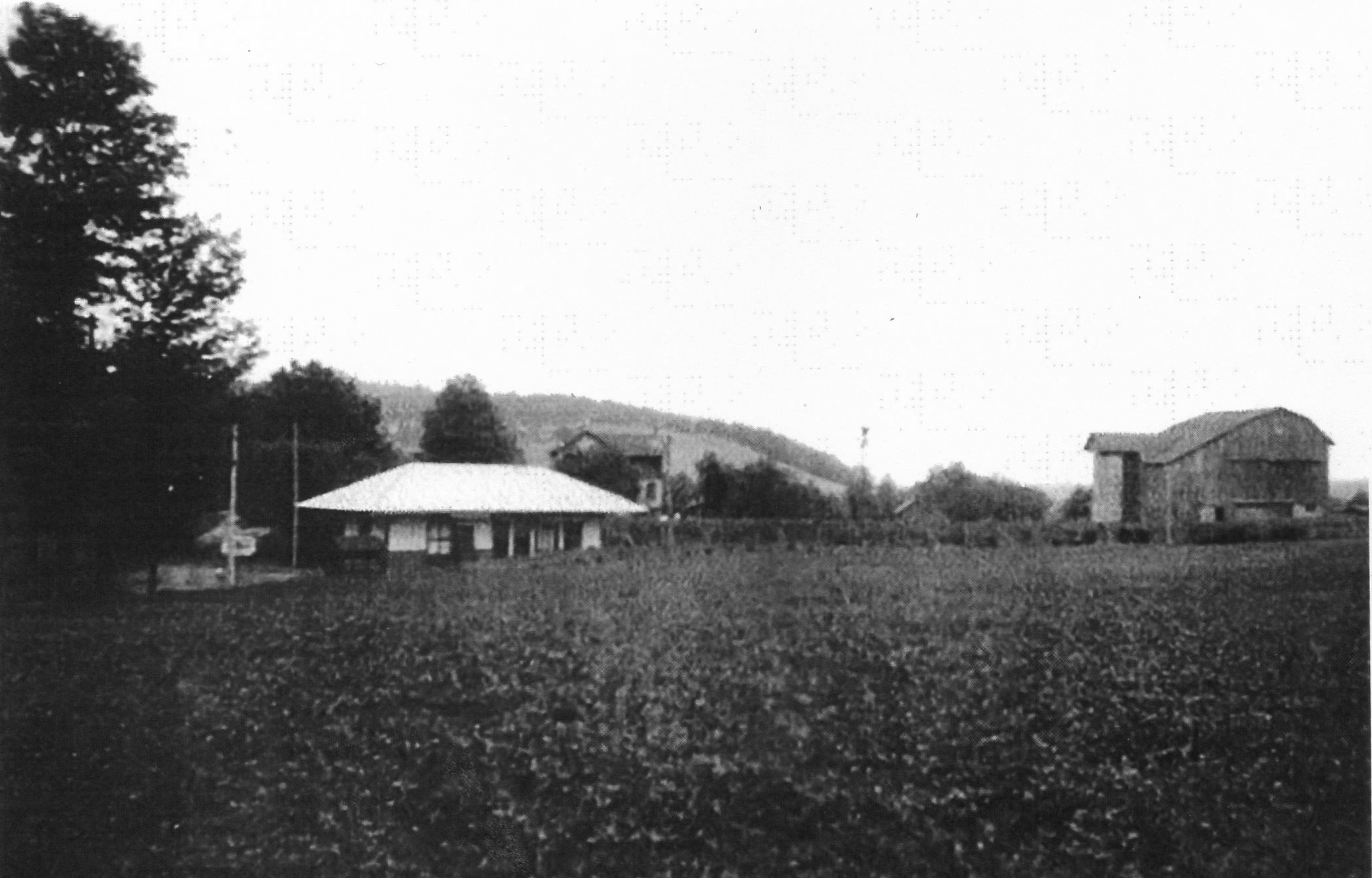
Photo courtesy Ferne Gochnauer
In this undated view, we can see the small barn whose roof is visible in the background of the Caloroso images above. Also note the trees planted along the edge of the shallow cut between the station and the barn. According to Kaseman, these were planted in the 1920’s to act as a snow fence, so the photo must date from that time. See the later photos above, when the trees were much larger.
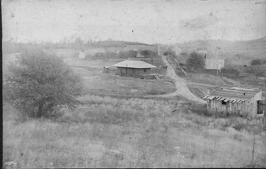
Photo courtesy Ferne Gochnauer
This photo dates prior to the 1918-1919 valuation map, likely shortly after the SNY was completed, probably ca. 1905. This eastward view shows the original alignment of the SNY mainline to Masten (to the right in this view) and the original location of the station near the road intersection and the CPL tramroad, seen further to the west on the valuation map and the Penn Pilot aerial view. We can see the opposite side of the large barn in the middle distance seen in the center of the 2000 view and the earlier view provided by Ms. Gochnauer.
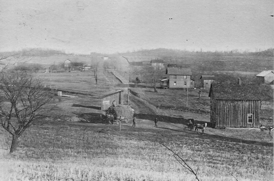
Photo courtesy Ferne Gochnauer
The Ellenton station has now been moved to its final location after the re-alignment of the SNY mainline, and can be partially seen as a low, light-colored structure in the left middle distance. The “old” SNY alignment can be seen crossing the road from left to right behind the nearest structures.
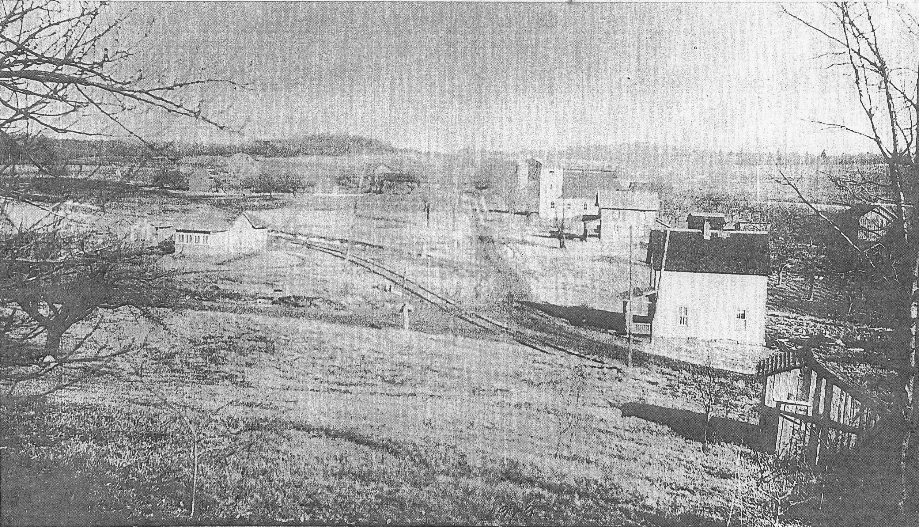
Photo courtesy Ferne Gochnauer
A house or other structure has now been built on the original site of the Ellenton station, and the Central Pennsylvania Lumber Co. tracks now join the old SNY mainline just in front of the new structure. These tracks are seen on the 1918 valuation map labeled “CPL tramroad”.
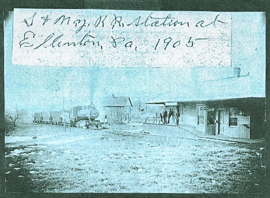
Photo courtesy Ferne Gochnauer
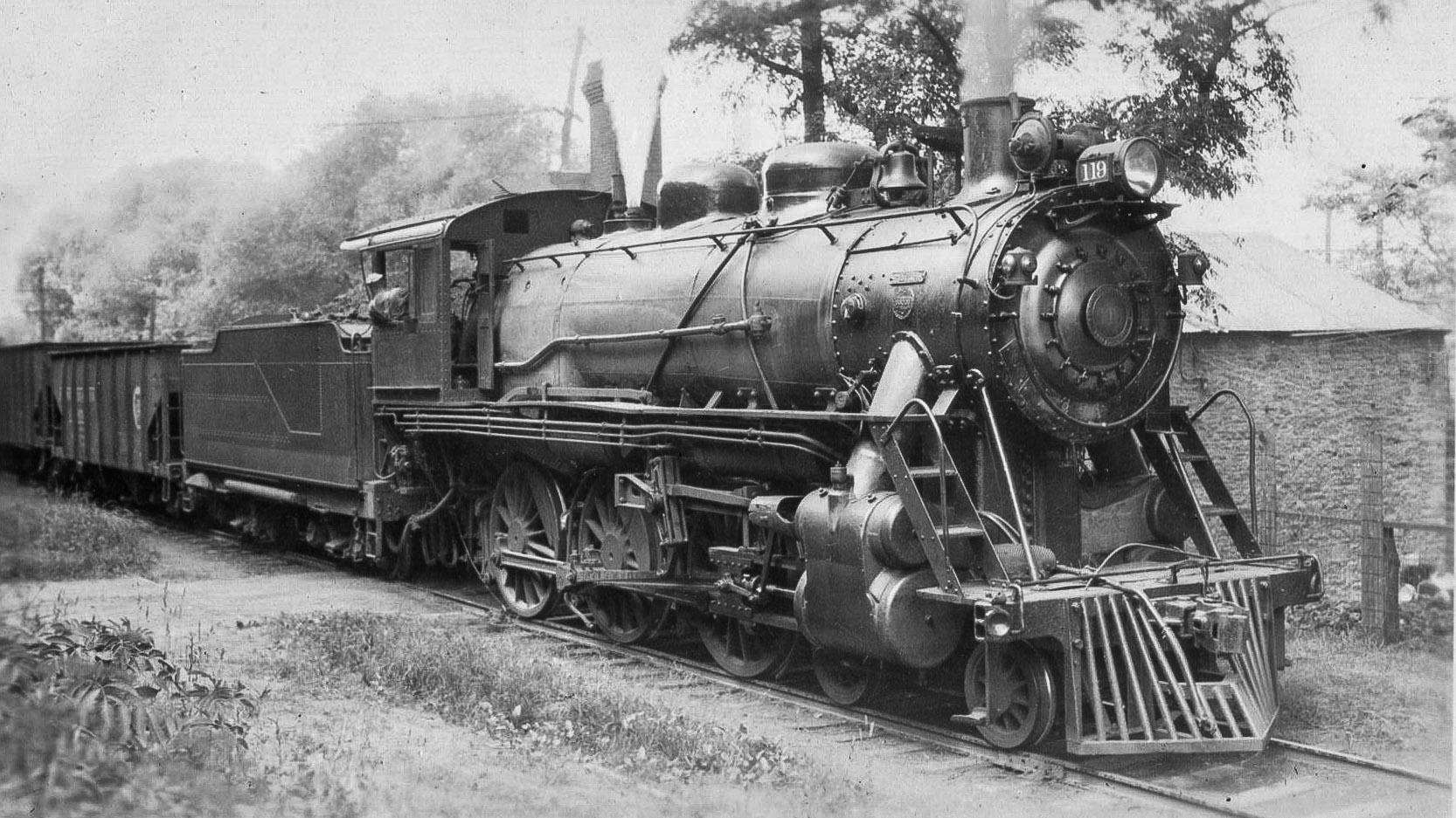
This is a southwestward view of the Ellenton station at the original location ca. 1905 . The small house next to the tracks on the last two views above can be seen behind the locomotive. The road junction can be partially made out behind the elevated station platform and the gentlemen standing upon it.
I had no idea that the Ellenton station had originally been at a different location, and subsequently moved, until Ms. Gochnauer provided that information.
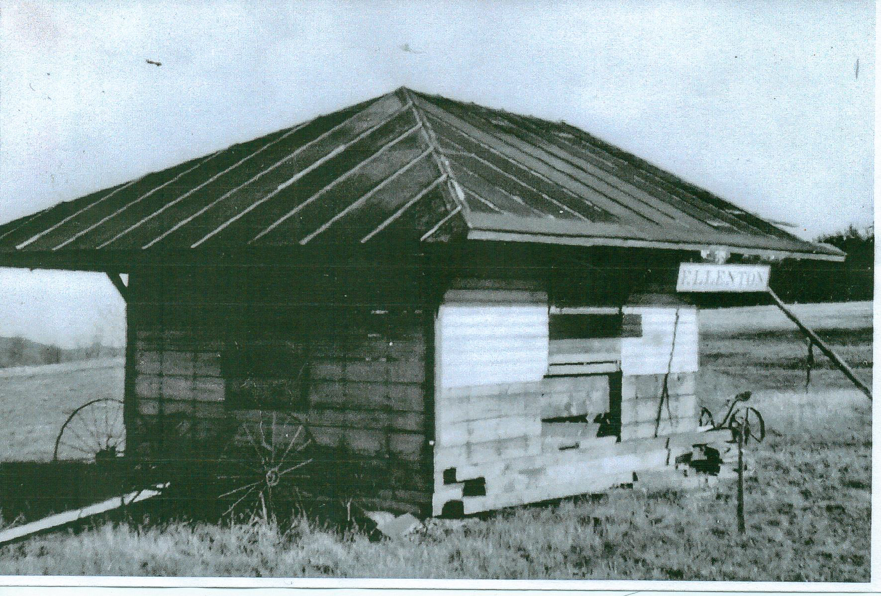
Photo courtesy Ferne Gochnauer
Lastly is a view of the remnants of the station after it was partially torn down and moved to a nearby field after the SNY abandonment. according to Ms. Gochnauer, one of the Ellenton station signs still exists and is in the possession of a local resident.
Recent Comments